Highs and Lows on a Sky Island
Things have really been trending upward, both literally--23,000 feet of gain in concentrated segments over the last 116 miles--and in terms of finding my rhythm on the trail. There has been little routine recently: one rest day, one day of slackpacking (hiking with no or an underloaded pack), three nearos (days with nearly zero miles), five days of relatively traditional hiking and two incredibly challenging days traversing snow on Mount San Jacinto, one of which was absolutely harrowing.
This post is much longer than the ones that came before. I have had access to a real computer. Apparently a full sized keyboard does not lend itself to brevity.
After several days of rest and improvement of my Achilles tendinites, I got the go ahead from Blaze Physio to slack pack the 6.5 miles I missed by getting off the trail at Mary’s Oasis as a 13 mile round trip (If any future PCT hikers are reading this: never get off the trail in Anza). I did my PT and there was a little pain on the hike, but when I woke up on Wednesday, my achilles had never felt better. We were back in business

I waited out the storm that was passing through on Thursday in the common room of the Silver Pines Lodge with a dozen other hikers, shooting the breeze, and drinking the finest drinks that the Idyllwild markets had to offer. By the afternoon, the storm was over and I caught a hitch up to the Paradise Valley Cafe to get back on trail. My Hotel California situation was over! I hiked a short distance up and out from the highway and set up my tent with a warm desert view.

My first full day back began with a little drizzle during breakfast and then a morning nap. Why not? I was only going to do 10 miles or so on my achilles. This indulgent start belied the fact that the day would prove to be one of my most exciting yet. The trail ahead was basically a well-graded climb approaching the sky island of San Jacinto. Even though I was still building up my hiker legs and general fitness, I was able to have conversations with my fellow hikers as we moved beyond 5,000 feet. In fact, the grade of the PCT makes my overuse injury all the more frustrating. Compared to most other backpacking that I’ve done, and with the exception of the conditions I would see in next few days, the PCT is gentle as it’s graded for pack animals. It lacks the grueling ascents of Yosemite’s high country or the direct climbs of the Great Smoky Mountains, at least for now.
Around 4 p.m. though, the temperature plunged. A dip at this time is normal, making it a great time to push out some more miles before making camp. This was different though. A giant gray cloud had moved over the mountain and the wind was relentless. It can be comfortable hiking my sun hoody and shorts down into the 50s. This was not comfortable. The winds that had buffeted my tent the night before picked up and prevented any sort of warmth from building up from my efforts. As I climbed past 6,000 feet, I could see a sunny day off to my right. At each saddle, the winds howled and there was only dreariness above and to my left.
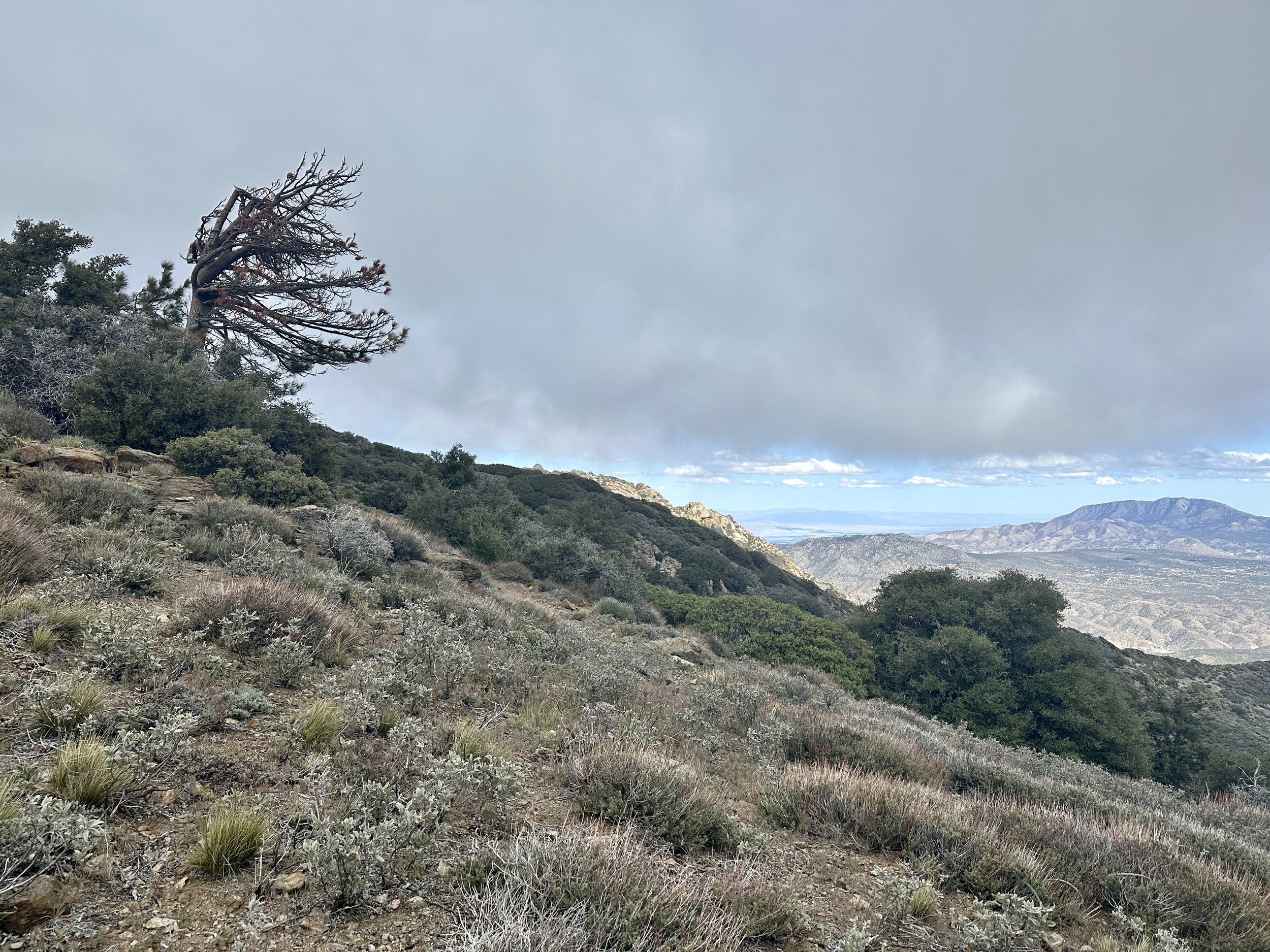

Eventually, around 10 miles in, the big climbing for the day was done. As I reached a level portion of the ridge, a small break appeared in the cloud. A beam of light came down, reminiscent of the old Hebrew National hot dog commercials. It was warm. It was glorious. And for a few moments, it shined on me–I was that blessed hot dog. As I basked in the sacred light, Jan, Oofa and Rene, a trio I had run into during my slack pack, caught up to me and captured the moment. They would go on to camp at a nearby spring a few hundred feet down. I decided to push on. I had enough water and wanted to find an easier spot to camp.
The trail kissed 7,000 feet and then rose above it for the first time. I was tempted to give up and take one of the few exposed campsites.. At this point, I was rushing. I was losing light and it was getting colder. Worse, the trail was passing through a burn area full of widow makers–dead trees that are liable to fall on sleeping campers–not something I was willing to risk while camping on this windy mountain. As I rushed on, a Canadian couple, Lloyd and Tania, appeared behind me. Bad news. More competition. They also told me that the next campsite was full and that we’d have to go further.
It was an interesting end to the day. Was I uncomfortable? Yes. Was I unhappy? In that moment, also, yes. But I realized that there was no danger and nothing was beyond my skill set. The worst case scenario was a little night hiking. I could handle that. Beyond my skill set would come a few days later. On that night, I indulged in an avocado I had packed out from Idyllwild. It was my first fresh food on trail and it was glorious.
After 12 miles and change I made it to a large campsite with many other hikers. I officially met Lloyd and Tania and the next morning, their friend Martin who, a week later would extend an incredible offer of kindness and generosity even though we only saw each other a few times in between. This trail is an amazing place full of amazing people.
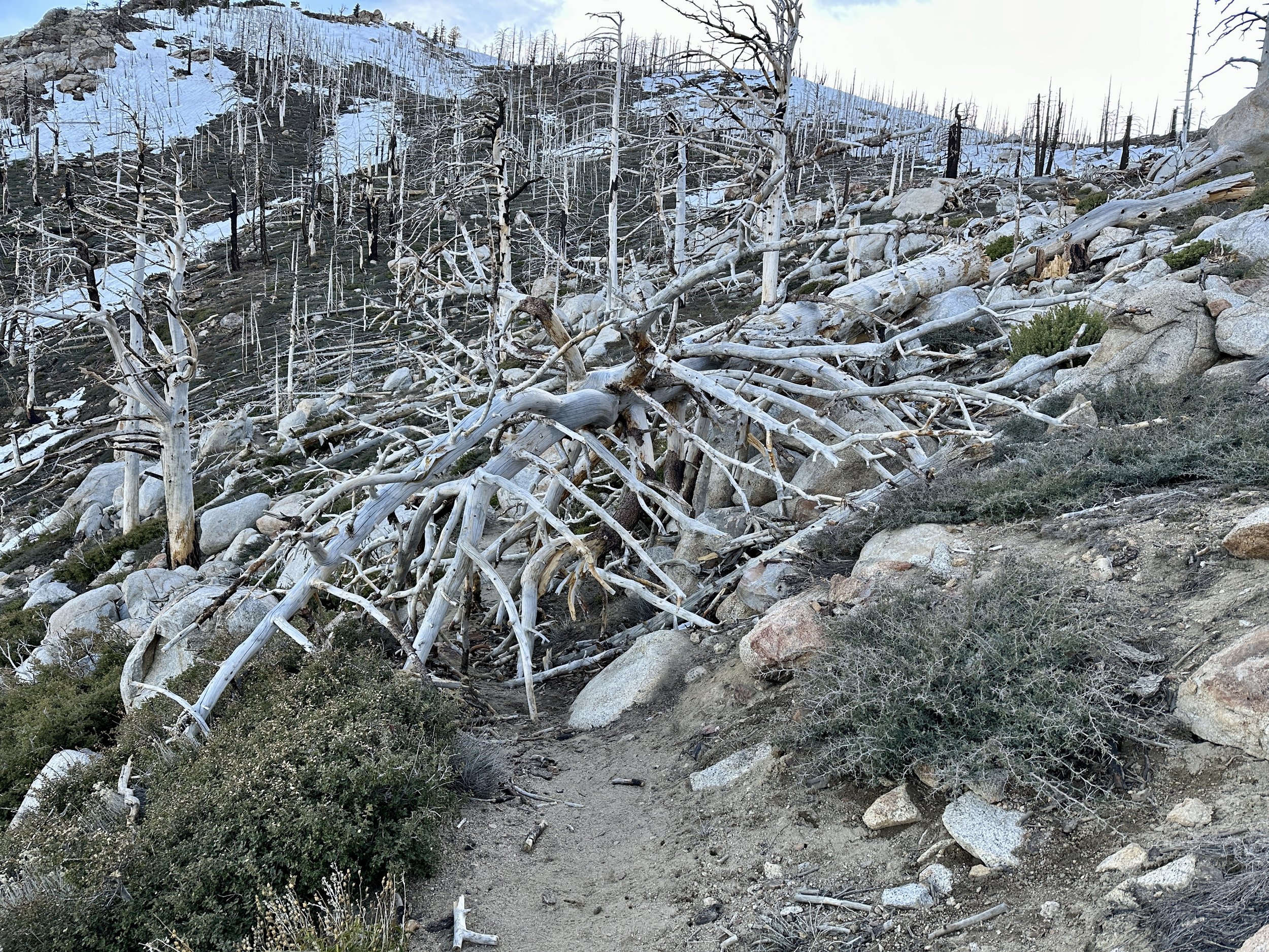
The following day brought the rise up to Apache Peak. This was a hard day of hiking. I don’t know if it was general fatigue, the new steep grade or the altitude, but I was struggling. Numerous blowdowns (dead trees that had come down across the trail) required climbing or navigating around.
There were also the infamous traverses around Apache Peak, the first potentially dangerous section of trail. Apache Peak, in snow years, could provide extreme exposure, that is a high risk of injury in case of a fall. San Jac Jon, an Englishman who summits San Jacinto multiple times a week in almost all conditions, provides weekly reports on conditions on the mountain at sanjacjon.com. Even after the recent storm he noted that Apache Peak on the PCT could be navigated with microspikes and an ice axe, equipment I had training on.
After the first traverse on Apache, though, I decided, I would get off the trail at Saddle Junction and take the alternate trail to reconnect with the PCT at mile 190. It wasn’t particularly nerve wracking. I just decided the reward was not worth the risk. There was enough snow to slip. There was not enough snow to self-arrest (stop a slide with an ice axe).
The day remained a slog and I worked through the remaining miles with Tony from Texas, whose wife was along for the journey, supporting by van, but leaving the backpacking to Tony. I hike faster when talking with others and during tough stretches this can really take my mind off the hiking. Tony definitely helped me get through the drudgery of the day.
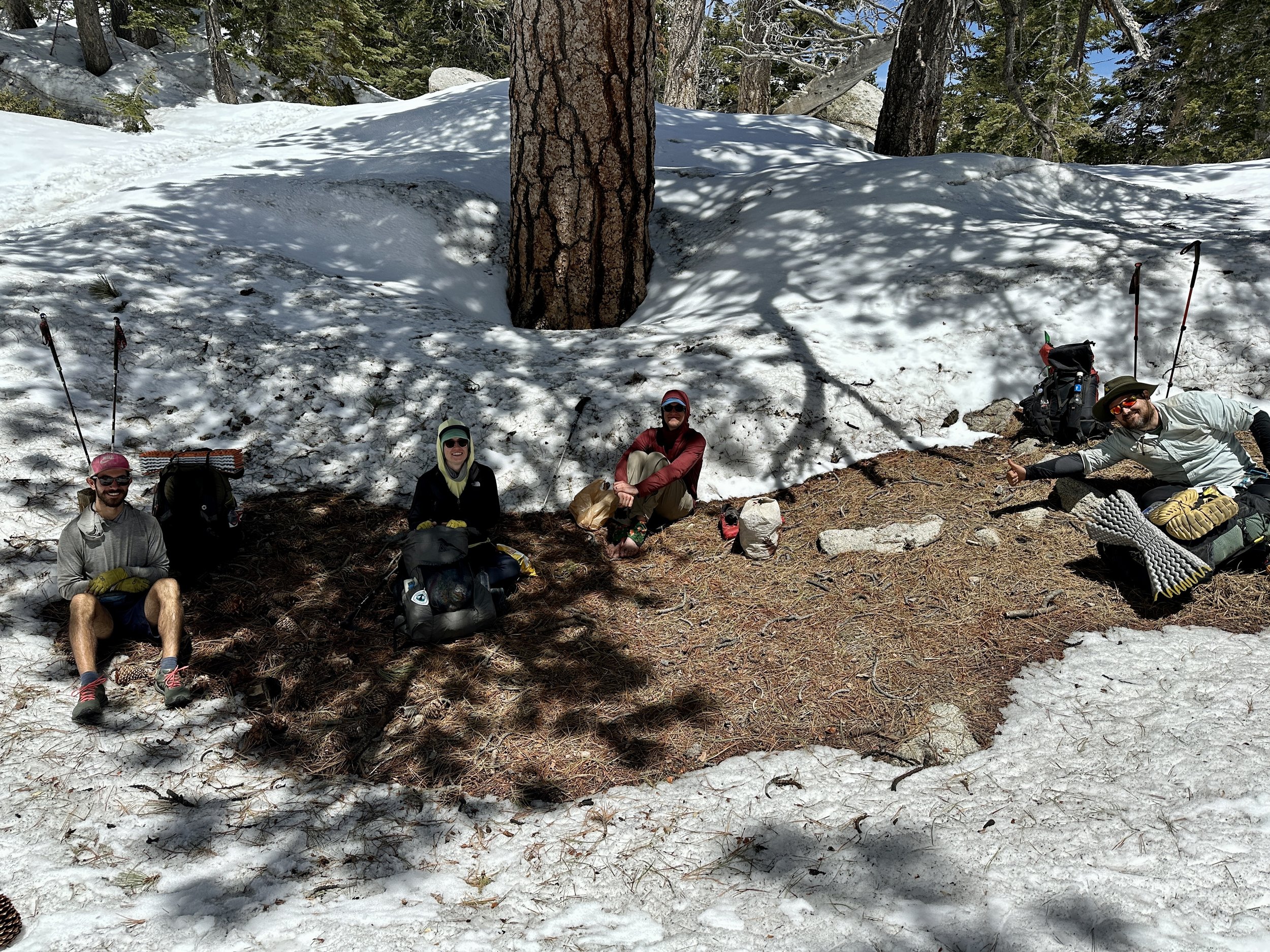
Finally, after a day long on obstacles and elevation, but short on miles, I made it to a camp at 8200 feet that must have had 30 tents. All of the usual suspects were there: Jan, Oofa, Rene, Lloyd, Tania, Martin and more. I found my little slice of San Jacinto heaven and accidentally and repeatedly kicked out the tent stakes of my good-natured neighbor, Pacman, while I was setting up. He and I would spend much of the next week together, including the challenges of the days ahead.

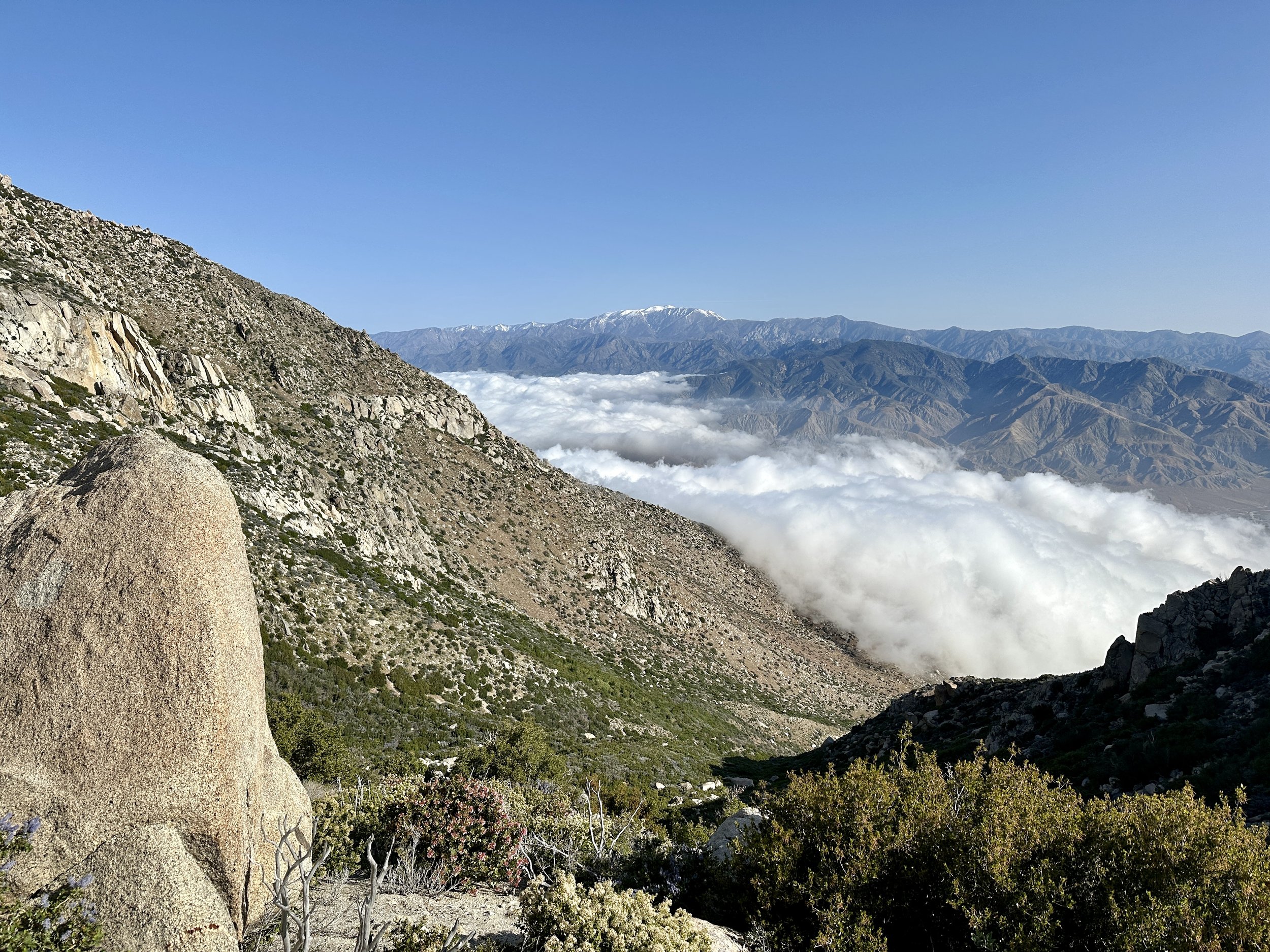
The campsite was stunning. A carpet of clouds lay beneath us with various ridgelines and peaks poking through. Everyone was thrilled the day was over. My feelings at the campsite turned from sullenness to elation. Maybe I would do Fuller Ridge after all. I would decide the next morning at Saddle Junction.
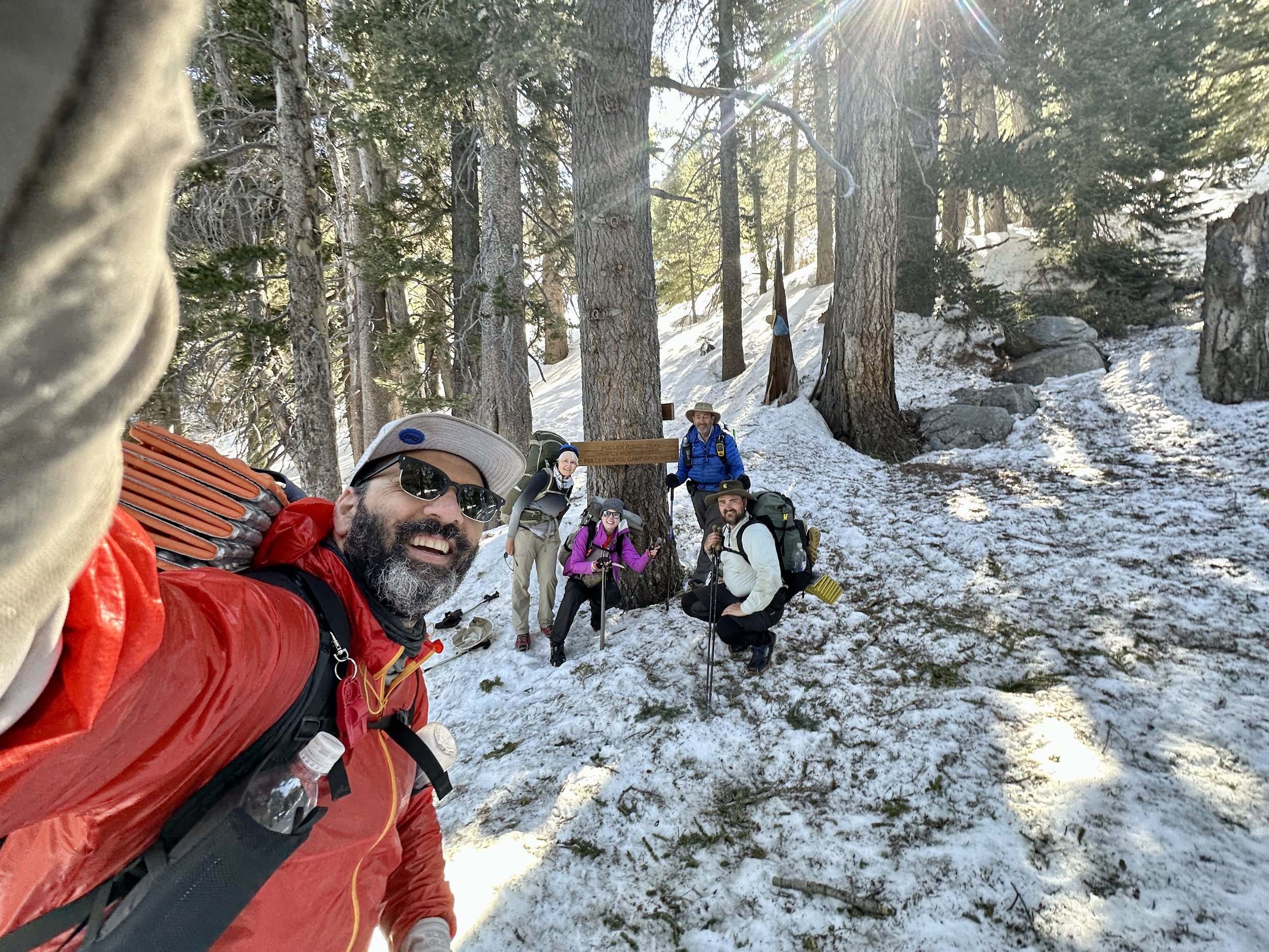
The morning after the climb around and above Apache peak brought a quick exodus from the camp and crisp snow cover, perfect for navigating in microspikes. It was a fun morning with Door, Kidska and Light Bright, a truly exciting trio to hike with and talk about life. Pacman joined in and we had a great alpine time, admiring the views and taking pictures above snow buried signs. We walked on, getting closer to Fuller Ridge, a dangerous stretch with little margin for error.
When the five of us hit Saddle Junction, I initially stayed back before pushing on. In the end, I decided, I could always back track and come back to take the bail out at Saddle Junction. I did not. I’m here and I’m fine. But I certainly wish I had.
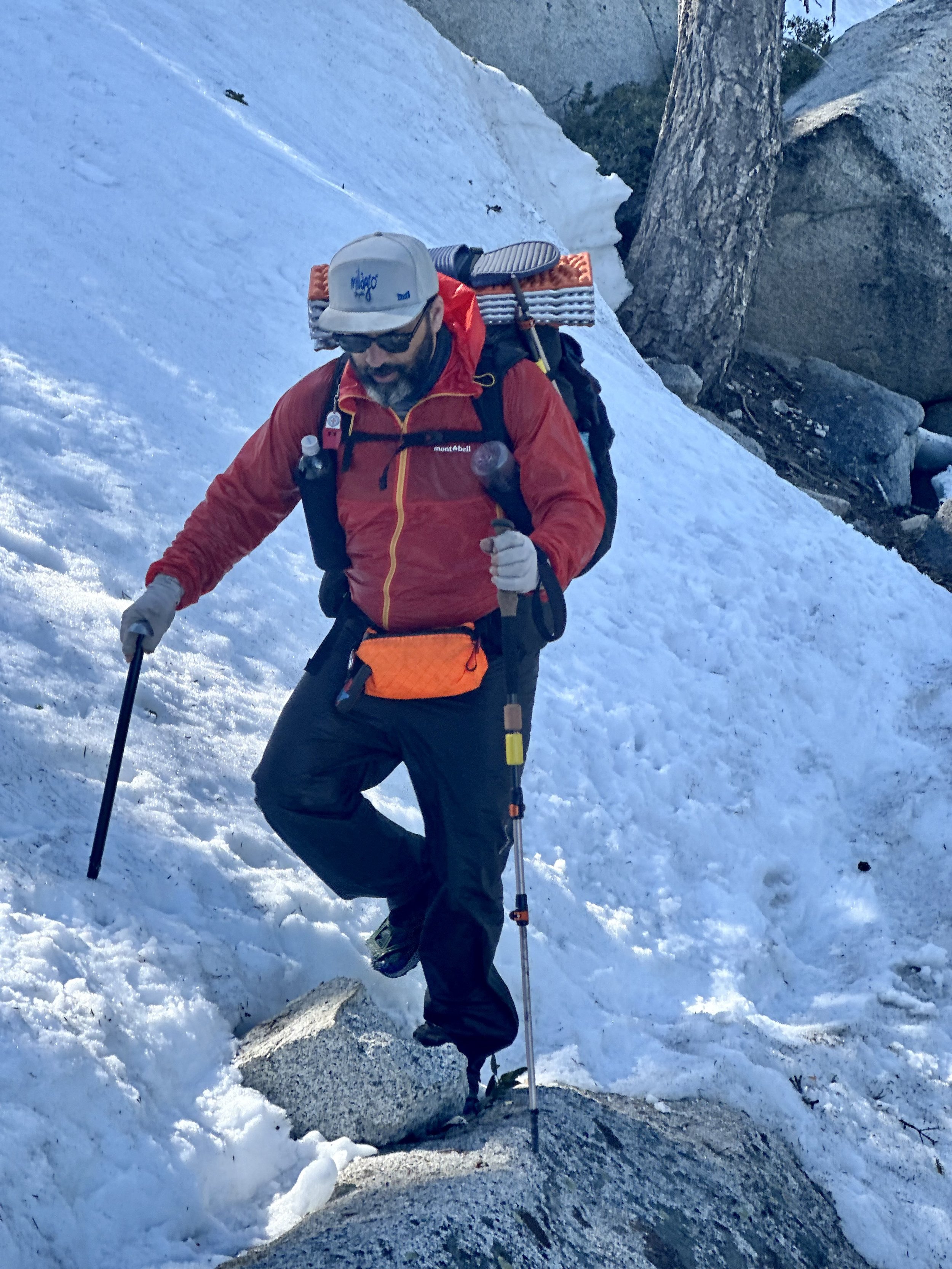
As we went on, a good seven or eight miles before Fuller, the snow started to soften. There was a clear boot path and little exposure. Travel was still fairly fun. There was a small decline that some hikers were down climbing. I decided to glissade down. Despite a few winter day hikes in Colorado and a full three days of winter mountaineering on Mount Washington in February, this was my first lesson that letting go of control on snow without aggressive equipment and real thoughtfulness could quickly go south. The short glissade decided to become a slightly longer one. I used my trekking pole to arrest and in doing so, bent it. In some ways this was a win. One of the reasons I have heavier aluminum poles, compared to lighter carbon fiber ones, is that carbon fiber would snap in such conditions; not great when you need your poles to support your tent or provide stability on snowy terrain. I could bend this pole back for the time being.
There was never any real risk in this slide, but the sense of losing control is never a good one. If this had been the only instance, I think my headspace going into the next day would have been different, but, unfortunately, it wasn’t. As the five of us headed on we found a number of snow bumps, maybe 5-10 feet long along tree wells and I feel like I was the only one that slipped coming down them. I didn’t reassess and I didn’t change my strategy. A second pole bent. At this point it was clear that Kidska, Door and Light Bright would continue on that day and Pacman and I would end at Strawberry camp, about 4 miles before Fuller Ridge. After a water stop, Pacman continued on to camp and I said I would meet him, and decide if I was going to go forward or not then.
On the next tree well bump after Pacman had moved on, I slipped again, this time snapping one of my poles in two. Now, I still had the right equipment to navigate a snowy traverse: an ice axe for the uphill side, a trekking pole for the downhill side and my spikes. It didn’t matter. Once the pole snapped, my confidence was absolutely shattered.
I took some time to look at my options: I could return to Saddle Junction. I could also, it turned out, descend from Strawberry Camp via Deer Spring Trail. I could go in and do Fuller Ridge.
Backtracking solo did not appeal. Deer Spring Trail solo also did not. I didn’t know the snow conditions or how often it was traveled. I had also got information from a hiker ahead that had done Fuller Ridge before the recent storm that it was not so dramatic. I decided that pressing on with a group, including Pac-Man, that was starting the next morning the way to go. We would start at 6:30 the next morning.
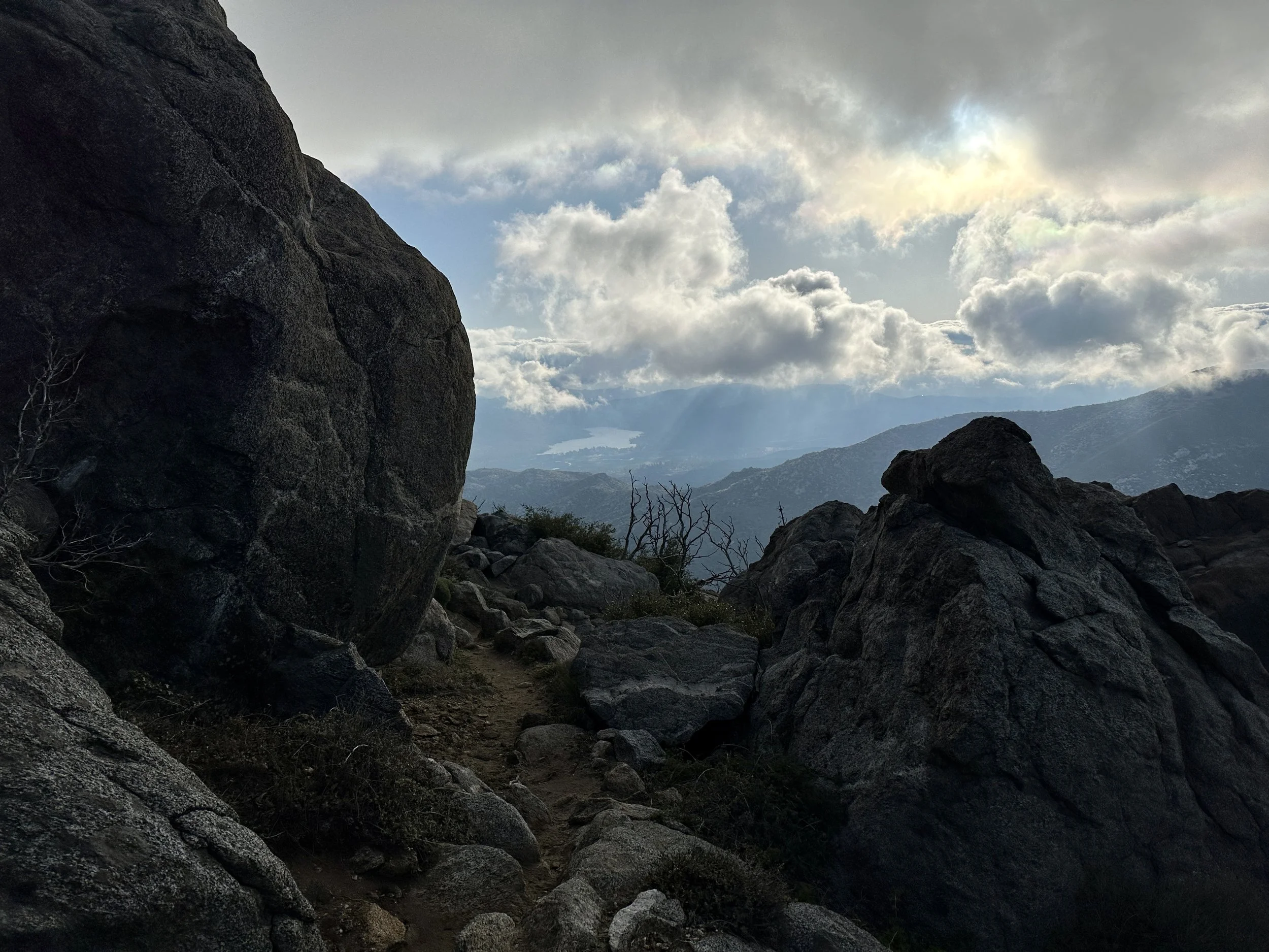
The early part of the day was incredible. Stunning views. Slow but safe snow travel that made us all feel accomplished. We took pictures. We told stories. I took my time. I used my ice axe to down climb the type of short descents that had given me trouble the day before. Even after getting off course we were in good spirits for a quick lunch and even better as we hit a quarter mile of dry switchbacks down and back up the trail. Conversations were flowing. Things were looking up. And then we hit Fuller Ridge.
The Fuller Ridge section of the trail is quite a bit like Apache in that it is also very exposed. Unlike the four short snow traverses that remained, however, Fuller Ridge was three full miles of eastern facing slope, completely snow covered and some of the first to get hit by the sun's light. San Jac Jon had said that a few days after the storm it would likely be difficult to navigate Fuller with microspikes. We were probably just beyond that timeline, but not well beyond it.
We hit Fuller Ridge at noon and the snow had been melting in the sun all morning. What followed was five hours of the most harrowing hiking I’ve ever done. Every step was taken with near constant exposure to falls that felt certain to be fatal. Slips were common and each one came with an adrenaline spike proportional to the consequences.
Experienced hikers and climbers navigate exposed routes all the time and one of the capacities they have is the ability to work in exposure with less fear. Even while we were on Fuller Ridge, another group of hikers flew through, and when I caught up with them later, didn’t seem to think it was so bad.
For our group of five, two of whom had no ice axes, only trekking poles, it was another story. We marched forward in silence. I have never been so ceaselessly on edge for so long. To maintain an absolutely uncompromising level of focus under a blanket of such fear brought me into a place I had never inhabited before. Eventually, I pushed through the last fraction of a mile with one member of the group. The terrain evened out. Patches of pine duff emerged and we came upon the other three snacking at a tent site.
The cathartic release was intense. To finally have the absence of the fear and the relief from the focus was incredible. I had extreme gratitude for being alive, but it will be the release from these feelings that I think I’ll remember most acutely.
We quickly packed up and started making our way down San Jacinto, happily padding away on terra firma. Before we turned off from a final viewpoint, I asked the other four, Sweetgreens, Linda, Pacman, and Anna to bring it in and we made a little circle with our arms around each other. I was certainly no leader of the day but I wanted to mark the moment. I said that today had been a lot, at least for me, and that I was glad that we had gone through it together. On a journey like this a group can fracture at any moment as individuals meet competing needs and timelines. Having this moment felt important.

Racing down easy trail to a beautiful creek washed so much of the day off of us. We made camp a quarter mile up from the clear, cold stream and that night I cowboy camped for the first time, sleeping under the shadow of San Jacinto as the stars faded into the sky. It was cold and the wind howled, but I slept.
Less than 24 hours later, we would be feasting on In N Out Burger and enjoying the hospitality of the Morongo Casino Resort, the finest trick stop casino I’ve ever been to. How quickly things go back to normal after near misses is staggering.

The next morning, my brilliant plan to resupply through Instacart delivery to the casino did not pan out. So after a big breakfast at the casino, Pacman and I raided the local Dollar General, met a few more hikers and were off to climb back out of the windy basin between San Jacinto and San Gorgonio, the tallest peak in Southern California.
The descent from San Jacinto had been nonstop and windy. The local windmill farms were there for a reason. Even veteran hikers had struggled through a dispiriting last three miles, leaning against the wind, legs stung by wind-flung sand before the I-10 oasis, a bastion of trail magic with cold drinks and snacks for hikers passing through.
The rise into the Transverse Range was no different, but with the casino’s finest eggs in our bellies, it was easier to start into the wind. Pacman was off like a shot and I simply marched through, enjoying the rise into the desert I had become familiar with before San Jacinto. All the while, San Jacinto’s familiar snow streaked peak would come back into view. I’m not sure if I would recognize it without the snow, but with its streaks of confectioner’s sugar, I don’t think I could ever miss it.
Before reaching the Whitewater River I met Sticks, a fireman from San Diego, and briefly hiked again with Tony. Occasionally, on a hike like this, you cross paths with a hiker of incredible capacity–30 and even 40 mile days being possible, almost standard for them. They’re a memorable blip on your hike but you’re unlikely to ever see them again. Earlier in the hike Old Head was a ghost, arriving after dark and departing before first light. On the night by the Whitewater River, Rat Tail arrived at 4 and we got on like gangbusters. We Cowboy camped on the band if the river and talked until hiker midnight, which is 9 p.m. and is observed with the solemnity of Yom Kippur. They broke the mold when they made this hiker and I hope the trail brings us back together again.
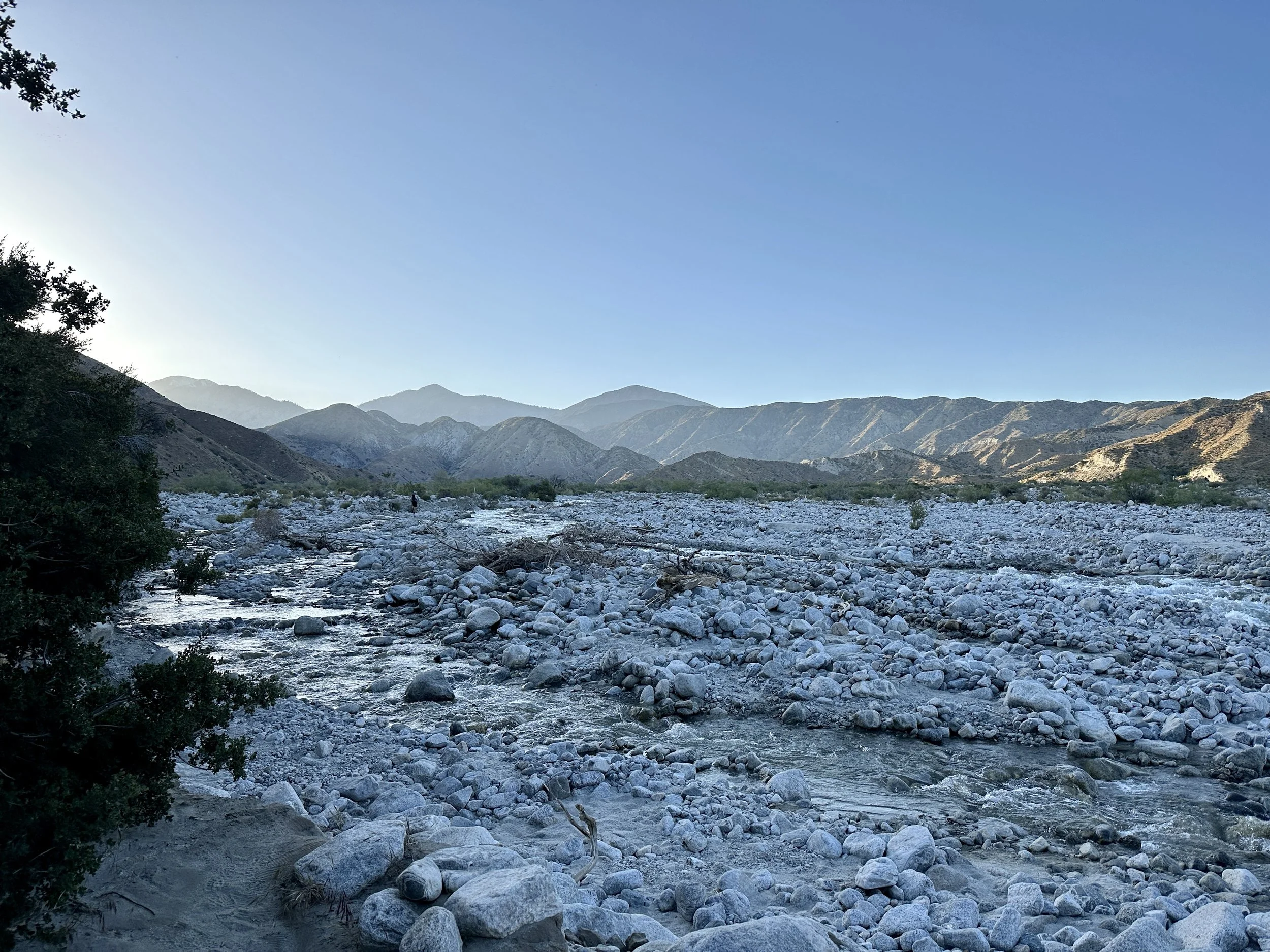
The next morning Sticks, Rat Tail and Roo guided the water crossing, the biggest in Southern California. After that we were all off on our own paces. I hiked a lot with Kachow and learned about his experiences moving to Norway after high school and the moment that made him want to work crafting houses from wood.
We would then descend to Mission Creek which, at its first crossing, became a hiker oasis. If there was a bingo card for hiker siestas, surely someone would have won. Underwear drying on a tree. Check. Hikers cooling feet in stream. Check. Hikers drying quilts and tents. Check. Hikers elevating feet. Check. Hikers sleeping. Check. Hikers comparing blisters. Check.
Kachow asked if I knew what the tree was that we were resting under (it was a sycamore), and he mentioned that he felt guilty for wondering what the wood inside looked like.
The rest of the day included at least twenty more crossings of Mission Creek, very wet shoes (which apparently are good for my blisters), and a big rise of 4,500 feet into the mountains.
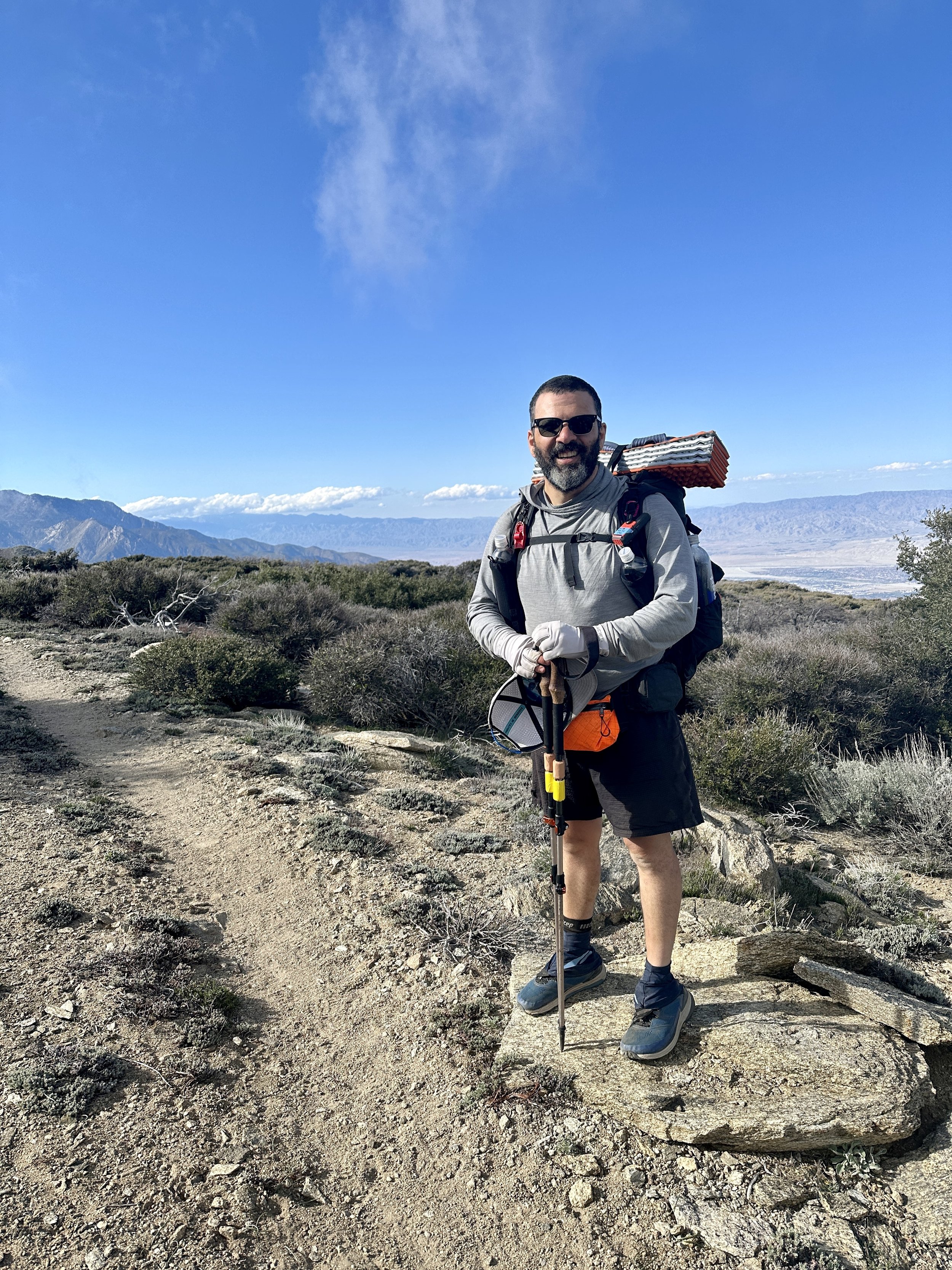
The next day was a similar rise, and I was on a mission to make it to mile 250 to hitch into Big Bear to get a package and, hopefully, new shoes. I did what had taken me 12 hours the day before in 8 and couldn’t have been prouder. The joints might be in rebellion, but the muscles are executing the mission. I picked up the package and met Papa Smurf, a trail angel, who had accepted my shoes picked me up. REI sent the wrong shoes but it didn’t matter. I had met the goal and I had the bounty of a Stater Bros. and a Vons–real grocery stores!—my resupply.
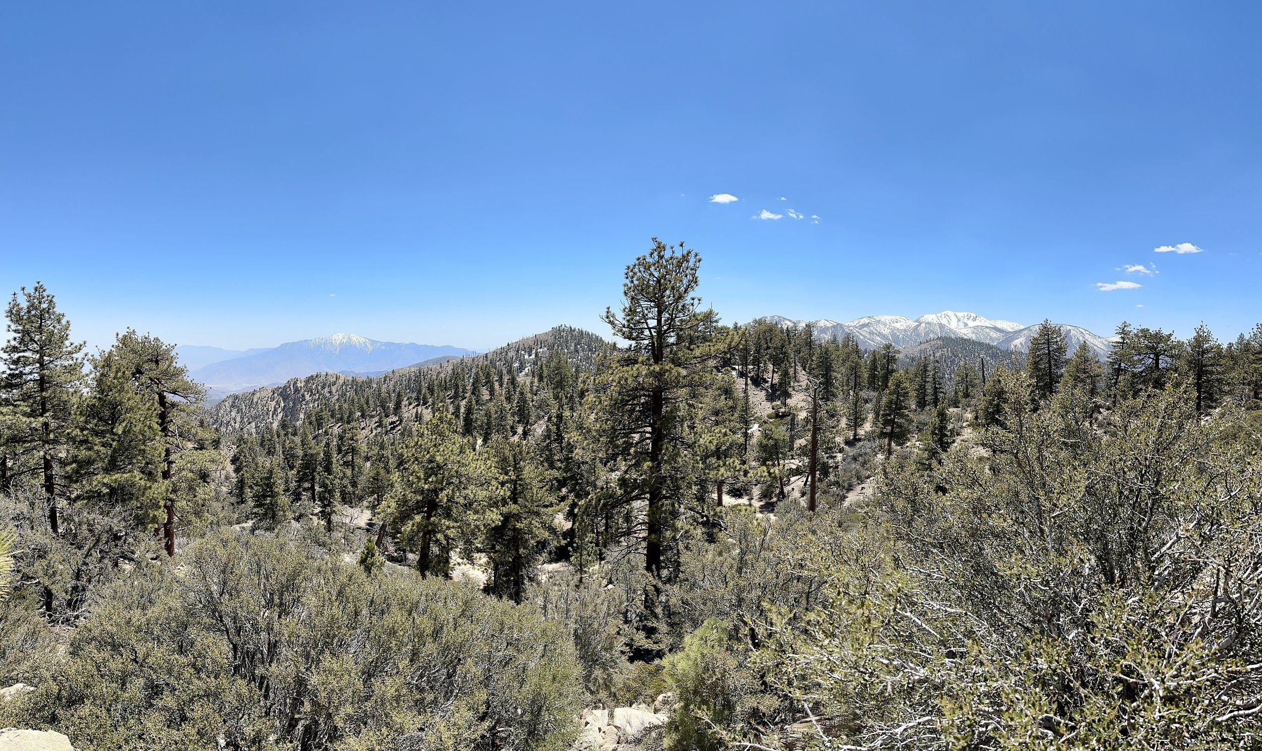
San Jacinto to the left. San Gorgonio to the right. I missed the opportunity to capture these two along with Baden-Powell (the next peak) and San Antonio (a.k.a. Mount Baldy) near LA.

Looking east to LA from San Gorgonio
I spent the night at an impossibly cheap, accommodating hotel with two jacuzzis and dollar laundry before heading back to the trail to knock out a couple of nearos along Ararastre Creek. I ran into Jan, Oofa, Rene and Kachow. I had another session with Blaze Physio. I had some great chats with my original tramily (trail family) up the road.
Somewhere between San Jacinto and Big Bear I realized that I had been treating every setback on the hike as an existential threat to continuing on. If it wasn’t one thing, it was another. But it was clear that obstacles would keep coming. New things would start to hurt. Groups would form but also separate. A successful hike wouldn’t necessarily be defined by a continuous footpath to Canada, but by successfully navigating continuous adversity. I could enjoy the hike and I would definitely enjoy the people. But it would never be easy. The commitment is to see it through.
Not that long ago, I approached some repeated conflict in my life the same way. I couldn’t see a path to resolution and I still don’t know if there was one. I do know that I could have worked harder. I hope that persevering through the challenges of the trail helps me get better at this for the future. Successful completion of the trail depends on it, and, who knows what else might come from it?