
Thirteen Days
When I woke up on September 3rd, I didn’t know that it was going to be my last day on trail. I was only about 25 miles from my next resupply in Quincy and I had a date in mind for meeting my family in Kennedy Meadows South, at the other end of the Sierra. The trail, however, had other plans.
Over thousands of miles and hundreds of thousands of feet of elevation change, mountain after mountain, the Pacific Crest Trail is, unsurprisingly, covered in rocks. There is the infamous lava rock of central Oregon. There are the gray slabs strewn down toward Stevens pass that sound like walking on dinner plates as they shift underfoot. Millions of mostly unremarkable rocks. I must have stepped, and misstepped, on loose rocks hundreds, if not thousands of times since I started the trail in April. I did about a thousand miles in shoes with absurd stack heights. Many friends warned about their instability and I had many close calls. Still, he perambulated.
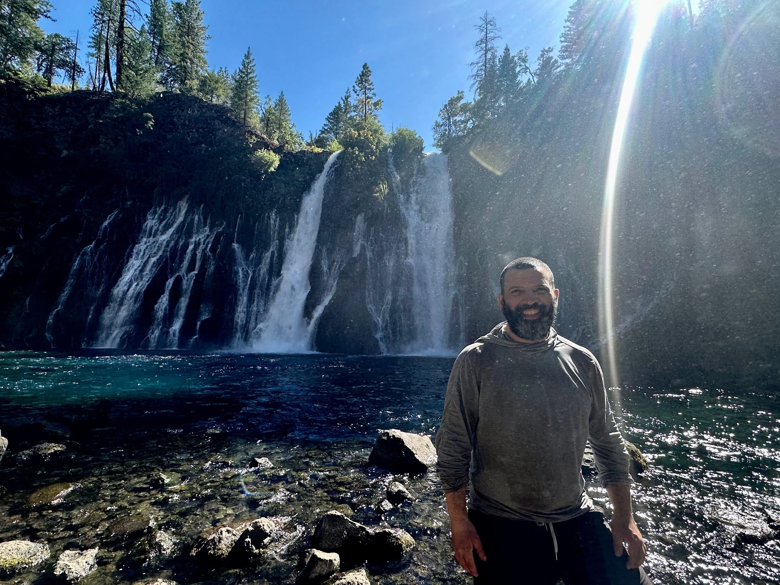
Then, somewhere in the ten miles between Burney Falls and Burney, at the very moment I was thinking about how much I loved my new, reasonable stack height shoes, I had a misstep that felt more like a sprain and was, in fact, the beginning of the end.
I had gotten to Burney by 7:30 in the morning and set a new record for town chores. By 11 I had resupplied, showered, and done laundry, so I decided a meal at the town’s finest diner was in order before getting back on trail. Simply walking around town with my fully laden pack had me limping, so I stayed the night, iced the ankle and wrote the previous post. And then, for the next five days, I put the pedal to the floor.
I don’t know if more rest would have helped but I certainly acted as though I didn’t need it and raced out of Burney. The trail out of town featured a fish hatchery, amorous bulls, less amorous cows, a plateau with views of Lassen Peak and Shasta, night hiking along the plateau rim, and cowboy camping as the Milky Way turned in the night.
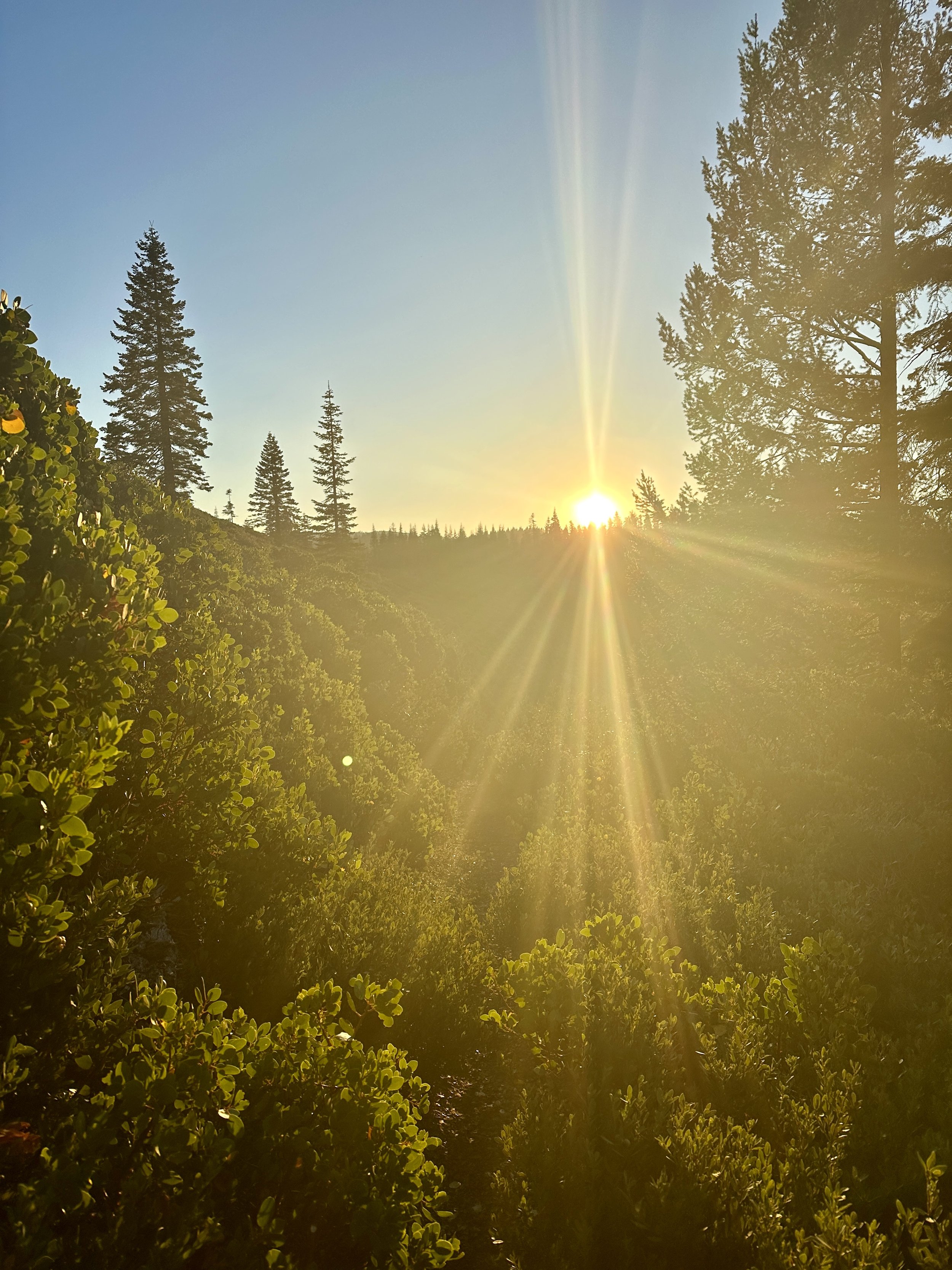
Powered by Mio (energy drink concentrate) and protected by ibuprofen, I moved fast the next morning. Once on the trail, the same cold air that had encouraged me to stay in my quilt was brisk and energizing. As light started to bleed over the horizon I moved faster, accelerating into the day. Getting up before first light is invigorating and I wished I had done it more.

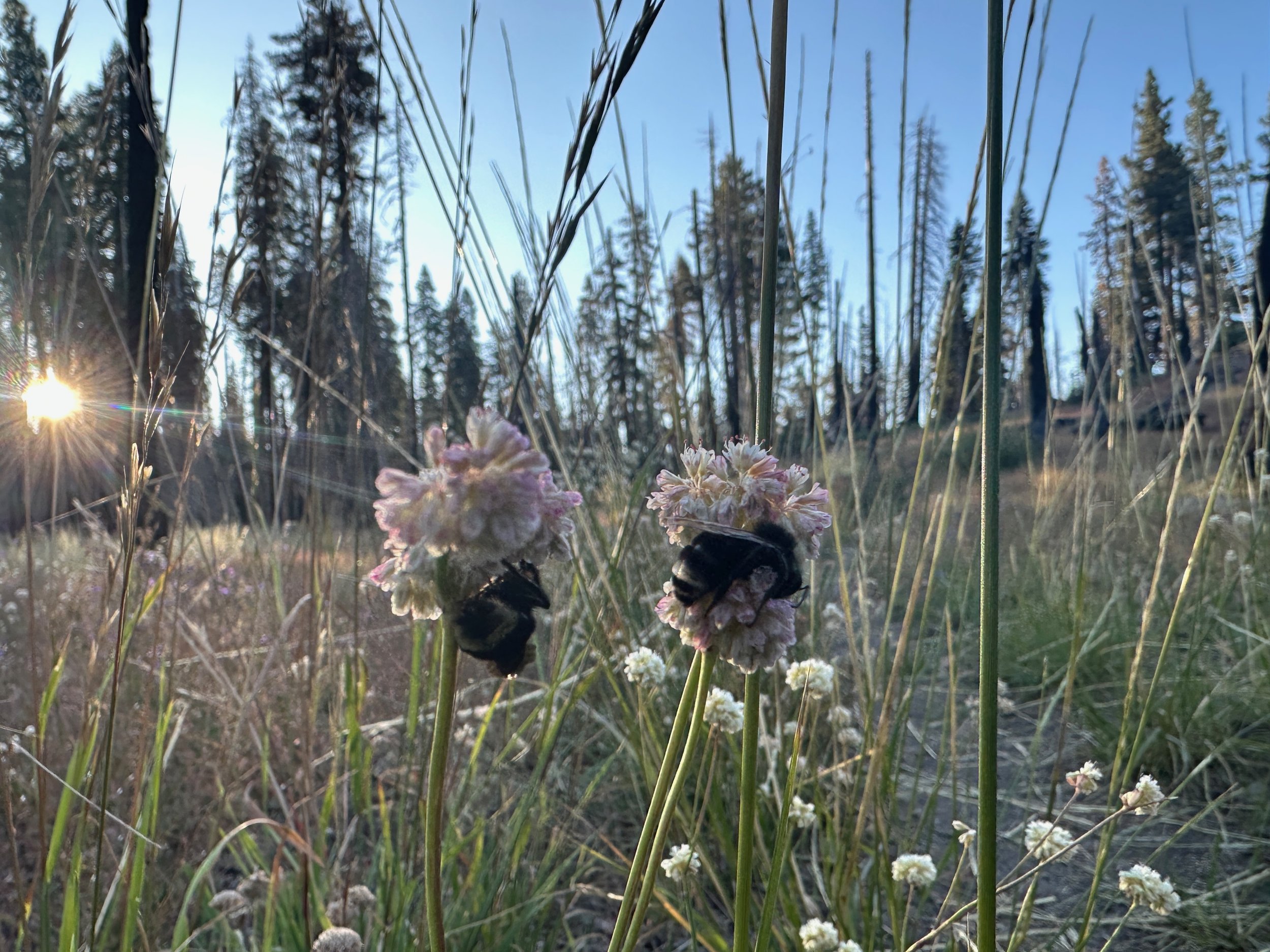
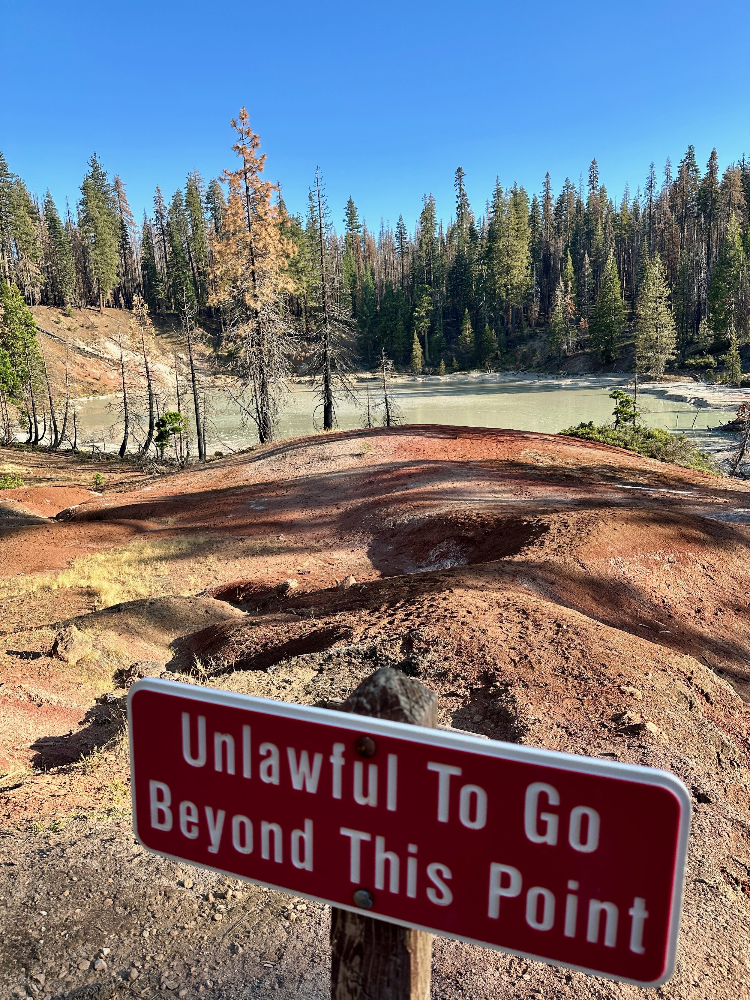
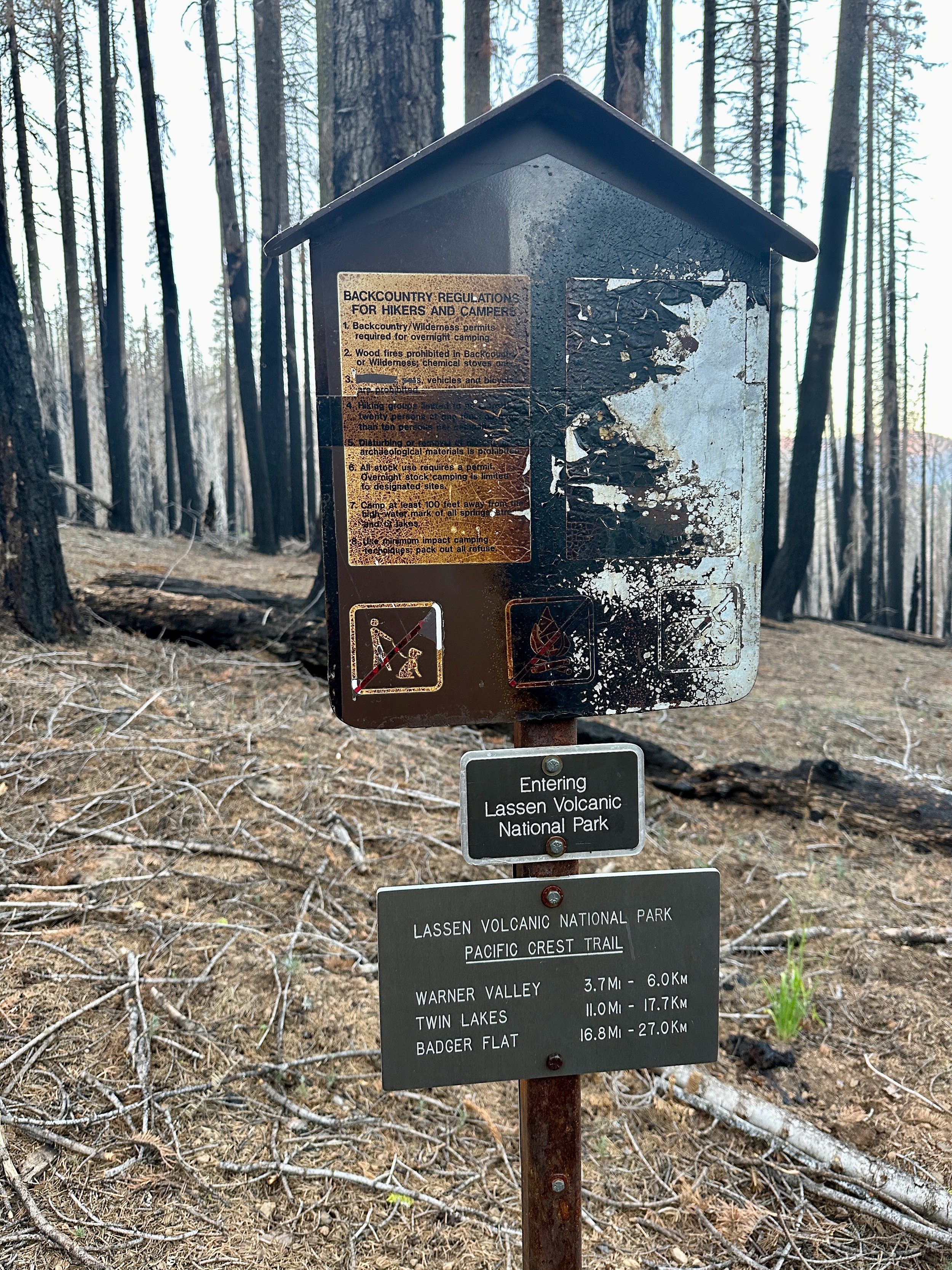
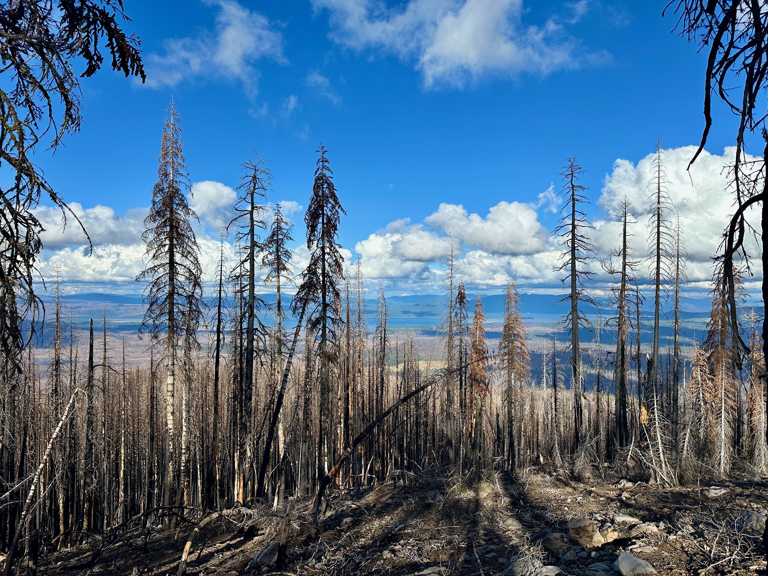
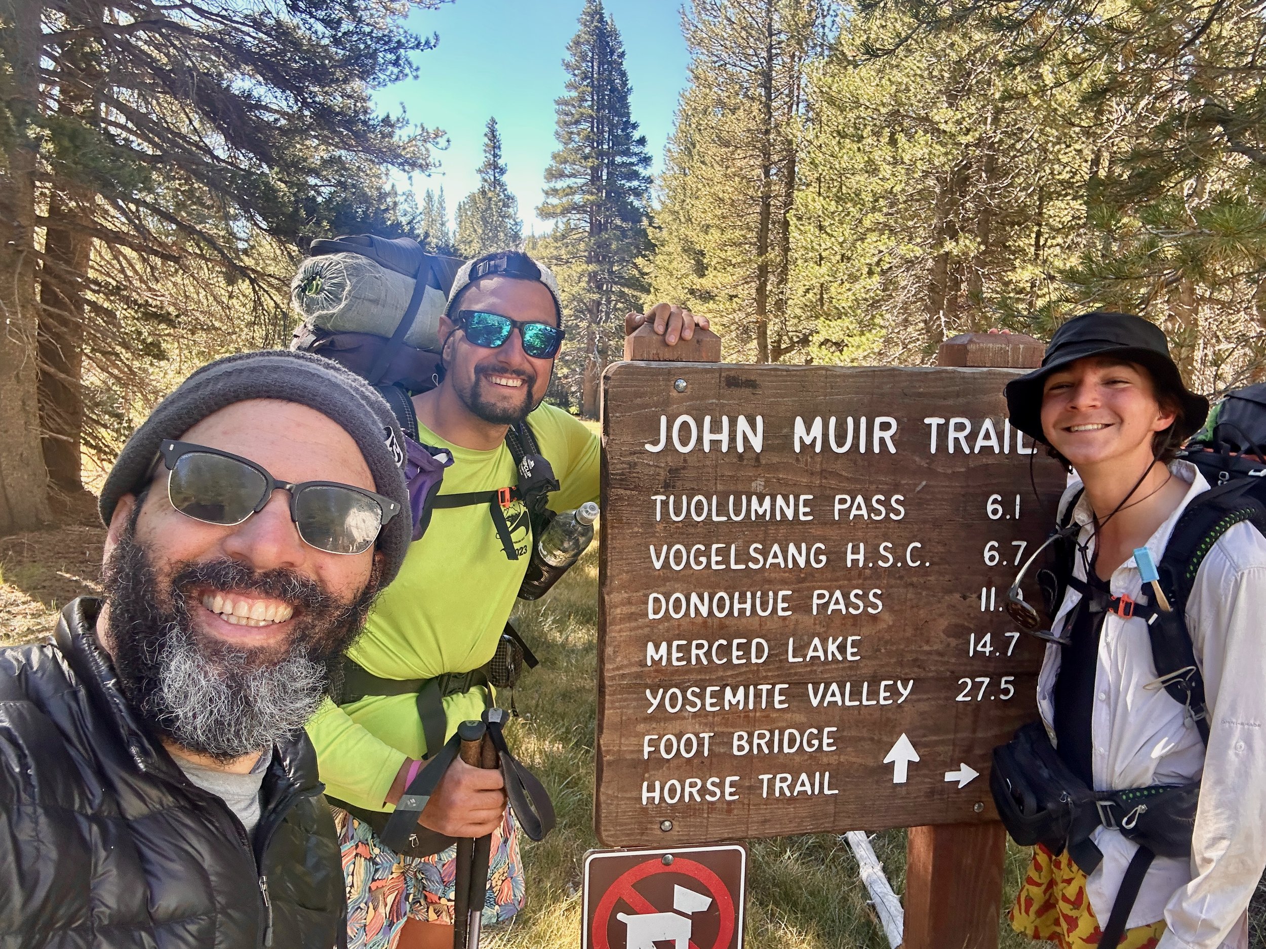
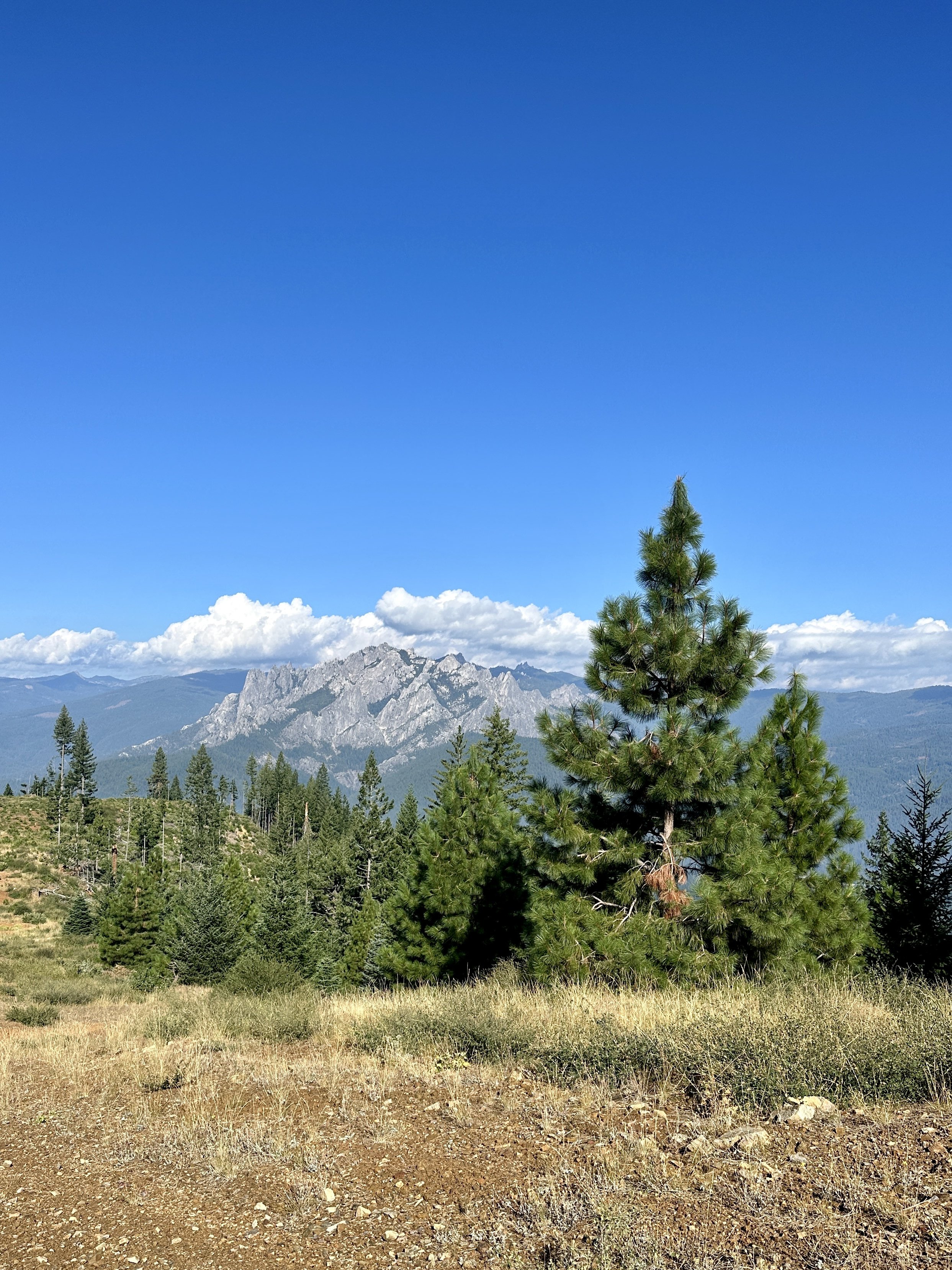
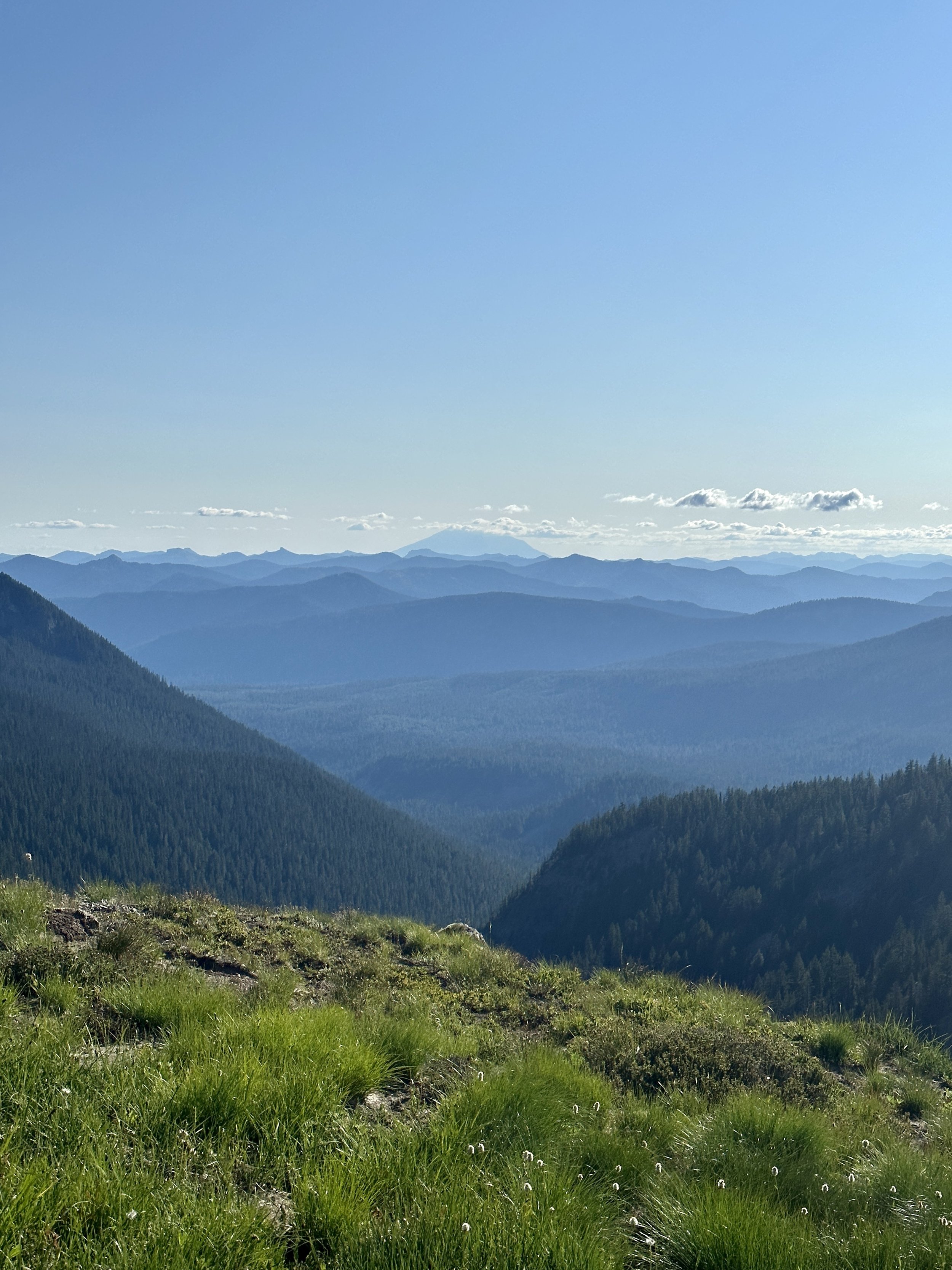
The trick after Old Station is to camp as close to the border of Lassen Volcanic National Park as possible since a bear can is required to camp along the 19 miles of trail in the park. At the same time, this is where the burn from the 2021 Dixie Fire becomes inescapable. Green patches are rare and the widow makers are ever present. I camped about 3 miles before the park and planned on making it to the Domingo Springs campsite about 5 trail miles and a road walk after the exit boundary, a 28 mile effort in total. Even a month before, this would have been intimidating. If the ankle held out, I knew I had the miles in me, and, despite being almost completely burned, Lassen offered a few treats toward its southern boundary: Boiling Springs Lake, heated to 125 degrees Fahrenheit by steam vents and a modest geyser that simply steamed in most years but shot up some water this season thanks, possibly, to a higher water table. Both were treats. I’m always up for a little geothermal action.
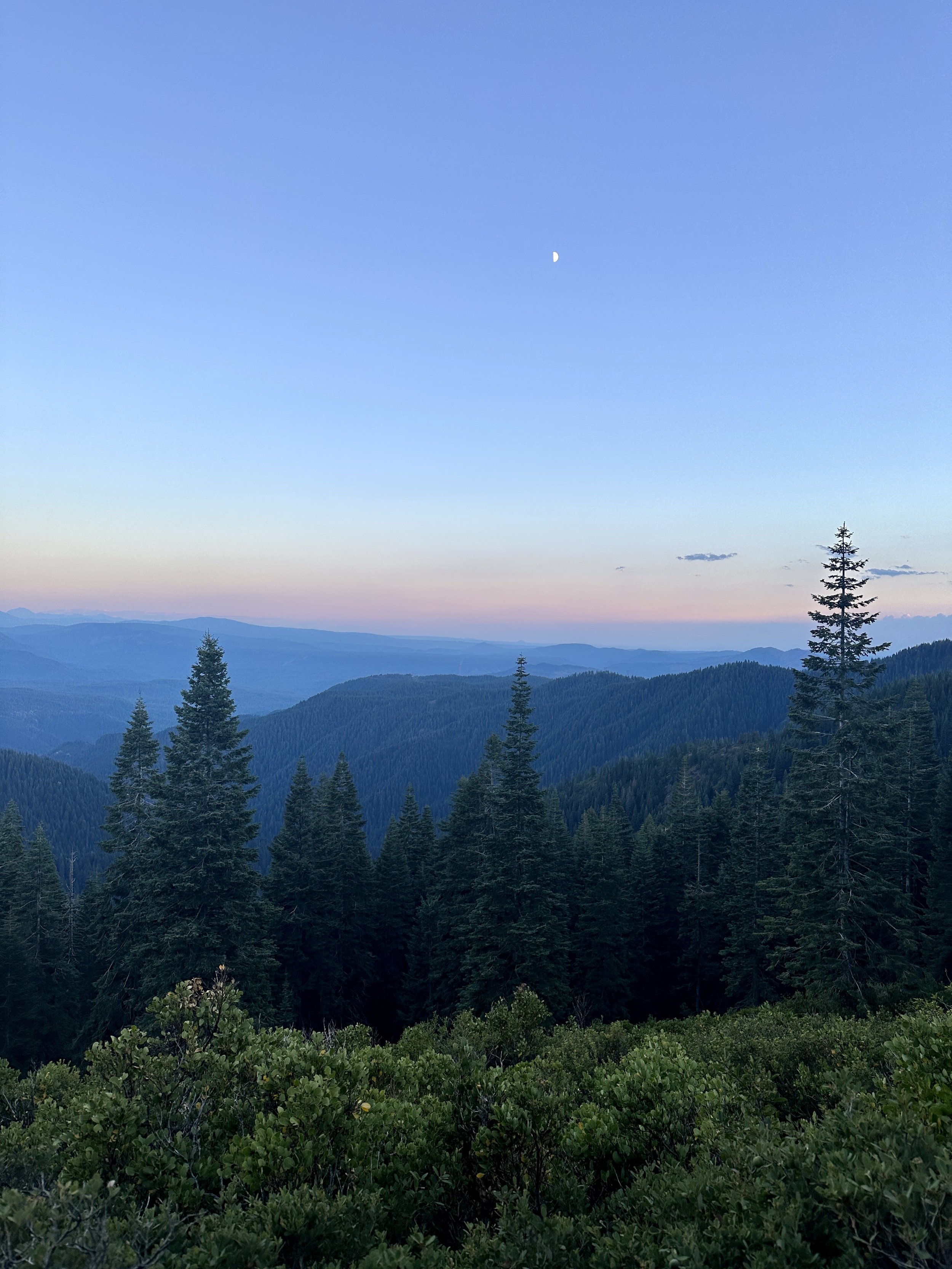
An enormous moon rose over the next ridge as I crossed the park boundary. Night had fallen but I wouldn’t need my headlamp until I reentered the forest a little further on. A barn owl, doing its best impression of a pterodactyl, called as I passed a campsite and I committed to the final 6 miles. The trees in the burn were covered by fruiting fungal bodies that plinked as they fell in the quiet of the night. Once or twice a full branch fell in the darkness, one of the more harrowing sounds of backpacking.
The injury that was aggravated by my bad step before Burney had been with me at a more manageable level for several hundred miles of trail, both in the desert and Washington, and I knew that relentless downhill could be trouble. The descent into Domingo Springs was about the worst that it had been. I had the night to rest and, thanks to Blaze, my bookbinder friend from the other night, I had a homemade freeze-dried beef stew–hot beef stew thanks to the stove I acquired for the Sierra. Eating on the trail had been pleasantly utilitarian for me. I had no complaints about four months of cold mashed potatoes and salmon packets, but there was no denying the joy of this gourmet feast.
The highs and lows of this week were whiplash. Beef stew. High! The ankle in pain for the flat ten mile stretch into Chester the next day. Low! Meeting up with Lucy and Caterpillar (formerly Pockets), who I started southbound with, and their friend Trent. High! A blistering 15 miles out of Chester after 2 pm. High! A frigid rainy 23 miles toward Belden. Low!

The last 5 miles of the 23 that day were the real low. I had been on track to make it to Belden a little after dark, but sometime after I passed the geological boundary between the Cascades and the Sierra the ankle had me down to a mile and a half per hour. I might have been winning the mental game with the ankle, but I was losing the physical war. There are few things I like more than being warm and dry under a roof sounding with rain drops. As I camped near the ruins of an old cabin that night, the weather obliged.
In the morning, the rain broke and I got back on trail for the last five miles into Belden. Somewhere in those last miles, this herky-jerky style, where a day off only earned me a few days of hiking seemed unsustainable. The best I could do, it seemed, was limp toward the Sierra. Entering that extreme terrain with its long food carries was a non-starter. Beside feeling pushed off trail because of the injury, I felt pulled by a desire to apply my learnings from the trail in the real world.
Although I found through-hiking to be a lot less restorative than shorter backpacking trips, the noise of regular life was clearly reduced. Some lessons came early and I had hundreds of miles to better understand or work on them: difficulty in dealing with certain kinds of adversity was one early lesson. Although I wanted to be on trail more than anywhere else, realizing that a misplaced competitiveness had been part of what brought me there helped me shed a number of distracting thoughts. The relentless challenges and surprises of the trail gave me time to contemplate on and practice, sometimes successfully, these learnings and others. I was looking forward to bringing this process to the off-trail world. This came with a feeling of guilt, however. This sense that I would enjoy post-trail life made me question whether there was a difference between getting off trail due to injury and simply quitting.
Still, it was settled. This would be it. It felt right. I felt optimistic. I slowly made my way toward Belden, the conifers on the ridge across the river fading in and out of the stubborn mist of the morning. I started to play out possibilities for my most immediate days post-trail. Maybe hitch down to LA and celebrate my birthday with Dave and Gustavo? Visit my friend Noah’s new bar? Follow that up with trail magic for Lucy and Naked Dave as they made it to the desert?
As I thought along these lines, my earbuds were filled with the tell-tale ringing of a FaceTime call. It was Kyler! He was checking in from the southern Sierra. He had a few hikes planned around Whitney, but after, did I want to do the Sierra southbound? Hell, yes, I did. All of a sudden, those trail lessons didn’t seem like they needed immediate application in the real world, the need to rehab my ankle a less welcome conduit for doing so. I told him I wanted to, but also that there was trouble in paradise. I’d reach out soon.
Immediately, I scrapped the LA plan. I would rent a car, do some trail magic, shuttle hikers around, schedule some time with Blaze Physio and rehab the ankle. I would not say goodbye to the trail just yet.
I dropped further down toward Belden, finally catching a glimpse of the bridge over the Feather River. Was that a martini made of iron and Edison bulbs atop the bridge? Earlier in Oregon, I had learned that trail adjacent resorts were more rustic cabin than five-star luxury. Still, this incongruous icon could only be read as a welcome sign.

I was joined in Belden by a coterie of very wet hikers, relieved to be off their feet and out of the rain. There were no martinis, but there were some local recreators who shared their breakfast burritos. The sun came out and we had a yard sale (dried out our gear) and charged up our devices. An older couple was heading toward Sacramento and were kind enough to give me a ride. This was good luck. The southbound climb out of Belden is of a legendary grade and most vehicle traffic was two-wheeled.

Within a day, I had picked up my car in Sacramento and, with a cooler full of beer and Lacroix, I headed out. I spent the next couple of days driving to the north Sierra, then south to Truckee, distributing Coors Banquet and PCT hikers along the way. I had been in touch with Kyler and Trevor who, along with Sydney, Amelia, Leggy, Gusher and Stakes, were going to camp at Onion Valley Campground on my birthday before tackling Mount Whitney. I would join them for the camping, at least.
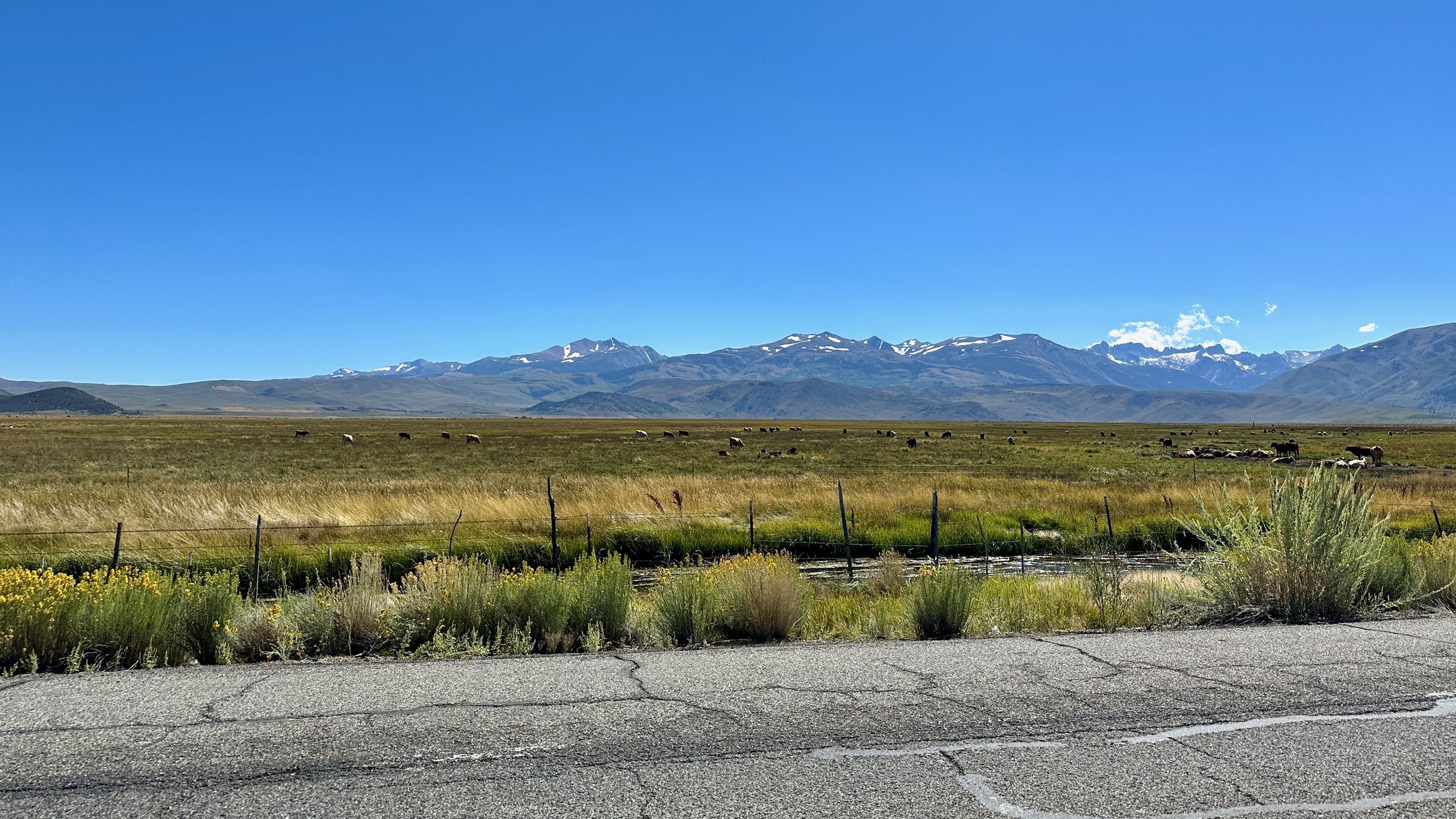
US-395 is possibly the most beautiful drive in the country. The Owens Valley sits just below 4,000 feet, while the tallest peaks in the Sierra sit above 14,000. The perspective on these peaks from the valley floor is nothing less than majestic. The stories of the hikers I met, along with these views, were some comfort for not covering these miles the way I had wanted to.
A little further down the way, I picked up pizza in Bishop and half of the crew in Independence before heading up to the campground. The pizza feast was preceded by a candle in a gluten-free marshmallow. A round of happy birthday rang throughout the Range of Light, or at least Campsite 11.
The first days on trail with Kyler and Trevor and Sydney had felt incredibly special, the bond with them as real as any of my friendships that don’t span an age difference of decades. While our meeting might have been happenstance, the fundamentals of the bonds were clearly not random. The other hikers that they had met along the way, some of whom I knew well and some of whom I had only met during our Washington meet-up, had the same commitment to humor first, the same maturity, the same strong empathy. I had often questioned my decision to flip up to the Canadian border. I could have met this crew at Crater Lake and continued north with them. It would have been a lot of fun. But there would have been other bonds lost. It’s hard to imagine Lucy and Naked Dave and Sweetblood or Big Daddy and Jai and Maverick or Wonka and her trail family as mere faces passing south.
We said our goodbyes the next morning and I headed down to Independence, picking up several hikers on the way. I drove north, the jagged peaks of the Sierra once again towering over my favorite highway. .
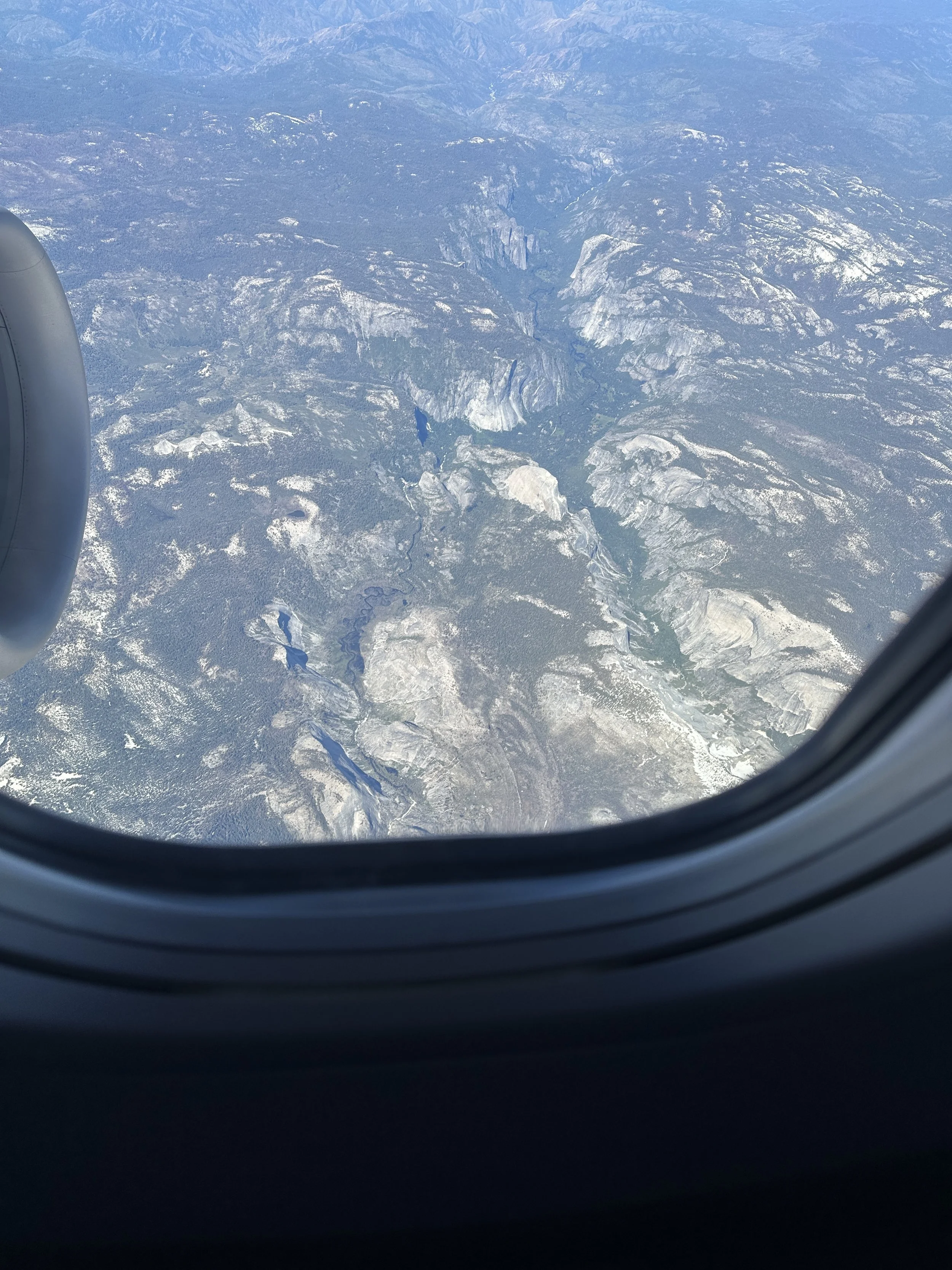
Just outside of Yosemite, I ran into Sam and Cameron, who I hadn’t seen since Washington, and camped with them at one of my favorite campgrounds outside the park. The next morning, I drove them toward Tuolumne Meadows to drop them off for the Sierra High Route. On the way, we happened upon the Israeli-born hasidic rabbi who drove them all the way from Oregon to Yosemite a few days before. He supervises a matzo bakery in Williamsburg. Naturally, we exchanged information
I then took a few more hikers down from the park and crossed the Sierra one last time on my way to Sacramento. I spent the next day with my friend Adam, who I knew from our time with Teach for America in Louisiana, meeting his wife and daughter for the first time. In the morning, I drove to the airport and, for the first time since April, did not know when I would see the trail again.
Lightning in the Air
It’s been about three weeks since I left Cascade Locks, but not quite 300 PCT miles. What gives? Didn’t I just write that I was doing my best hiking of the trail? Didn’t I just say that I was as pain free as I’d ever been? Absolutely. I was and I am. A combination of epic trail, planned zeros, unplanned zeros and what felt like thousands of simultaneous wildfires filled this time with beauty, reunions, frustration, and determination.
Before leaving Cascade Locks, I was lucky enough to spend the night with my friends, Tony and Kaylee, who live in a beautiful space perched over the Hood River where they’ve been busy enjoying and adding to this community with its strong connection to the outdoors and exceptional food and wine. The visit was too short. I’m lucky to have a number of friends close to the trail and the time we get to spend together is truly rejuvenating, but never long enough.
Before I knew it, I was trotting down a path along the Columbia River in the opposite direction of a local road race, a salmon swimming upstream. I was on my way to the Eagle Creek alternate. All but the staunchest of PCT purists often branch off from the trail to visit some of the country’s best known hiking sites and most beautiful stretches of trail. The most famous of these is Mount Whitney in the Sierras. The most taken is probably the Eagle Creek alternate. The best alternates are beautiful and parallel the trail, adding few if any miles. Paralleling the PCT and passing by Tunnel Falls, this alternate hit all the high notes.
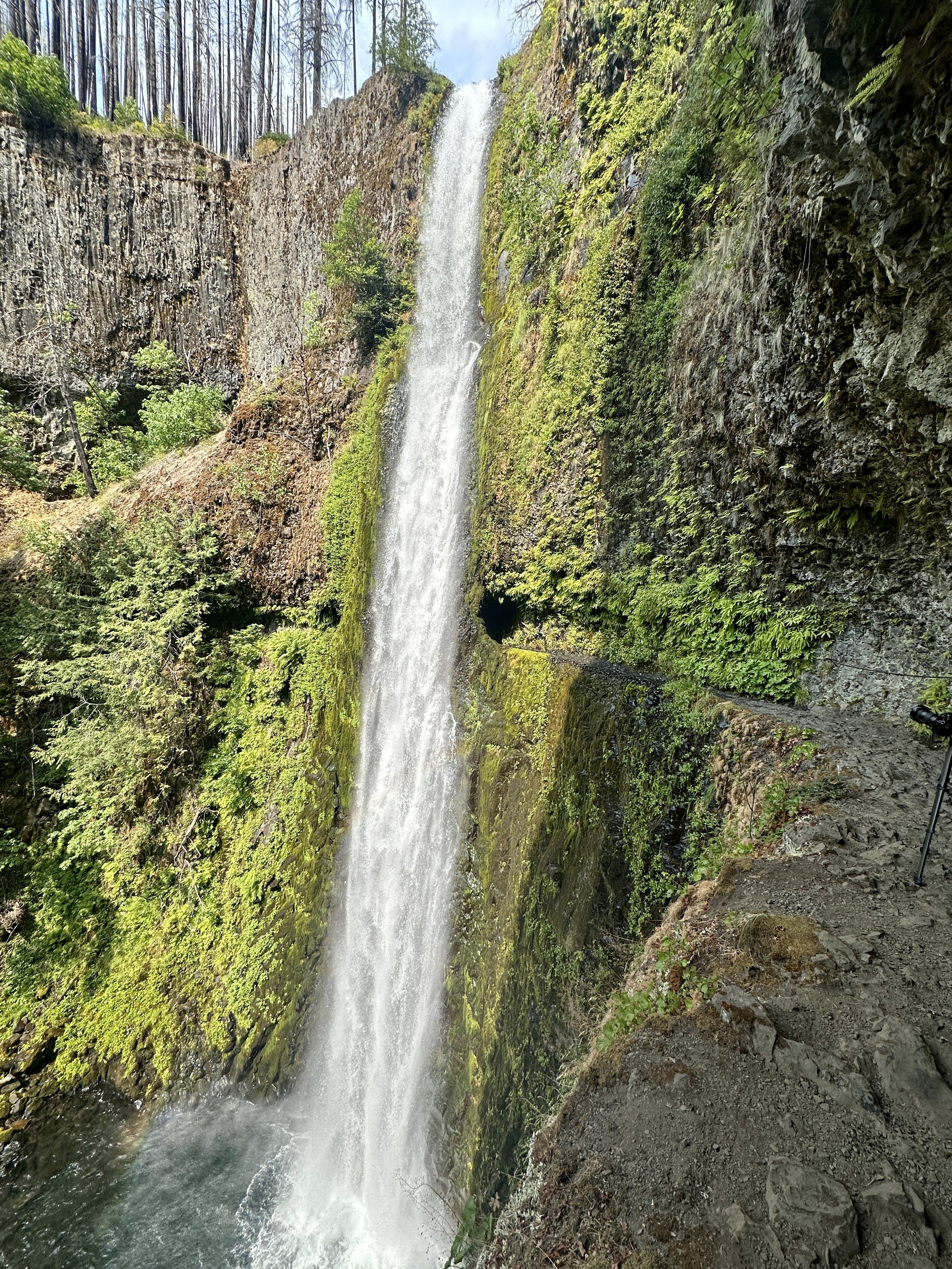
Tunnel Falls is epic. The Eagle Creek Trail trail, blasted out of sheer rock, rises through a burn to reveal waterfall after waterfall, each one worthy of a hike of its own hike. Eventually, the trail turns a corner and passes behind 130 feet of crystal clear water cascading down in a thunderous torrent. It’s electrifying. Sometimes the first miles out of town can drag but this trail was energizing through and through.
I continued along Eagle Creek in what must have been some of the most serene creekside hiking I’ve done yet. I had a firm destination of Wahtum Lake which ended up requiring some night hiking. As it turns out, I love night hiking. The air is cool. The miles flow by. It’s energizing. I also love sleep, so I do try to keep the night hiking to a minimum.
Arriving at the lake I hear a helpful voice from under a red headlamp say, “There should be a few spots over there.”
“Jesse?” I asked.
“Allan?”
I had just run into Jesse, now Charmer, one of the very first hikers I met on Day 1, but hadn’t seen in months. Jesse is one of those people who just brings joy and positivity to every interaction and you not only experience it when you’re talking to him, but you also experience it when people simply mention him. A lot of random decisions led to this most happy of reunions, all the better since Jesse was Nobo and was going to need to get off trail at Cascade Locks the next day for a number of weddings. Just in time.
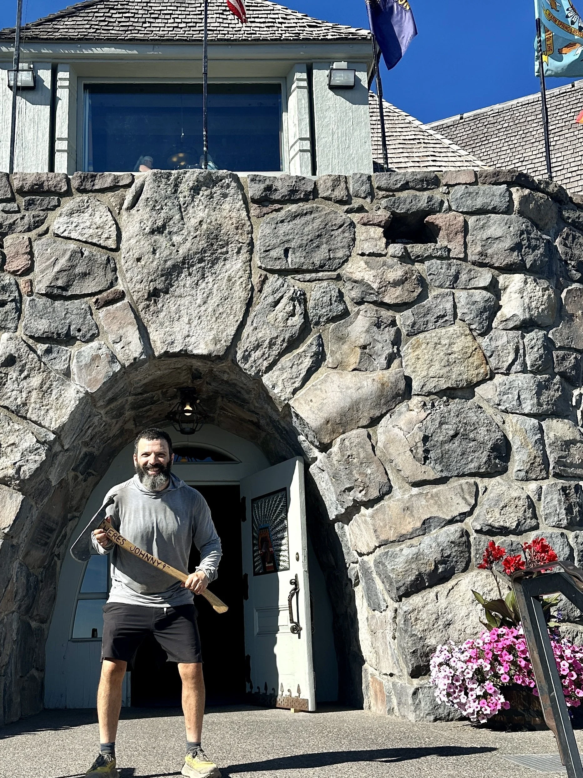
I was eager to push on the next morning. Coming up was Ramona Falls, another stunning alternate, and maybe more importantly, the all you can eat breakfast buffet at the Timberline Lodge (best known for its role as the Overlook Hotel in The Shining). Incredibly, the trail passes within a few hundred feet of the hotel where hikers camp the night before feasting themselves silly the next morning.
A few miles into my day, I asked a passing northbound hiker about a water source. He said he hadn’t gotten to it yet. I asked if he was sure, since I thought it was about a mile and a half behind him. What we had here was a classic case of “someone is going the wrong way” and no one wanted it to be then. Miles are hard. Big miles are harder. Wrong way miles, and the miles to recuperate them, are the hardest. He sounded confident. Even though the sun was in the east and to my left, the trail can double back. At the same time, my navigation app was malfunctioning in a way it it never had. By the time we parted ways he said he’d see how his mileage went and turn around if he was wrong. I was still relieved to see him return a few minutes later. We ran into each other again at the Timberline Lodge the next day I was worried that I had made him feel embarrassed. Instead, he thanked me for saving him even more miles in the wrong direction. I get it.
I was moving slower than I would have liked but it was hard to speed through this section. It was rife with beauty. Ramona Falls is truly mesmerizing. I had hiked to a similar cascade in the Jameson Valley near Sydney back in January. This, I thought, would be more of the same. I was wrong. Ramona Falls is full of moments. Each part has its own details, nuances, moments. In her Desert Island Discs interview, Maya Angelou decides to take a painting of Kumasi Market by John Biggers to the island with her because it is full of hundreds of moments and she could study it forever. That’s how I felt about Ramona Falls.
It’s an often lamented fact of the PCT that, if you want to be close to doing the whole trail in a season, you need to constantly push for miles. In think I only stayed at the falls for a half hour. Sacrifices like these make me want to get faster.
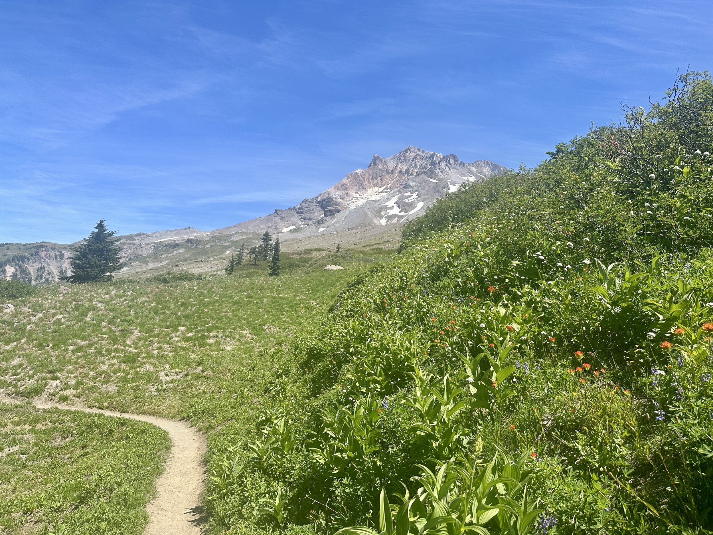

I continued on toward Timberline Lodge and the promise of breakfast. I had my first real creek crossing in some time before climbing up to the Paradise Park Loop, another alternate. The loop promised several miles of wildflower super bloom in a meadow immediately below Mount Hood. The loop delivered. It was an embarrassment of riches. Tunnel Falls. Ramona Falls. The meadows.
Oregon gets a bad wrap with PCT hikers for being boring, and, to be fair, I’ve missed about two thirds of it. I do have to say, however, that if you’re heading south, it sure starts with a bang.
The Timberline breakfast was everything I’d hoped it would be. I’ve been to Passover Seders that were shorter than this meal. Thankfully the trail was downhill. I’ve never carried so much internal weight.
Tourists pay hundreds of dollars to stay at the hotel, a head-turning WPA project, yet don’t seem perturbed in the least that the lobby is full of malodorous hikers charging devices and sorting food. In fact, many want to know more about what we’re doing.
The day after I left Timberline a hiker passed me. Somehow we started talking. About books, I think. She slowed down … a little. I sped up … a lot. I had just met Sweetblood, my new hiking partner for the next four days. We took breaks left and right. On this first day we had second breakfast at Little Crater Lake, took a swim at Timothy Lake, had lunch at a horse camp, had a long chat with our mutual northbound friend, Charm Pony and still managed a 24 mile day! A four hour break for beers on the dock at Olallie Lake? 22 miles. Three breaks before noon? A marathon. We were cooking. This was hiking as it was meant to be done. A couple of days required some dusk and night hiking, but seeing the sun set over the Three Sisters Wilderness is more than worth the price of admission.

Sweetblood
Reunion! Dr. Dynamite
Reunion! Snake Mate & Zippy
The day we passed through Big Lake Youth Camp, a children’s camp that has free facilities dedicated to hikers and feeds them for free in an act of true generosity, we were nearing the end of this run. Sweetblood was going to push on past Bend. I was going to stop in town and zero with my northbound friend, Lite Bright, who had been crushing 30s to make our date.


The night before we parted ways, we could see smoke rising from behind a distant ridge, an omen of things to come. After a few miles of hiking over tedious lava rock the next morning Sweetblood stayed in trail and I went looking for a ride into town. She had shown me what I had suspected: I could hike farther and faster than I had been. I just had to choose to do so.

The beginning of the Lookout Fire.

Among hikers, Bend is known as the vortex of vortexes. I have no doubt that at least one hiker has dropped in for a zero and has never left. It’s not hard to see why. Not 10 minutes after my hitch from Mackenzie Pass dropped me off, I was at the local hostel feasting on authentic Oaxacan food and drinking of the finest local cider. I grew up in a hippie town. Woodstock could have easily happened in my hometown. My introduction to Bend made my hometown look like Gordon Gecko.
Lite Bright got into town the next morning as planned and we did it up. REI. Free Cider. Thai Food. A motel with a hot tub. Life in Bend was good. We even met a celebrity of the trail running world, Scott Jenkins (@scottjjenkins)—an ultra runner in the midst of completing a triple crown of 200+ mile ultras who seemed impressed by what we were doing. We made quite the mutual admiration society. But even as we chatted in the hot tub, easing our aching muscles, the smoke was rolling in.
Optimistically, I shipped packages ahead in Oregon. I ordered shoes to Oregon. The forecast for the day was 98 degrees. I’d wait one more day before getting back on trail.
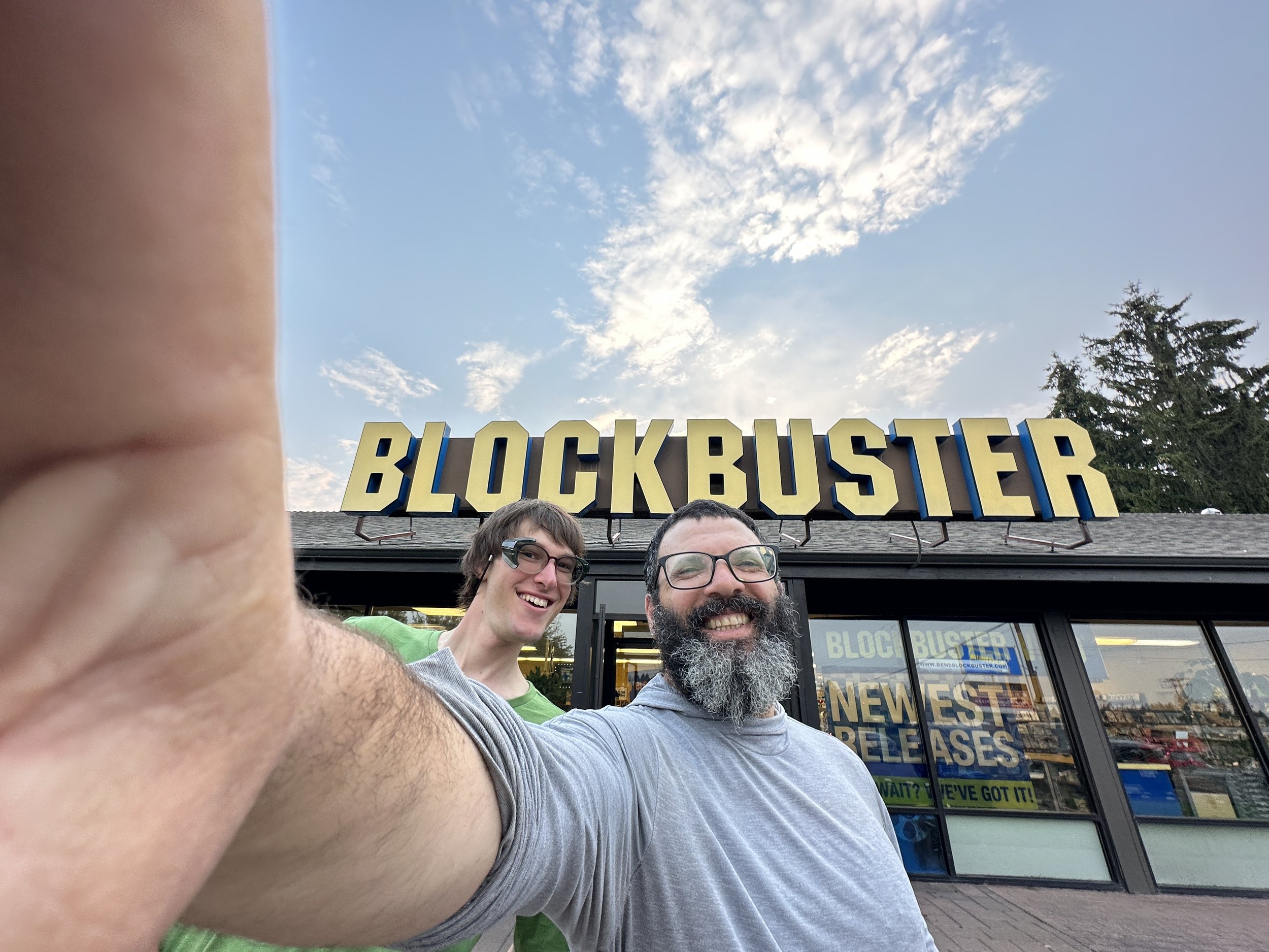
The Last Blockbuster
0 miles. 1300 miles.
900 miles. 0 miles.
900 miles. 0 miles.
Meanwhile, lightning had set off fires in all three PCT states. The section from Stehekin, Washington to the border—one of the most epic stretches on the entire trail—was closed, thwarting Kyler and Trevor and Amelia and the rest of the tramily on their March to the border. Fires in Northern California erupted and the trail closed from Etna to Seiad Valley, thwarting Baywatch, Townward and many of the others who had successfully navigated the physical and mental challenges of the Sierras in a year with a 300% snowpack.
Hiking well and far and fast had me focused on finishing my second state. Crater lake was less than a week away. 280 miles to the border was what? 2 weeks? It was in the bag. Except it wasn’t. Even though the trail in Oregon remained opened, I couldn’t convince myself to hike in the smoke.
Even before Bend, I had been considering flipping from there back to Kennedy Meadows to once again head north. Still I could not make up my mind. No matter what I did, though, I knew all roads went through Portland. So I made my way there, had a second reunion with Lite Bright who was there to meet up with his wife, and I rented a car to head south to pick up where I had left off two months before.
It would seem that I dislike certain forms of uncertainty. Like everyone else, I knew a hurricane was headed for the Eastern Sierras but I would just have to play it as it came. I planned resupply. I got trail conditions from rangers. I was headed to the Range of Light with a stopover to stay with my friends Paul and Emily and their two daughters in Sacramento.
The morning after the storm passed, however, I saw pictures of the damage to roads up to the Sierras. If these were the roads what were trail conditions like? It would be a week or so to know. I didn’t feel like I had that kind of time. I didn’t want to head in not knowing. With my headspace at the time, I knew that a false start might break my resolve. I didn’t want to let that end my hike. I decided to change my plan again.
Southbound friends who I started Washington with were about to skip over the Northern California closure. That was enough. I would meet them and create, much to my dismay, two sections of trail to complete. One uncompleted section is the rest of the trail. Two uncompleted sections are gaps. Regardless, NorCal it was.
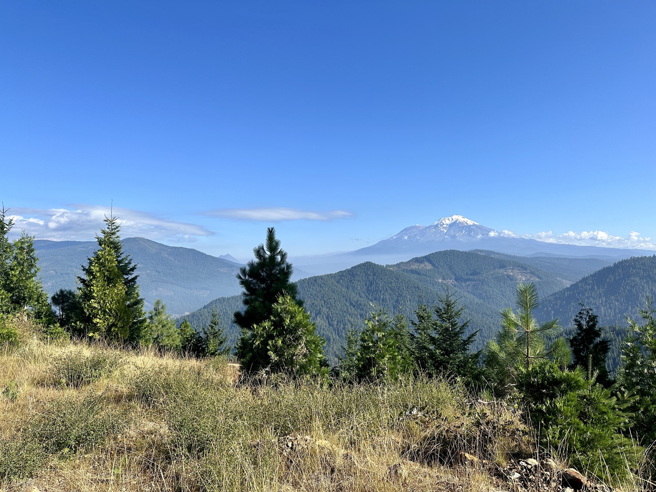
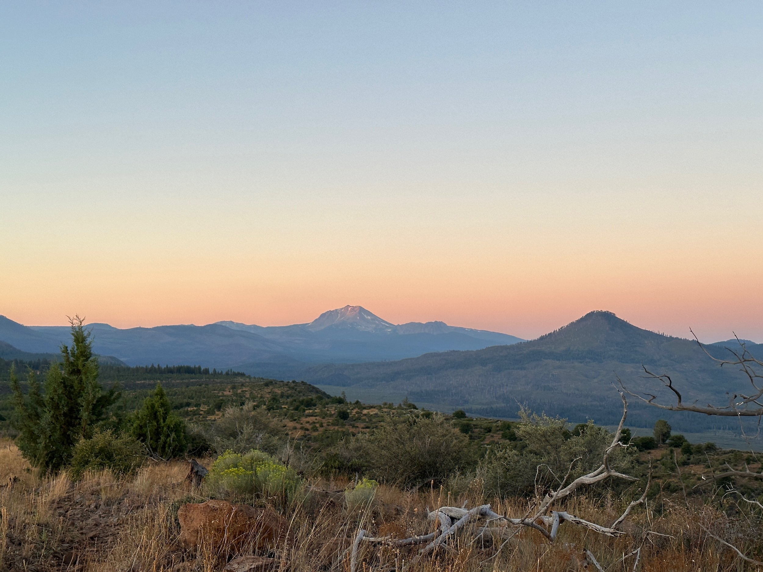
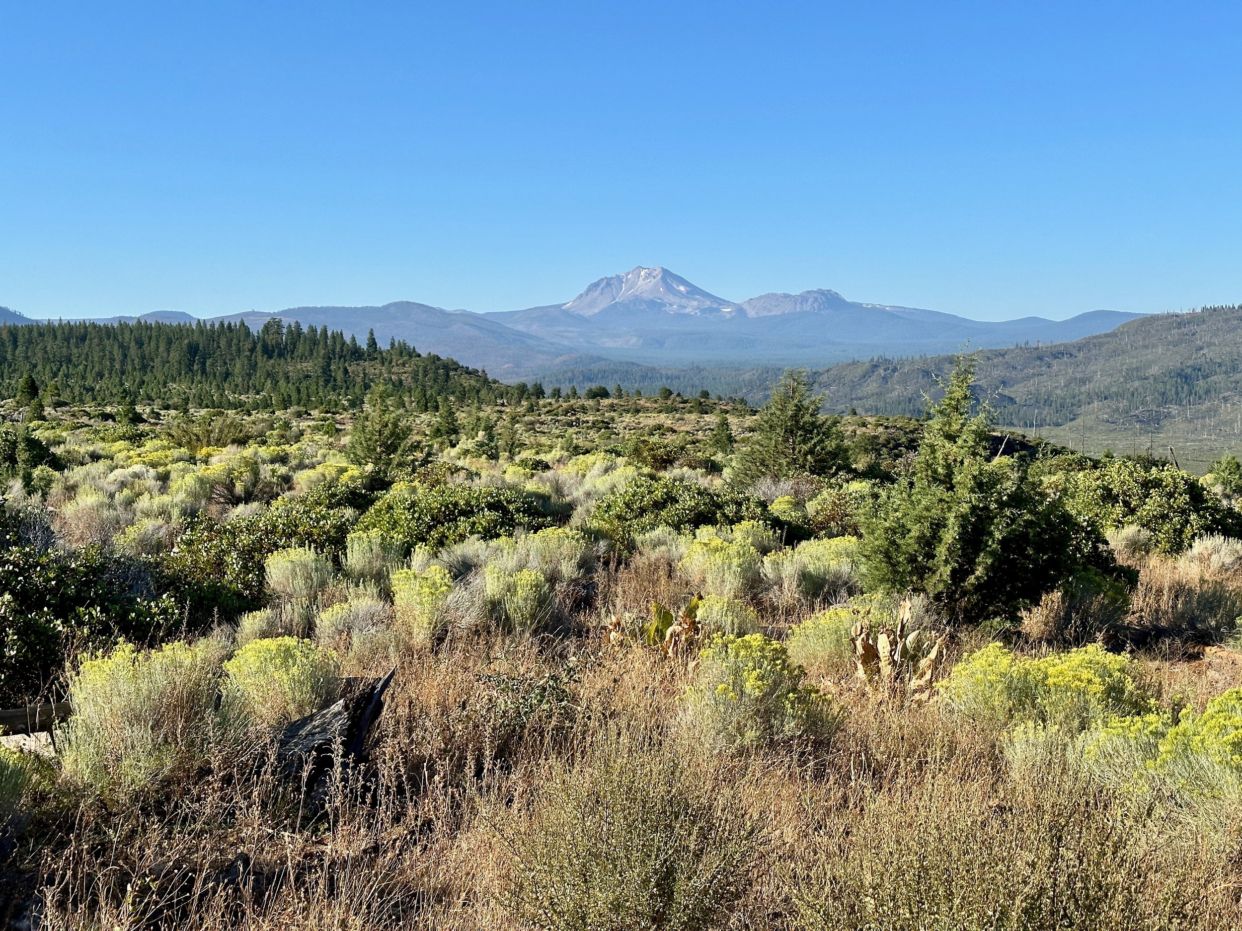
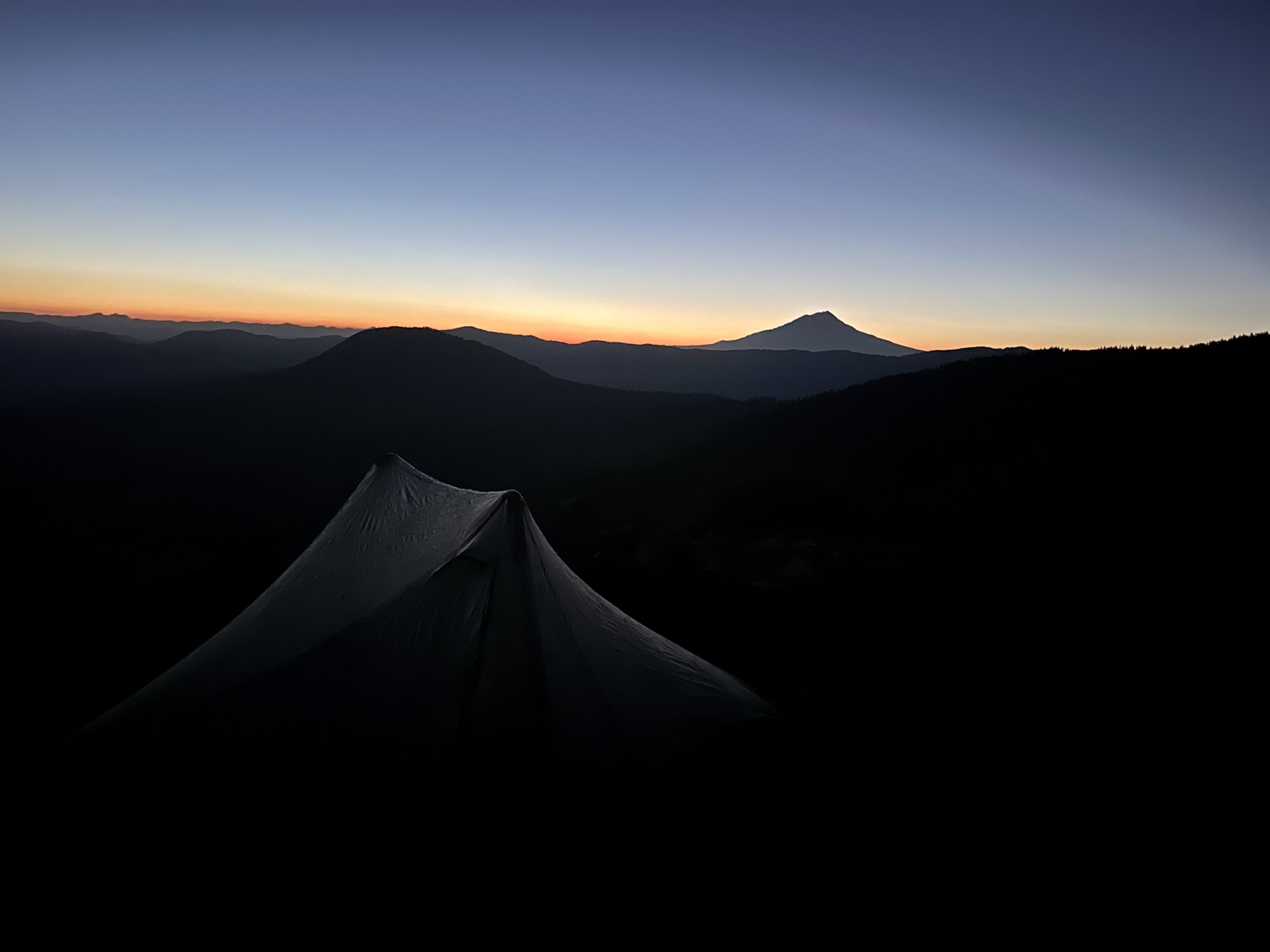
Before the recent storm there was no snow on Shasta.
Castle Crags

Peak hobo.

Reunion! Townward
When I moved back to New York in 2022, I seemed to manifest pieces of furniture I needed on the streets of Brooklyn. A drop leaf table around the corner? A lamp down the street? Yes, thank you.
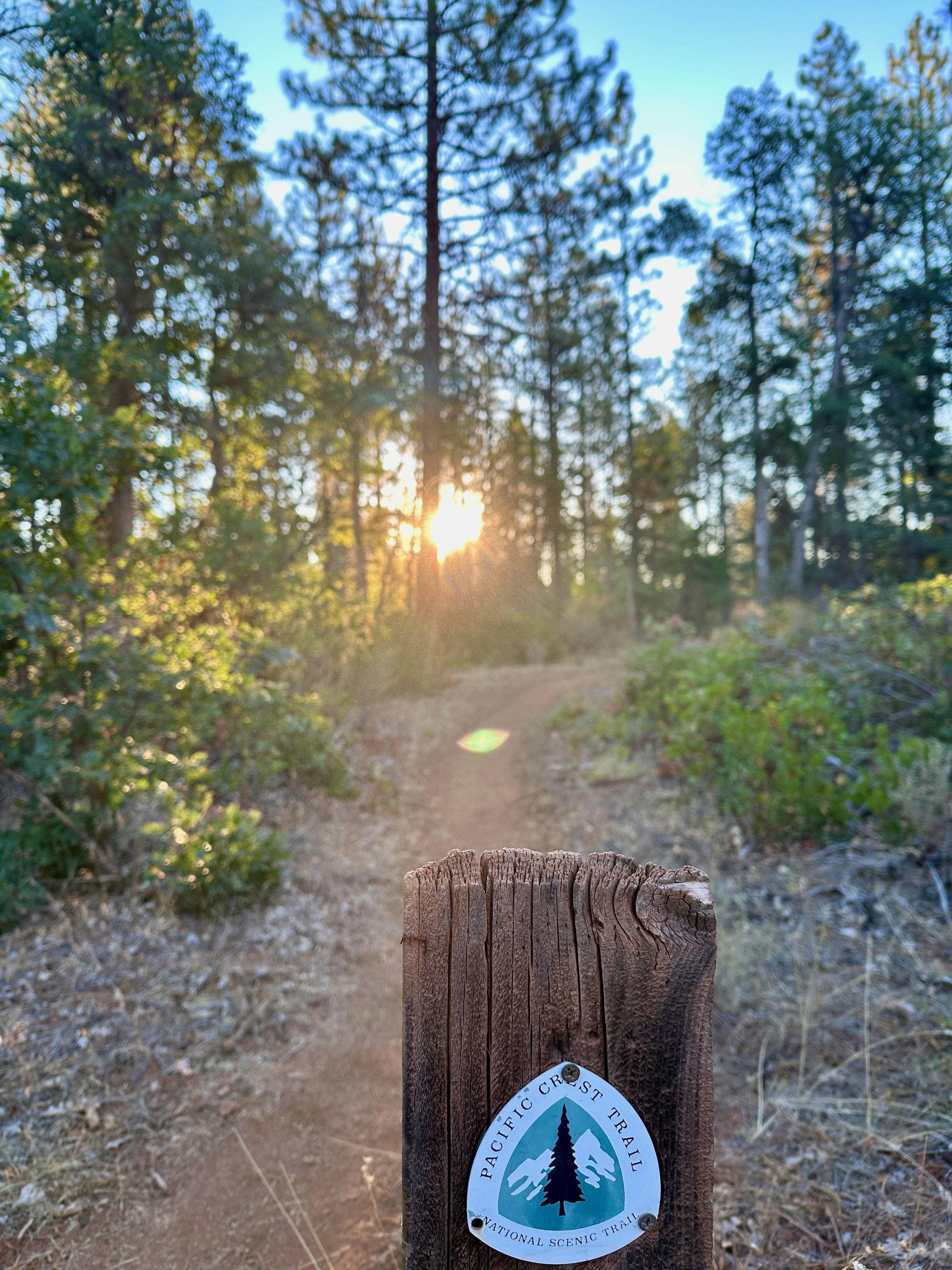
Earlier this week I manifested a 200 mile hitch from just outside Sacramento to the trailhead in Dunsmuir. Did the Tesla driver come up to ME to offer the ride? Oh, yes. Did he live 15 miles from the exact trailhead I was going to? Also, yes. He seen the PCT tag on my pack, a tag that had come to me on the trail after 1300 miles via a couple of volunteer rangers. Most hikers go to get theirs the first week.
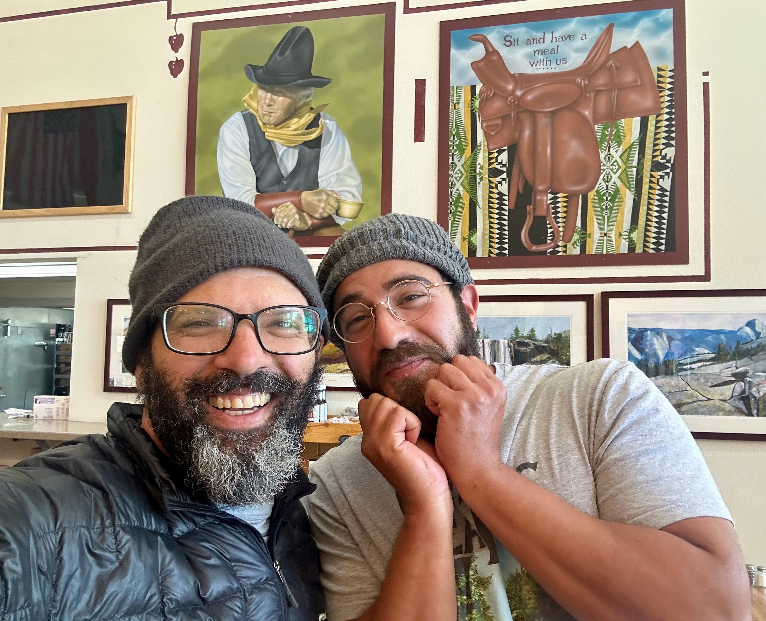
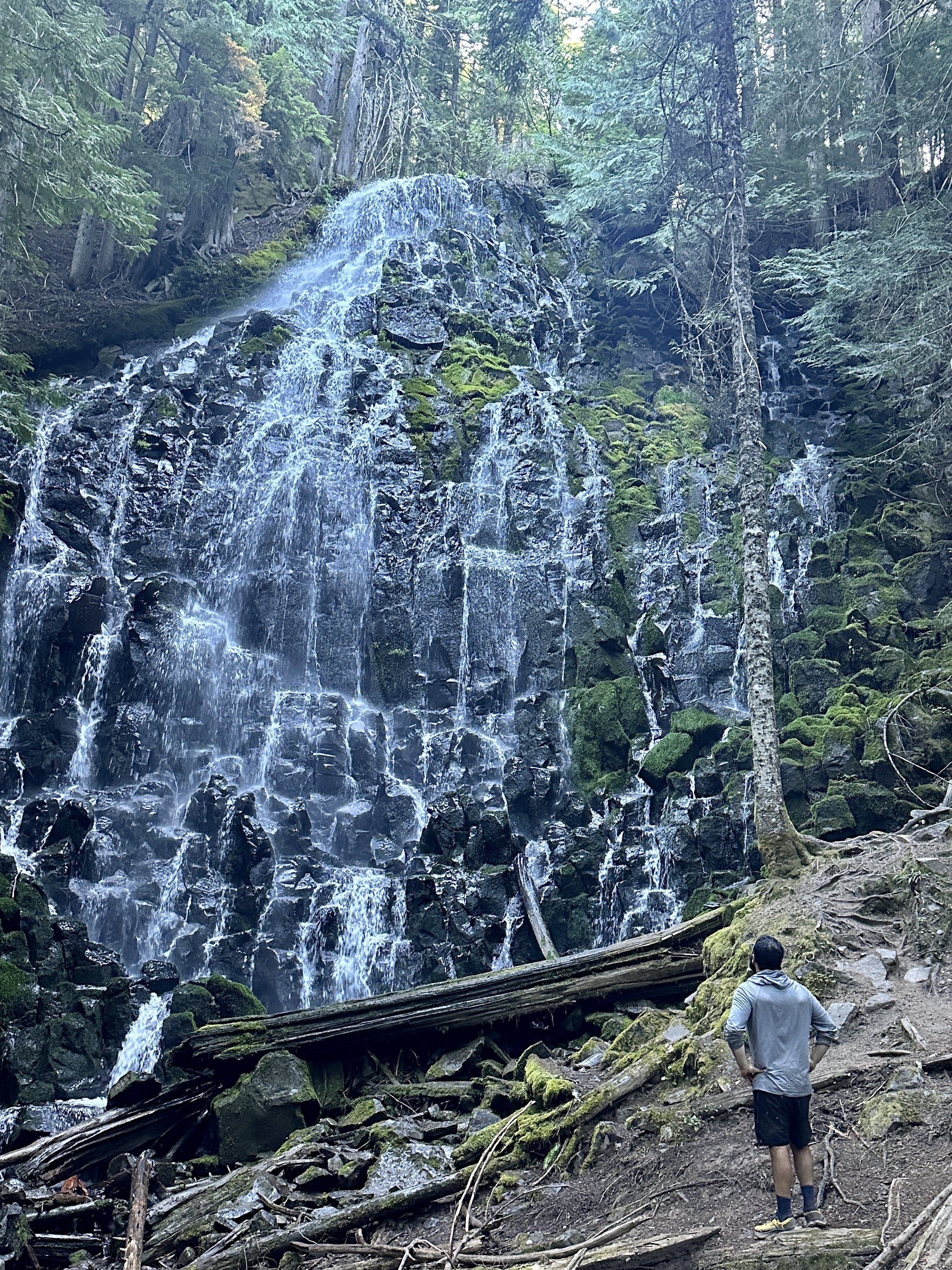
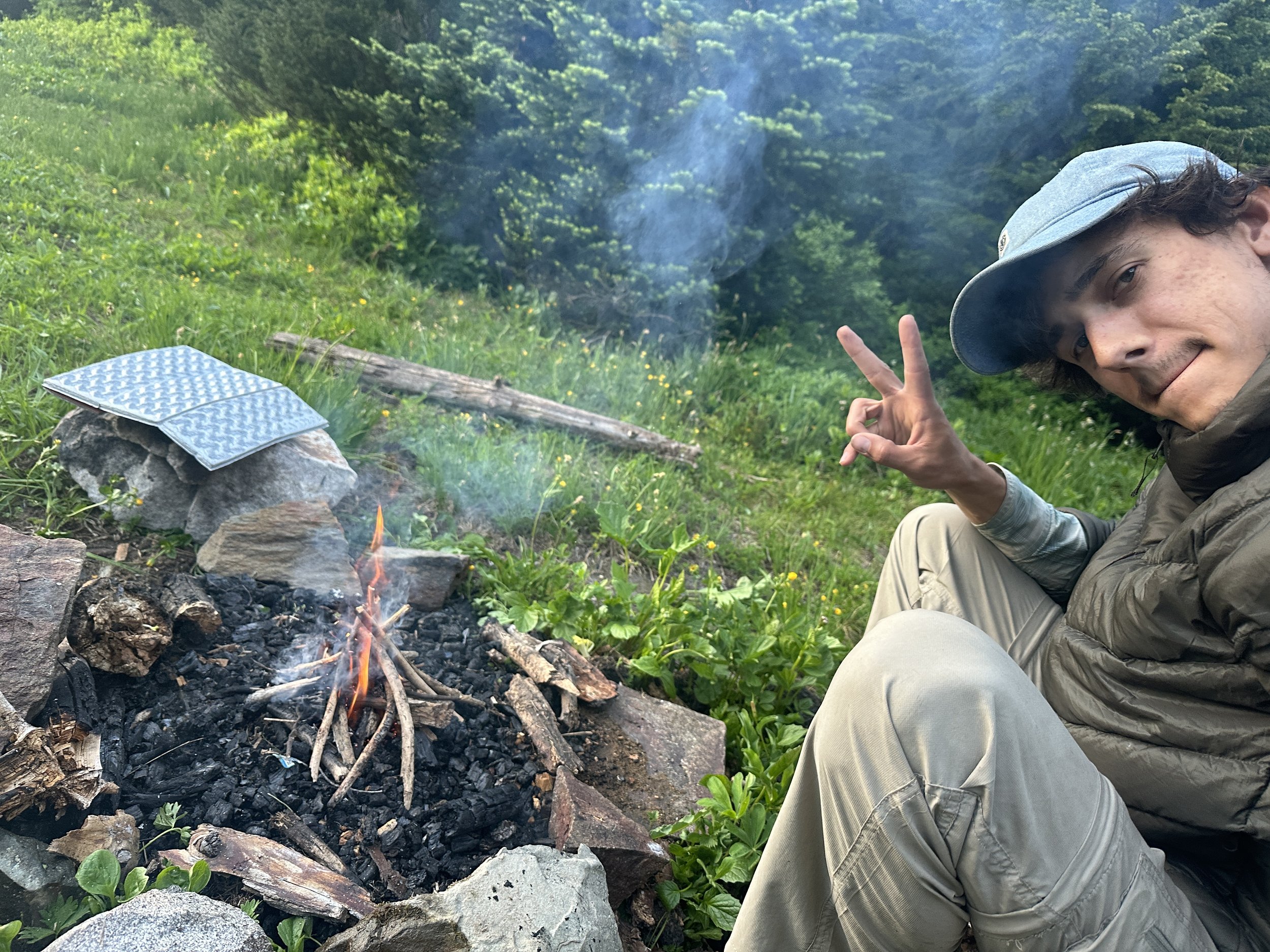
This stretch in NorCal has been amazing already. I’ve walked along the ridge line as the sun set over Mount Shasta. I pushed through another food shortage—hiker hunger seems to grow faster than the mile. I ran into Townward, my Yurt-mate from Kennedy Meadows, in a truly joyous reunion! Just the other day, I did 10 before 10 (actually, 9 before 9 💅), saw Burney Falls, spent two hours talking tent to tent with a 31 year-old bookbinder, and still did 20 miles.

Have my Dunsmuir friends caught up to me yet? Did I twist my ankle before those 20 miles? Do I want to waste a day resting it? It doesn’t matter. I’m going to go grill steaks with Nicole.
Feast when you can.

Reunion Hills
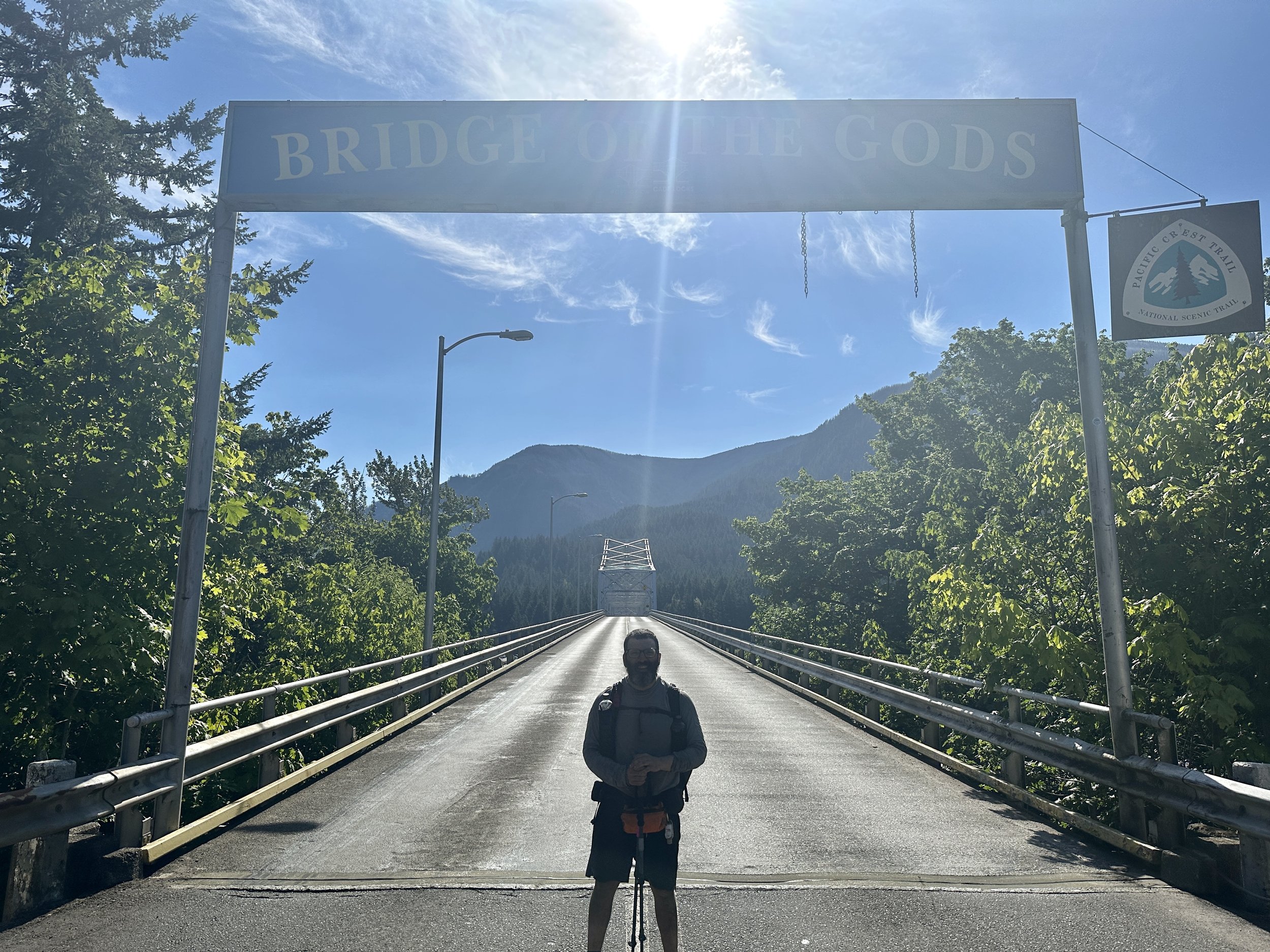
Guess who has 1,200 PCT miles and an entire state to his name? Yesterday, powered by an abundance of blackberries, I cruised through the last few miles of Washington on the PCT, crossed the Columbia River over Bridge of the Gods, and entered Cascade Locks, Oregon. Another section of the PCT done.
This is a milestone to be sure and I’m proud to have completed what is arguably one of the hardest sections of the trail. At the same time, it didn’t quite have the same resonance as walking into Kennedy Meadows in June before I flipped to Hart’s Pass, and this is interesting to me. My hiking is the strongest it’s ever been. My body is probably the most free of pain it has been since the end of the first week. I can now expect the progress from myself. I don’t know that ability diminishes achievement, but it certainly seems to change its interpretation.
In any case, I get the sense that whatever I needed to prove, I proved in the desert. Now I’m out here because being out here feels right. There’s a distinct lack of pressure. Impelled, not compelled.
A little over two weeks ago, milkshake in hand, I hitched out of Leavenworth and climbed back into the wilderness. Stunning lakes. A lot more forest. The section had a feel. Some sections of the trail are so stunning as to underline the moment. Here, it was immersive. I leapfrogged with Wonka, Dutchess, Sunny Wash and Double Dip. I met Fireball for the second time when she pitched her tent after I was in my quilt and talked tent to tent for a couple of hours. There’s a certain openness in conversations on the trail. Revelations and honesty. This was heightened in this set up.
Along the way I met a lot more hikers than usual–folks out for a few days or a few weeks or for the entire state. (There’s no official definition, I don’t think, but hikers out for at least a few hundred miles are known as LASHERs: long ass section hikers). Washingtonians get out there!
I also ran into a day hiker in some level of distress. He was unprepared, lost, out of water, food and power. I gave him some water, some power, some purification tablets and directions and sent him on his way. He had 5 miles on one to his trailhead, plenty of day hikers around and plenty of daylight. Apparently, I had underestimated his sense of distress. I later learned that he ran into Fireball and at this point needed more water and food and more help to get back to his trailhead.
This got me thinking. When someone is unprepared in the outdoors and needs to rely on others’ resources their margins for safety can get narrower. There’s a lot of talk online about the 10 essentials–effectively the basics of what one needs to be safe outdoors–but this was the first time that I really thought of this as not just a matter of personal safety, but as an obligation to others. Now, I wouldn’t have given more than I could have, but I also would have hiked this guy back to his trailhead if I thought it had been necessary, even if it would have meant needing to get off trail to resupply. Thankfully, it wasn’t that kind of situation and Fireball did get him in touch with some friends. A trail runner heading to the same trailhead did decline to take him there, an unusual lack of the general outdoor ethic I’ve experienced. Even though I’m sure this ended well, I don’t like not knowing for sure. This is interesting. I hadn’t realized it was on my mind.
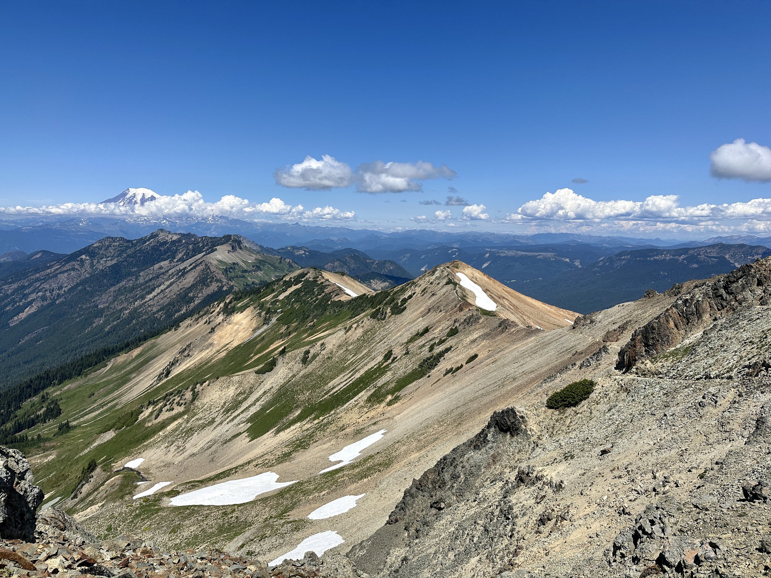
In the moment, I simply went on, relieved that even though the elevation gain and loss was the same as the Glacier Peak Wilderness between Stehekin and Steven’s Pass, the trail conditions were much better. The section ended spectacularly. Rounding a descent there was suddenly the first good views of Mount Rainier. A mountain goat was thoughtful enough to graze just under the mountain. It was stunning. In a cruel twist, these views overlapped with miles of hiking over rocky trail, requiring everyone to look at their feet rather than these views. In one moment, I had to look up. I heard the roar of a fighter jet, the first I had heard since Walker Pass which was near one of the Naval air bases that is or is the basis for the Top Gun franchise. I looked up. No plane. But it was so loud! I looked up more. No plane. I looked ahead. Holy shit! The jet seemed to be a thousand feet away at the most, screaming vertically out of the valley. Get me some lasik and a time machine. I want that job.
Rueing my career choices, I traipsed along, eventually arriving at Snoqualmie Pass where the Washington Alpine Club (WAC) opens up one of its cabins as a summer hostel for PCT hikers. Meals. Beds. Showers. Laundry. All hosted by volunteers. Everybody was there. Lucy, Naked Dave, Fireball, Feral (a sexagenarian Triple Crowner), Valentine, Anton, Pockets, Fletch and more. Pockets and I put it together that she had babysat friends from grad school (Hi, Georgia! Hi, PJ!) It was good vibes only. And to gild the lily I was set to head into town the next day to resupply and spend the night with my friend Ross and his family. Even though WAC was anything but, times on trail still felt hard overall during this stretch. To eat dinner with a family, a friend’s family, and to stay in a home really helped keep me going until my mindset evolved. Ross really seems to be thriving and it was great to share in that energy and home.
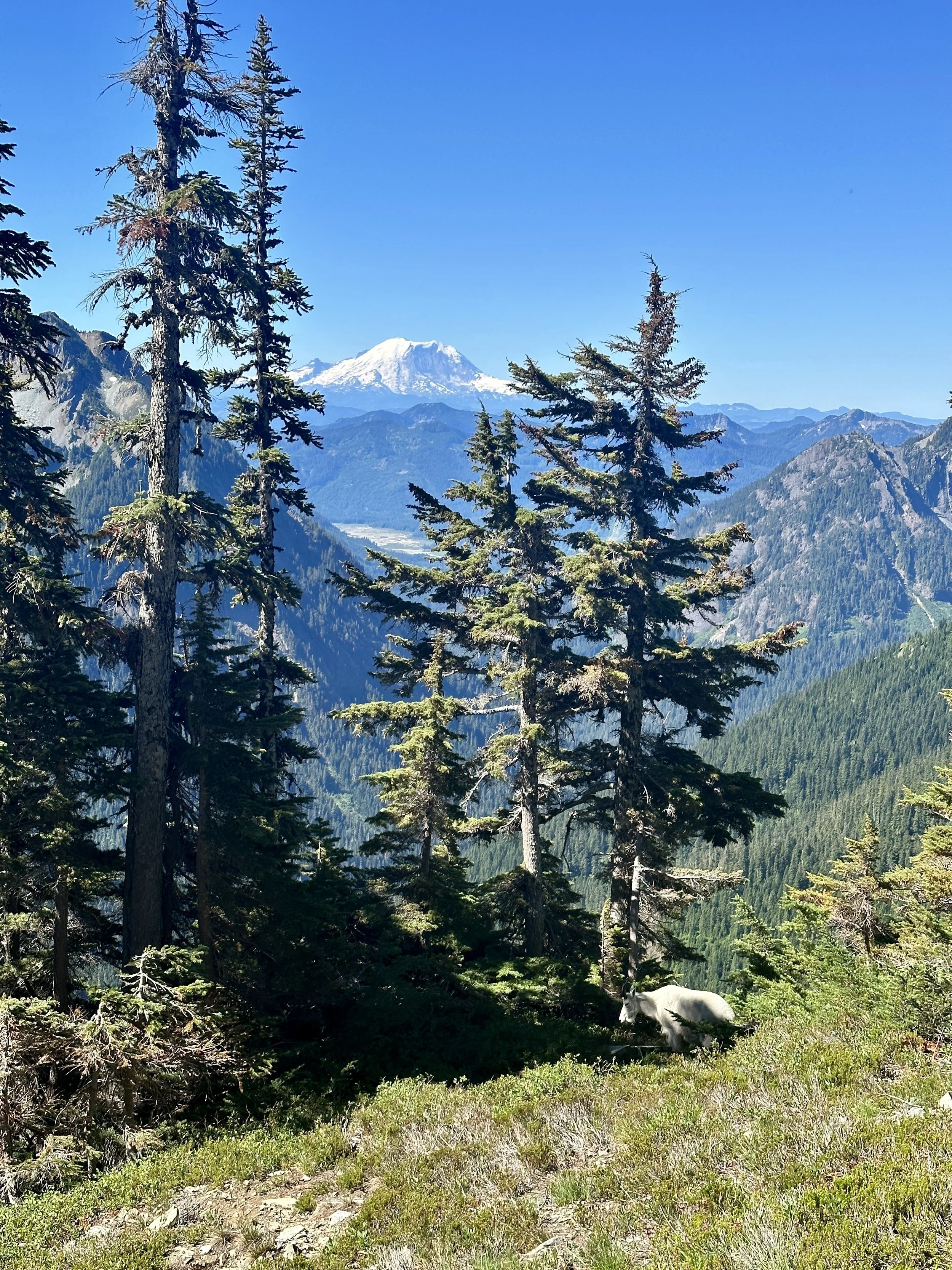
Rainier & Goat
Back on trail after my time in Snoqualmie, I was feeling good in mind and body. I was in new shoes once again thanks to a consult at Capra Running in Squamish in late June. Even though Zappos had sent the wrong width, the ankle pain that had been plaguing me since the flip got a little better every day. Ahead was a reunion with the Ride Bride Five, a trail family I’d met at the Lion’s Den and 30 miles of super buttery trail.
The next two days overlapped with a 30 mile stretch of trail being used for the Cascade Crest 100, a one hundred mile trail race for which the trail had been completely cleared of blowdowns and groomed better than the Westminster Kennel Club. May the road rise up to meet you. Every six miles there was an aid station that welcomed hikers. There were PayDays. There were pickles. There was soda. There were port-a-potties. Port-a-potties in the wild. I left no amenity unenjoyed. Was overlapping with the runners inconvenient? Sure. But it was also inspiring. The attrition rate for the race was something like 80%. They all felt like winners to me. They told us we were nuts. We told them they were nuts. We all agreed we were nuts.
Ross’s front yard.
The cowboy themed race station.
It was sad to go back to regular trail, but thankfully this stretch was really just a preview of what was ahead. More and more forest meant more pine duff covered trail. This was also the beginning of what I’ve been calling the Reunion Hills, a stretch where I’ve been running into friends and acquaintances from then desert.
Just before my first real burn section, I unexpectedly ran into Lloyd and Tanya, two Canadians I’d met on San Jacinto as we politely raced each other to the last remaining tent sites between a stretch of blow downs. Lloyd and Tanya have the better part of two decades and about a mile per hour on me. I had thought they were back in Canada! It was a great surprise and just the beginning! Over the next stretch, I would run into Couscous, Moses, Roy, Pickles, Walrus, and Rat Strap (erroneously Rat Tail in Highs and Lows on a Sky Island).
When Rat Strap and I parted ways after crossing the Whitewater River I thought I’d never see him again since he was crushing big miles every day. He wasn’t so sure and he was right. I even got stopped by a few people who remembered me from random trailside conversations. I ran into Snackzilla snacking trailside and I was doing laundry at the White Pass Kracker Barrel when Sam barged in tired, hungry and windswept after night hiking to resupply after running out of food. I even ran into Martin who, upon hearing that I broke a trekking pole on San Jacinto, tried to give me one of his. We had met twice.
Disco Daddy who I shared a room with in Idyllwild got a big hug as he neared the end of his climb out of Cascade Locks. And right before the Goat Rocks Wilderness, another spontaneous reunion with Rumor, Gourmet and Low Bat who I hiked with from Julian and also stayed with in Idyllwild. We had kept in touch and knew it was coming but it was still such a surprise. The heart was very full over these days.

Tanya & Lloyd

Sam
Snackzilla

Martin

Chill
Disco Daddy
There was still one reunion I was hoping for more than any other. Kylker and Trevor and I had been keeping in touch, hoping for a zero together in Trout Lake and then, instead, an on trail zero at Goat Lake. With the vagaries of the trail, it was looking like it might not happen by a hair. I blamed the several extra hours it took me to get back on trail after Ross dropped me off at Snoqualmie Pass and it was heartbreaking.
I still don’t know if it was circumstance or serendipity, but the bond from those first few days was incredibly strong and incredibly natural. As Trevor said, “On day three we started hiking together and didn’t stop talking for a week.” Even months later, having not hiked together since the very beginning of the trail, it felt as strong as ever. I left White Pass thinking that it just wasn’t going to happen. And then, right as I was about to get back on trail my phone buzzed. I had forgotten to put it in airplane mode. A text came through that I didn’t get when connected to WiFi. Kyler, Trevor, Amelia and a few others were going to leave Goat Lake early. The plan was to stop and camp together when we crossed paths that day. I was elated.
I started climbing out of White Pass. I descended. I passed water sources and camp sites. No Trevor. No Kyler. I started climbing again. More campsites went by. The possible sites to meet up kept going by. Three left. Two. And there, at the very last campsite before a massive climb that would have to wait there was a huddle. At 6’ 7”, Trevor is hard to miss. I was home.
We pitched out tents and had dinner together. It felt like old times. Unsurprisingly, the folks who had joined up with my friends were people I would have loved to have been hiking with. Maybe that original connection was neither serendipity nor circumstance. The positive mindset that had been building was buttressed. I would hike on the energy of this one night for a while and other good nights would come from it.
These guys mean a lot to me. Kyler is half my age but seems to have wisdom from lived experience that helps him navigate through the world in a deeply considered way. Trevor is a touch older and has an enthusiasm for nearly everything. He seems to be the improviser’s ethos of “Yes, and…” personified. They’re both deeply considerate of those around them. I’m excited that these friendships feel like beginnings.
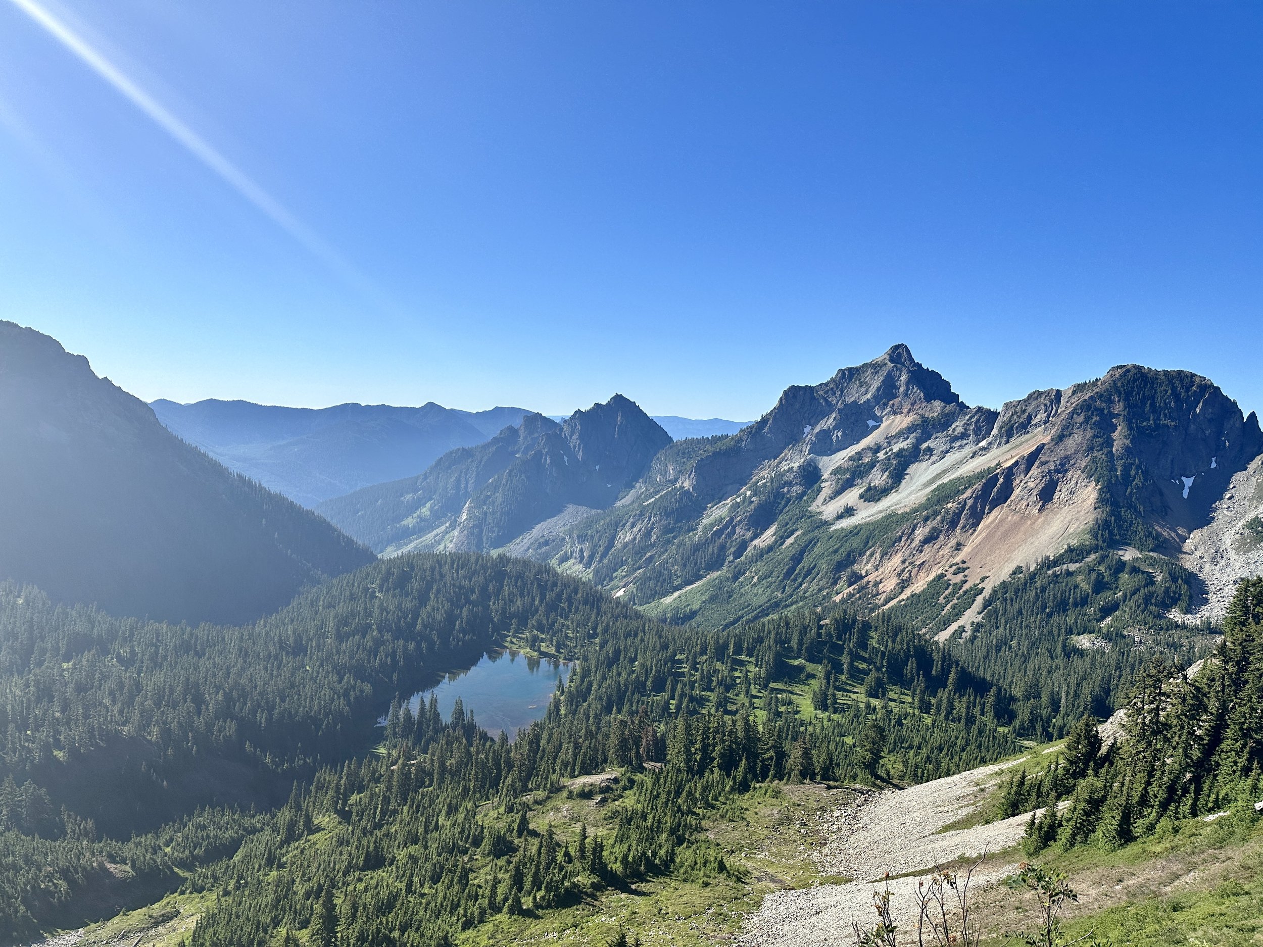
I slept in the next morning and walked backward with the crew for water before ascending into the Goat Rocks Wilderness, traversing the famous Knife’s Edge and taking the old PCT alternate on Old Snowy Mountain with stunning views of Mount Adams, Mount Rainier and Mount Saint Helens, a childhood favorite. My progress was slow but this was stunning country. People often rate Goat Rocks as one of, if not, the best or favorite section of the trail. It is odd, in a way, to rank nature. How can one possibly evaluate? Who knows? But I do it, too. The Glacier Peak Wilderness felt akin to a religious experience at moments. One of the best days of my life.

Amelia, Kyler, me, Trevor

Knife’s Edge
Rainier from the Knife’s Edge

Mount Saint Helens in clouds
The day after Goat Rocks I camped in a meadow full of wildflowers, drank from an obscenely picturesque waterfall and, from my tent, watched the red light of sunset bathe the glaciers of Mt. Adams. A day later I walked to the road that leads into Trout Lake where the local pastor’s wife drove a few hikers into town. The wife of the local pastor who, when she needed to care for her parents and had to revise her schedule, started going to synagogue. The synagogue-going wife of the local pastor who learned how to play Mahjong from her new friends. The Mahjong-playing synagogue-going wife of the local pastor who, upon moving to Trout Lake, Washington started teaching her new friends how to play Mahjong so she could keep playing. And they say you should stop at Trout Lake for the Huckleberry Milkshake.
I left town just ahead of Big Daddy, Maverick and Jai of and associates of the Ride Bride 5. We kept pace for a few days as we sprinted over easy country toward Cascade Locks. (Some of us may have traipsed rather than sprinted). We took a long break at Blue Lake, which was stunning. Somehow, I still managed my biggest day, just a half-mile short of a marathon. And then, after two more days of long miles with the head down there was the Bridge of the Gods. As I crossed it, an Osprey landed on its nest, talons clutching a prize.
Describing it here, the saturation of these last days feels overwhelmingly rich. It’s almost enough to make me want to turn around and walk back to Canada.
Camping under Adams

Mount Hood
Mount Saint Helens

Seekin’ Stehekin, The Hard Hundred and Other Tales from the Evergreen State
Greetings from the ersatz Bavarian town of Leavenworth, Washington where the schtick and schnitzel are both hammered hard. After only 12 days back on trail and 220 miles of hiking (of which only 188 count, but more on that later) I’ve completed about a third of the state. The same proportion of California took me nearly eight weeks. This makes it all sound like a walk in the park, but it’s been the toughest hiking yet of the trail. Washington has more up and down than even the Sierras, albeit at much lower elevation. Still, some back of the napkin math puts me at 1,000 lifetime backpacking miles and I’ll be at the 1,000 mile mark for the PCT in a week or so.
Once back from Vancouver, I picked up my gear from Bainbridge Island off of Seattle and caught a ferry and three buses which got me all the way to Twisp, Washington. Along the way, my bus route converged with that of Lucy, a true SoBo-er as well as Double Dip, Wonka, and Sunnywash (SnoBo-ers, like me). Lucky for us, once in Twisp we were spared bus number four when Lucy ran into Raven, a hiker and trail angel who makes runs from a hiker oasis called the Lion’s Den in Mazama to Hart’s Pass, the closest access point on the trail to the Northern Terminus.

The Lion’s Den was a truly incredible stop along the way. Lion and Raven have poured so much love, work and organization into the property that it is impossible to not feel at home and well cared for there. It could not have been easy to put it together and it must take even more work to keep it going. Getting close to Hart’s pass is challenging and getting to it can depend on the whim and rhythms of day hikers. Raven and Lion make the last miles effortless and make sure that you’re clean, laundered and fed along the way.
Along with a dozen other hikers, I was dropped off at Hart’s Pass on the 29th of June and it was immediately clear we were not in Kansas anymore. Evergreens surrounded the North Cascade peaks, streaked and mottled with the last remaining snow patches struggling against the rapid melt of this year’s summer. Hart’s pass is about 30 miles from the Northern Terminus of the PCT at the US-Canadian border. While Canada has recently resumed a program that allows hikers to enter Canada through Manning Park, which is then only a 7 mile hike from civilization, the US does not return the favor. Although no one is there to stop you from entering the US, we all hike in 30 miles to the Northern Terminus and then 30 miles back to start making progress against the full mileage of the PCT.
After dropping off my snow gear and half of my food resupply at the Hart’s Pass bear box (and going a mile down and back a forest service road instead of the PCT), I was off! It felt great to be back on trail. It felt great emotionally. It felt great spiritually. It did not feel great physically. While my muscles were eager to climb and my lungs happy to still fuel me a mile high, my joints and ligaments were rusty after nearly two weeks off. After a relatively light first day of ridge traverses the old bones were still glad to make camp along with nearly everyone else who started at Hart’s that morning. It had been a good day. I get a lot of energy from meeting new people on the trail and there was a new element here. Hikers were able to meet each other in volume in both directions since everyone had to repeat the miles from Hart’s the the Terminus. Lucy and Two Braids camped on either side of me and we had a good chat while I ate cold instant mashed potatoes from inside my tent, safe from the mosquitos.
Things were looking up on the second day back. The birds were singing. The sun was shining. The border was only 14 miles away. But then, the check engine light came on. Something was wrong with my knee. Should I stop? Turn around? A mile in would be a mile to hike back out if something really was wrong. At risk of writing checks my legs couldn’t cash, I decided to push on. I had somehow left my Vitamin I in the bear box, but the kindness of Pat, Naked Dave and others left me able to dull the pain. Thankfully, it was a one off. I did 21 miles, hit the highest point on the PCT in Washington, a viewpoint with a panoramic view of the North Cascades, and included a long slack pack from Hopkins Lake to the border and back.

The entire experience at the border was a little surreal. Because I hadn’t earned the full 2600 miles between Campo and Canada, it lacked the same emotional resonance as when I arrived at the southern monument with Matt, Jessie and Penny two and a half months earlier. Still, the site was unmistakable. It consisted of the same five pillars as the southern monument, only this time made out of wood, rather than concrete. I thought about how many hikers who had skipped up ahead of fires last year only to be turned away 60 or even 30 miles away when fire threatened. I also thought about the last hikers to make it before the trail was closed. Such a fine line.
I read the trail register and saw names of friends I had made in the desert and the names of hikers I had met on the way in. Not long after I arrived, a man and woman loped in easily to the clearing where she climbed the monument and posed with glee. This was Sprocket. She had been denied by 60 miles last year and was just now completing her hike.
Her companion looked familiar. I thought he looked a lot like a thru hiker and YouTuber named Jupiter, one of the stars and celebrities of the thru-hiking world. This coincidence was somewhat akin to going to play a round at Augusta and finding that Phil Mickelson just happened to be there, playing a casual round with friends. We chatted a little at the monument and ran into each other again the next day when Jupiter hung back for a little and hiked with me to give me some info on the trail up ahead. That return trip was 24 miles, a new record for me and included over 5,000 feet of gain, another record, albeit one that would be broken again and again the next week. I paid for the prize with a very sore ankle and while I’d intended to continue on the Stehekin the next day, I decided to recover with a zero at Lion’s Den once again.
The next three days flew by. There was the grand rise from Hart’s Pass (south this time) and the long descent to Glacier Pass, where I caught a photo of Legacy, almost imperceptible on the switchbacks below the towering range. I had my latest rise yet on trail (8:20 am!) and still made close to 20 miles. I had inadvertently set myself up for one of my greatest days on trail and in town yet.
I woke up a little late the next morning as well when a number of us would hike in to High Bridge in order to get the shuttle into the small town of Stehekin, known for its bakery, and only accessible by boat, float plane or foot. Once I hit the trail, things felt good. Very good. I was moving at a clip comparable to the Mission to McDonald’s, the Adventure to Acton and, of course, the 10 before 10. There was a 3pm shuttle as well. I was going to turn on the after burners and see if I could make it. The day would be for Seekin’ Stehekin. No music. No stopping as I blew through North Cascades National Park, my first of the trip. Just pushing. The state felt almost meditative. I filtered water once. I stopped for a five minute lunch. Aside from a quick hello to Niko and Angie who I met on my first day back out and a few slower steps to grab some barely ripe Huckleberries at the warmer, lower elevation it was all push.


I made it to high bridge alongside Anton and Valentine, two French hikers, with 20 minutes to spare. This meant getting into town before it closed down: delicious gluten-free pastries from the bakery, cider at the general store and, most importantly, a cabin at the Stehekin Valley Ranch. This recreational ranch felt to me more like summer camp than resort. It had an feeling of welcome and trust. In a world often driven by exchange, this felt like a community. Within 20 minutes I was clean, (most of) my clothes turning in the washing machine, and was chatting happily with two owl researchers from the Forest Service. Not long after a storm spared my clothes on the wash line I was talking to another guest, Steve from Buffalo, out with his wife to visit their son who had moved to Vancouver, Washington. It was a great talk. He and his wife had met at my favorite Buffalo dive bar and I really wish I could have taken those extra Grateful Dead tickets off his hands.
The next morning I was feeling a little solitary. I sat down to eat by myself, gluten-free bread from the Stehekin Bakery making a stellar plate even better, when I notice the owl researchers eating with Steve and his wife. I had taken a spill a few days before and had a nasty bruise on my right arm that the researchers had seen. Right as I sat down, Steve mentioned he was a doctor and one of the researchers who had seen the bruise the night before said they knew someone who maybe should see one. A minute later I was being examined. All because of Seekin’ Stehekin. Once again, the trail provides.


Resupply
With a heavy heart, I hiked out of High Bridge that afternoon after a long talk with the ranger. Unknowingly, I was about to begin the Hardest Hundred miles of the trail. Beta (trail information) had come down by word of mouth and through the Far Out app that this section would be a bear. There were complaints of blowdown after blowdown, overgrown trail and 5,000 mile gain days, day after day.
After the first two days, I thought my SoBo colleagues were soft. If they wanted to see real blowdowns, they would have to wait until their descent around Apache Peak on San Jacinto. How wrong I was. After tackling occasional blowdowns on the way to the Suiattle River, I suddenly found myself paralleling the river navigating a jungle gym of 200 year old cedars. Just 13 miles into this day it was 4:30pm and I ran into Valentine making camp before the climb to the first true view of this Hardest Hundred. There was a decision to make. Head to Dolly Vista Camp and risk the same brutal set of blowdowns the preceded, arrive at camp late and dispirited or ensure a low mileage day during a stretch where hikers had already warned of delays and suggested taking extra food.

A PWAV: Poop with a View

I decided the morale boost of camping and eating with Valentine was far better than the risk of a low morale going even lower. Soon we were joined by Michael, Chris and Pockets and would all leapfrog through the next section, the hardest part of the Hardest Hundred.
And although the 40 blowdowns on the way up to Dolly Vista were completely manageable they were just an introduction to extreme highs and extreme lows. I had experienced these on the trail, but never to such extremes and in such proximity. The trail may provide, but it also tests. Right after Dolly Camp were several miles of stunning alpine meadow, interrupted by snowmelt stream after snow melt stream, all ringed in by snow shadowed peaks. Yet once through, it was time for the most challenging of descents, a steep 4 miles of overgrown rock-studded, loose-dirt switchbacks that we’ve affectionately named The Salad.


What looks like a well manicured zig zag at the center is, in fact, the wild terror we know as The Salad.
The Salad was a new Swamp of Sadness. And once I was at the bottom, my achy ankle finally getting some relief, my stomach more than ready for a snack, the thunder cracked and the skies opened up. Once again morale was low and I plodded on. After a long climb, I reached the stunning Mica Lake and then Fire Creek Pass, one of the sections Jupiter had warned me about. Thankfully, the risky snow sections were long melted out and I was treated to a stunning panorama–180 degrees of snowy Cascadian peaks in a half moon around the pass. Suddenly, this felt like one of the best days of my life. All of a sudden, morale was high.

I caught up to Valentine. We made dinner and ate around a fire. I pitched camp, tired but feeling accomplished and in awe of my surroundings. Before I went to bed I noticed condensation collecting on my tent and, in the morning, awoke in a bowl of pea soup with a soaked tent. Morale was low. I hiked on through a cruisy forest section, met Amelia, cleared Red’s Pass and ended up making camp on an extremely windy ridge, my tent still wet, and attempted to sleep as my tent heroically resisted the intense buffeting. A howl would arise from across the valley. A warning. A minute later the sides of my tent would push in and the trekking poles holding it up would strain. A grouse hooted indifferently. Morale was lower.


I was now behind my colleagues but if I made good time this next day and the day after, I might make it to Leavenworth in time for sweet relief and an inner-tube float down the river. The sun was peaking out. Relief was in sight. Morale was up! The pea soup was back. Morale was down. Finally, after another lake, the sun was truly out. I had a yard sale (dried all my gear) and morale was … a little higher.

I made a lead foot for Leavenworth and met a dozen hikers, some PCT and some not, and they charged my battery as I made my way to Steven’s Pass. A woman fishing with her father gave me an orange. I met a hiker attempting an audacious feat and caught a ride with him into Leavenworth.
Lucy and Naked Dave gave me a warm welcome in town. We floated. We recharged. We ate a lot of ice cream. Morale is high.

It Was the Best of Climbs. It Was the a Worst of Climbs.
Even in the best of times, leaving town is hard. Real beds. Cold drinks. Hot meals. Cold drinks and hot meals at the same time! Never before have I considered a motel jacuzzi to be so close to paradise. Leaving Tehachapi was especially hard. After 550 miles, everyone was tired of the desert. At least I know I was. There is no promise of grand views until the Sierras, 150 miles later. There are no significant named peaks to climb over or around. In addition to all of this, the trail begins to truly embrace its path through the Mojave as the dirt of the trail turns into what hikers like to call “kitty litter.” The saving grace of hiking the section this Spring was that the temperatures remained exceptionally low, rarely dipping below the mid 40s at night and, more importantly, rarely going above the high 70s during the day: water and cool temperatures in what is typically the most grueling section of the desert. In this section of steep, unrewarding climbs and relatively long water carries, the cool temperatures made it all the more bearable.
I slowly wended my way out from Tehachapi after a full zero the day before, confident that hitches would get me to the trailhead. If a hiker doesn’t stop at Walker Pass to resupply, it’s a 136 mile food carry to Kennedy Meadows (South). At 5-7 days and 2 pounds of food per day, this makes for a heavy pack, especially with the frequent 4 liter water carries (8.8 pounds). Unlike my wiser colleagues who had slack packed the 10 miles between the first and second hitches into Tehachapi while in town, I got on trail with a 146 mile food carry ahead of me. This is not epically unwise, but we like to stack the cards in our favor in this game.
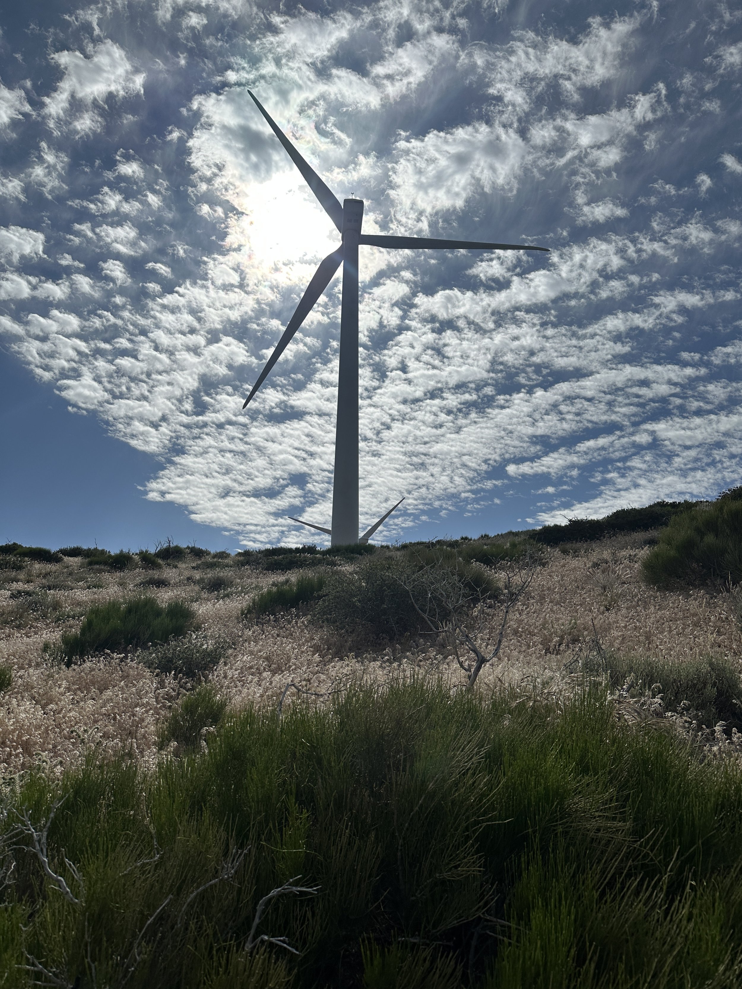
Thanks to a second hitch from a wind turbine mechanic who was regularly briefed on conditions in the area, I made it to mile 558.5 in the afternoon with a heavy pack and a little more information about the weather and the Mojave Green, a rattlesnake of significant concern due to its exceptionally potent venom. And so with sunshine on my shoulders and joy in my heart, I once again stepped into the Tehachapi wind farm. The hiking, if uninspiring, was equally unchallenging. The only green I ran into in this segment were the gluten-free mint Oreos, past Allan packed in his food bag. He also packed out a reuben from the local bakery which was devoured just after making camp behind the windbreak of a juniper tree. What a guy!
What followed were several days of hauling a heavy pack up steep, unrewarding climbs through terrain that alternated between rocks, dirt and the kitty litter. There were also windmills. Those windmills that were wondrous sunflowers laying shadowy mosaics on the landscape on the descent into Tehachapi became dispiriting monoliths. Yes, I was wilting at windmills. There was such a disconnect. These were great days hiking in a community I had come to know incredibly well. Big group dinners. Catch ups with old friends. First trail conversations with new friends. Talks with hikers that turned acquaintances into friends. The times with people were good, but I was mentally ready to be done with the desert and it showed in my hiking. I was going slowly. I was getting the miles in, but it was taking more of the day than it should have.

The grey fox is at the very center of the photo.
After two or three days of this, there were whispers of epic trail magic at a campground in the middle of nowhere from a trail angel known as Old Yeller. This was great news! If I hit the trail magic quickly and ate well, I might be able to stretch my resupply all the way to Kennedy Meadows.

There is a concept on the trail known as the Vortex. The Vortex usually occurs in town, but it can happen any time, any place. The Vortex has a mission, and that is to deter you from yours. The Vortex is fun. The Vortex is hard to resist. The Vortex is the enemy of making miles. Many hikers were vortexed by Old Yeller’s trail magic. The beer seemed to be limitless. The carnitas tacos were well braised and even better seasoned. Now, technically, I was not vortexed at this trail magic. I came. I ate. I donated. And two hours later, I left. Yet, somehow, I only hiked for 5 hours that day making about a dozen miles.
The goal of filling up to make my food last to Kennedy Meadows was a wash at best with this low mileage day. As it turned out, it was exactly what I needed. I hiked the early morning with Popcorn and then with Battery Acid, and finally, before the trail magic, with Min, a chef from Hawaii. I reconnected with or met another two dozen hikers at the trail magic, and ended up at an incredibly well stocked and impeccably kept water cache too early to go to bed, and stayed too long to start the next leg. More importantly, when I arrived I got to spend time with Lemon, who had experienced some of Gustavo and Paradice’s trail magic in Acton, as well as Margot, Mercedes, Baywatch and Turtle, who has hiked the trail most years recently.

🐢
Turtle, who had helped out at the trail magic by drinking my share of the beer, was laying down by one of the water taps, rehydrating like instant mashed potatoes and playing a superb game of non-sequitur theater. Turtle was just doing his thing. I don’t know what it was about this but it unlocked a certain care-free feeling that I had at the beginning of the trail, but that had dissipated somewhere along the way. Turtle and some of the others packed up and moved on, but the feeling stayed. I felt great and just rolled with it. I got a few good lines in and Baywatch asked me if I was going to do trail stand-up. As it turned out, I had a little outdoor material I had worked on a few months back and delivered what I could remember. Did I slay? It’s hard to say, but I’m excited to work on the material.
As we pushed deeper into the Mojave the next day, Joshua Trees, thunderstorms and kitty litter abounded. Late morning I hit an intersection where the PCT hits an ATV trail at the same time as Andrea and Susan, two Czech, hikers, and about a dozen rally cars that were tearing down the road. The parade of vehicles came to a stop. The driver of the lead car bounded out and asked if we wanted any water or soda. Susan asked, “Do you have beer?” A minute later we were plied with two sodas and a Modelo for Susan.

If this wasn’t manna from heaven, then the next water cache was. Clearly maintained by the same generous, organized trail angel as the last cache, this one added hundreds of battery packs, a modest PCT library, a first aid resupply and a hand washing station. I had dinner, refilled my water bottles and my phone, and took off up the next big climb when I saw the weather threatening. I didn’t beat the storm, but I made it to a stunning campsite overlooking the valley just as the rain cleared and the sun shone on my side of the mountain. I made camp and ate dinner in the last rays of the sun.
I woke up the next morning, hell bent on making it to Kennedy Meadows. I had just enough food. I was going to go for it. This, however, was before the big rain. Before the big temperature drop. And most importantly, before Lite Bright texted to see if I was stopping in Ridgerest to resupply. I couldn’t resist the temptation of a bed, a dry bed, and one more dinner with Lite Bright, Kidska and Door. I made it to Ridgecrest after 18 miles and was lucky enough to make it to the highway just as a trail angel was coming to refill a water cache. In no time, we were all in true desert heat, sipping on ice cold horchata and eating some of the largest tacos I’ve ever seen. This was likely the last time I would see these friends, or rather, if I hadn’t stopped, the trail magic with Old Yeller would have been the last time. They were taking a full zero and I would likely beat them to Kennedy Meadows. It was a great decision. The next days would be tough and having had those eighteen hours were great memories to have in the bank.
I nearo-ed out of Walker Pass the next day and cowboy camped, watching the lights of Ridgecrest blink on before I went to bed, knowing the next day and the day after would have big climbs. The climbs were tough, not so much in and of themselves, but simply because I was tired of the Mojave. My brain was slowing my legs down. We hit the dew point each night and the overcast days made it tough to dry out my gear. One night I rolled into camp just before 9 and discovered that the condensation from the night before had knocked out my headlamp. I was ready for a change.


Luckily on the third morning out from Walker Pass, I woke up next to gurgling creek as the first light peaked over the horizon. Today I would pass 700 miles and make it to Kennedy Meadows, the end of the desert and the gateway to the Sierras. Pints of ice cream and cold White Claws awaited at the Kennedy Meadows General Store. Grumpy’s famous Triple Crown Burger awaited two miles into this town of less than 200. I was off like a shot. A couple of miles in a hiker passed me as I was removing rocks from my shoes. I asked where he was coming from.
“A campsite a little while back,” he replied.
“The one two miles back?
“No. About 15.” It was 7 a.m.
I had just met Townward, a hiker currently attempting a Calendar Year Triple Crown: the Pacific Crest Trail, the Continental Divide Trail, and the Appalachian Trail–about 8,000 miles of hiking–all in one year. And then hew was gone.

Not long after, Baywatch caught up to me and we passed the 700 mile marker together. We also made the mistake, once we got to the road that leads to the General Store, of accepting a ride from a truck that stopped for us. There’s a long tradition of clapping in hikers as they walk up to the General Store. We may have missed our claps but something had told me to buy a couple of minis of bourbon before I left Ridgecrest and we toasted the completion of the desert before walking into this land of milk and honey and Ben & Jerry’s and White Claw.

Townward & Baywatch

Anna

Captain Cook with Grumpy’s all you can eat pancake.
My plan, from this point, was to hitch back to LA, fly to Seattle, send supplies ahead to a few trail towns in Washington and start hiking the trail southbound from the northern terminus in about a week and a half, giving the snow in northern Washington a little more time to melt. Amazingly, a ride to LA appeared after only half an hour. This time the trail provided a little too early. I needed to enjoy this time with my community. Townward and I had to talk shoe lacings and blister care and Hobbes and water filters. I needed to help Zip pick up a package. I needed to catch up with Anna, who I hiked Fuller Ridge with and hadn’t seen in almost 500 miles. I needed that massive stack of a burger from Grumpy’s. So I stayed and I trusted that the trail would provide again.
And did it. As I was eating ice cream the next morning, trying to glom a ride from the General Store down to the Owens Valley (step 1 of my 3 part plan), claps erupted. Lite Bright, Kidska and Door were walking up. Of all my clapping, this was my first standing ovation. I bought a round of drinks and we got one last catch-up before they headed into the Sierras (I got word earlier today that they safely reached Lone Pine! Anna, too!).
My plan to get to LA worked perfectly: Kennedy Meadows to 395. 395 to the 14. The 14 to Van Nuys. Well, I didn’t plan for Van Nuys, but it was close enough to Paradice’s apartment in Glendale, my base of operations before my flight to Seattle. Once in LA, I survived the crush of shoppers at Trader Joe’s, planned my Washington resupply and even squeezed in a few Frog Claws at the Frogtown Brewery with Gustavo and his dad on Father’s Day!

The corporate lounge membership expires in 2 weeks.
I’ve been in Seattle for about a day and a half, staying with my friend Luke and his family, and have already run into a half dozen hikers at the local REI. On the way up, my flight passed directly over Sierras and Yosemite. The views of the snowy peaks were, in Lite Bright’s words “beautiful and intimidating.” I felt good about my choices.
Yosemite Valley: El Capitan. Half Dome. Glacier Point. Yosemite Falls. Horsetail Falls. Nevada Falls.

Friday, I’ll head to Vancouver for a little hiking R&R to stay fresh and early next week I’ll be heading to Mazama to get back to the trail, this time heading south. Nothing is given, but I hope I don’t need to flip again. I sure would like to wrap things up with another pint of ice cream at the Kennedy Meadows General Store.

Water, Water. Everywhere.
Over the last week, I climbed out of Agua Dulce, spending two days hiking through low, misting clouds. With healthy manzanita bowing over the trail from both sides, it often felt a lot more like sections of the Appalachian Trail—the Green Tunnel—than the PCT. Yet, it was the night a large group of hikers spent walking the Los Angeles aqueduct, and the day that followed, that dominate my memories. They were far from my favorite days of hiking, but I find myself remembering them as standout days. The inaccessible pipe of the aqueduct and the towers of the wind farm imposed on the trail; infrastructure as landscape.

After writing the last post, I caught a ride from Acton to Agua Dulce where, among the movie ranches and horse farms, sits Serenity’s Oasis, a section of Farmer John’s backyard where hikers can stay, shower, do laundry and resupply. I skipped up so I could spend the next morning hiking “backwards” or sobo (southbound) back to Acton to meet my friends Gustavo, an owner of the Frogtown Brewery and Dave Paradice, DJ and Glenfiddich Ambassador, rather than spend the morning in Acton waiting for them to arrive in the afternoon.
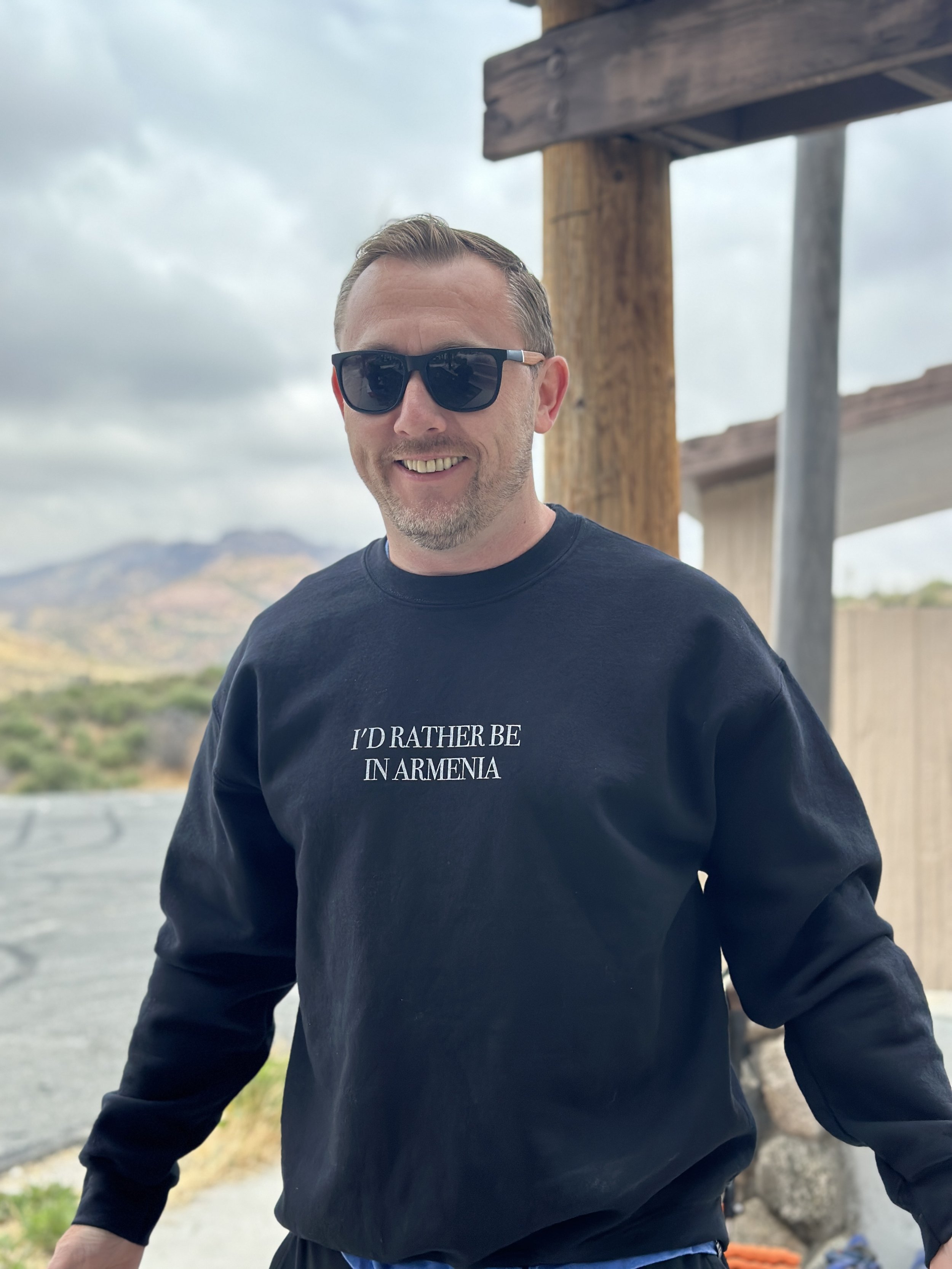
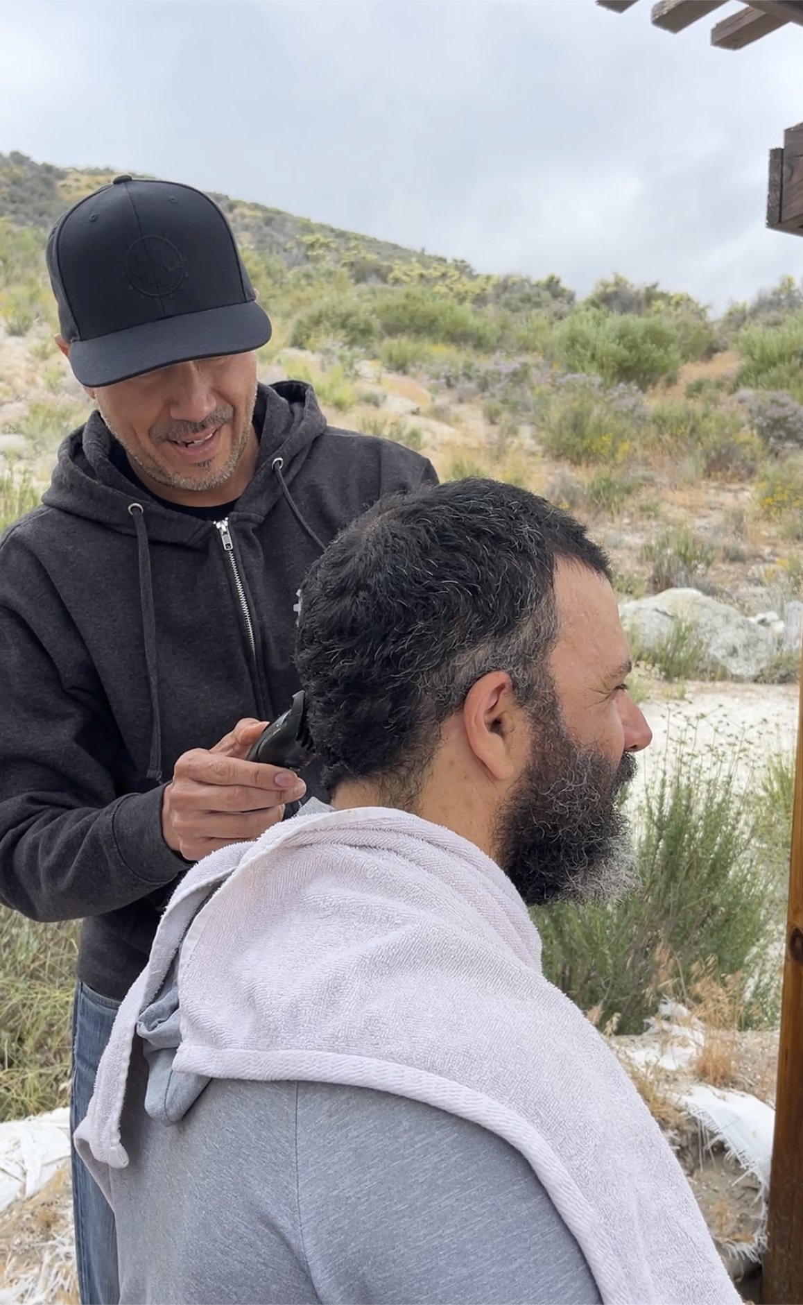
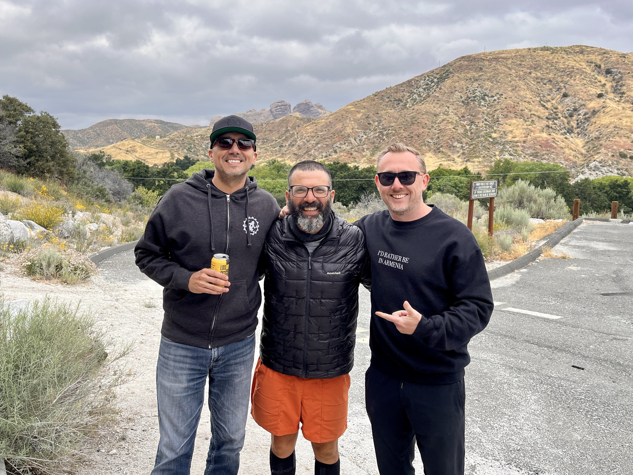
I could have met them both in LA, but I was excited for my friends to get a sense of the trail, meet some hikers and share some snacks and Frogtown beers with them. And so an afternoon at a parking lot trailhead it was, pit toilet and all. Beers were shared. I enjoyed Frogtown’s finest hard seltzer, Frog Claw. Snacks were devoured. Best of all, Gustavo brought some clippers and gave me a trim. I’m thinking the beard is going to go fully rabbinical, but it’s nice to keep the noggin fresh. We somehow also squeezed in a trip to the post office and the 49er Saloon for some town food, but it was all too brief and Dave was dropping me back off at the Oasis to continue on.
This next stretch of road walk was not the highlight of the trip. Despite shedding close to a pound thanks to swapping out some gear, my pack was heavy with resupply and extra Frog Claw and the roads were dusty and clung to an endless series of fenced off properties. Back in Park Slope there was a guy on Union Street who used to make and hang unusual carnival style posters in his front window. One of my favorites read, “If there’s one thing I wouldn’t want to by twice, zombies is both of them.” Well, if there’s one section I wouldn’t want to hike twice, the road walk out of Agua Dulce is both of them. I camped a few miles in by a distinctive pink tent and, unknowingly, a few yards down from Lite Bright, Kidska, and Door who I had hiked with briefly the day before I hiked Fuller Ridge.
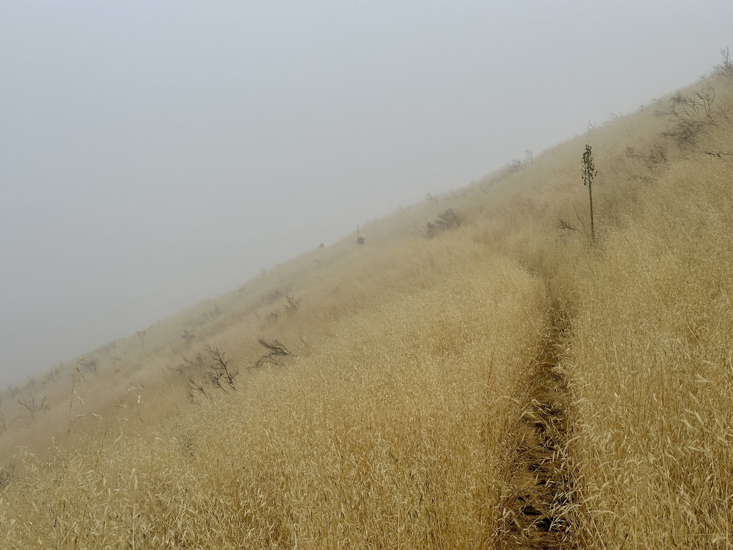

The next morning was misty and almost magical. There was a steady, gradual climb into the clouds that had been blanketing L.A. for the last six weeks in what they call May Gray and June Gloom. This wasn’t just climbing in fog, but truly in a cloud. Moisture hung on everything, the new array of flora on the climb, especially. Tall grasses bent over the trail and before long we were all soaked. It couldn’t have been more than fifty degrees. We were soaked and cold. As I turned one wet corner to another, I heard a familiar voice. Lite Bright! I was sure that he and Kidska and Door were miles and miles ahead. It turned out that they had been going at a moderate pace and had taken a few days in L.A. to gear up to enter the Sierras. We caught up for a bit and, a mile or so later, I got to see Door and Kidska again. I still almost can’t believe it.
That night I made it to a paved road that leads to Green Valley, but where no one stays thanks to some very aggressive mice near the campsite. Instead, I ran into Waldo and along with about 20 other hikers, camped at the Green Valley Fire Station before climbing again toward Lancaster and Hikertown.
Water on the trail always two sides. It’s tough to carry, but important to have. Beautiful to camp next to, but that can lead to cold nights and condensation clinging to the inside of your tent. It’s a beautiful relief on hot days, but get wet on a cold day and you can become hypothermic. It is worth mentioning that down loses all its insulating properties if it gets wet. Almost all puffy jackets and sleeping bags on trail are down. I’m sure we’ll get to snow melt and river crossings later.
In any case, I woke up the next morning with a very wet tent, so I was excited to find creek-side oasis that was only mildly ant infested for lunch and to dry out my tent. Thankfully, the drying went quickly and the lunch was a leisurely affair when Splinter and Dundee showed up. We hiked together for a bit before hitting a road that, just 11 miles into my day I thought would be a way station. Instead, we pitched tents on the side of a forest service road in a rare on trail nearo. We weren’t the only ones to see this roadside as a resort. By the time night fell there was a very expensive tent city lining the road.

The next day I would pass the 500 mile marker and camp just outside Hikertown, a fantastical movie-set of a hiker retreat, complete with only the best in bucket laundry, dollar beers, mail station and refreshments from a lovely caretaker named Marta. It has also become the jumping off point for a night hike of the L.A. aqueduct, a notoriously hot stretch as the trail becomes firmly ensconced in the Mojave Desert. In dry years, I imagine that the water carry can be longer than the 14 miles that we had to deal with, making night hiking an absolute necessity.

I did a small resupply near Hikertown, met Postmaster and Forerunner who helped me find and patch a hole in my sleeping pad and generally just lazed around until 4 when hikers started to trickle out to start the hike. The sun started to set just was we hit the pipeline of the aqueduct, creating a landscape of backlit Joshua Trees and desert scrub. Night fell, but a full moon kept the scene bright and surreal. Over the next several hours I hiked a little with almost everyone I had met over the past week. A past PCT hiker named Coffee Break had provided three days of trail magic along the aqueduct in order to surprise his friend Detour and I was thrilled to have an 11:30pm LeCroix. I caught up with Lite Bright, Door and Kidska and we eventually cowboy camped on one of the enormous concrete slabs that cover the aqueduct and drifted off to the sound of L.A.’s drinking water rushing beneath us.
Lite Bright’s alarm went off about three hours later. It was not enough. I hiked most of the morning by myself, dragging. I’ve discovered I need at least three things to hike well: good hydration, good nutrition and good sleep. Most of all, good sleep. A steady ascent into the Tehachapi wind farm felt relatively unremarkable. Big structures. Unshaded hills. It was the kind of steady climb I usually love, but without sleep it was a struggle. I also made the mistake of breaking for a second breakfast around 8:30 and by 9 the heat was oppressive. This isn’t even considered to be a hot year. Not yet. I made it to Tylerhorse Canyon and embarked on an extended 5 hour siesta with Andrew, Extra, Matrix, Island Time and others. One dry creek and a big climb later we were at an amazing on trail oasis with a massive water cache. I cowboyed again under the big moon, relishing in the simplicity and the open sky. As summer gets into full swing the mosquitos are going to make these nights under the stars a faded memory.
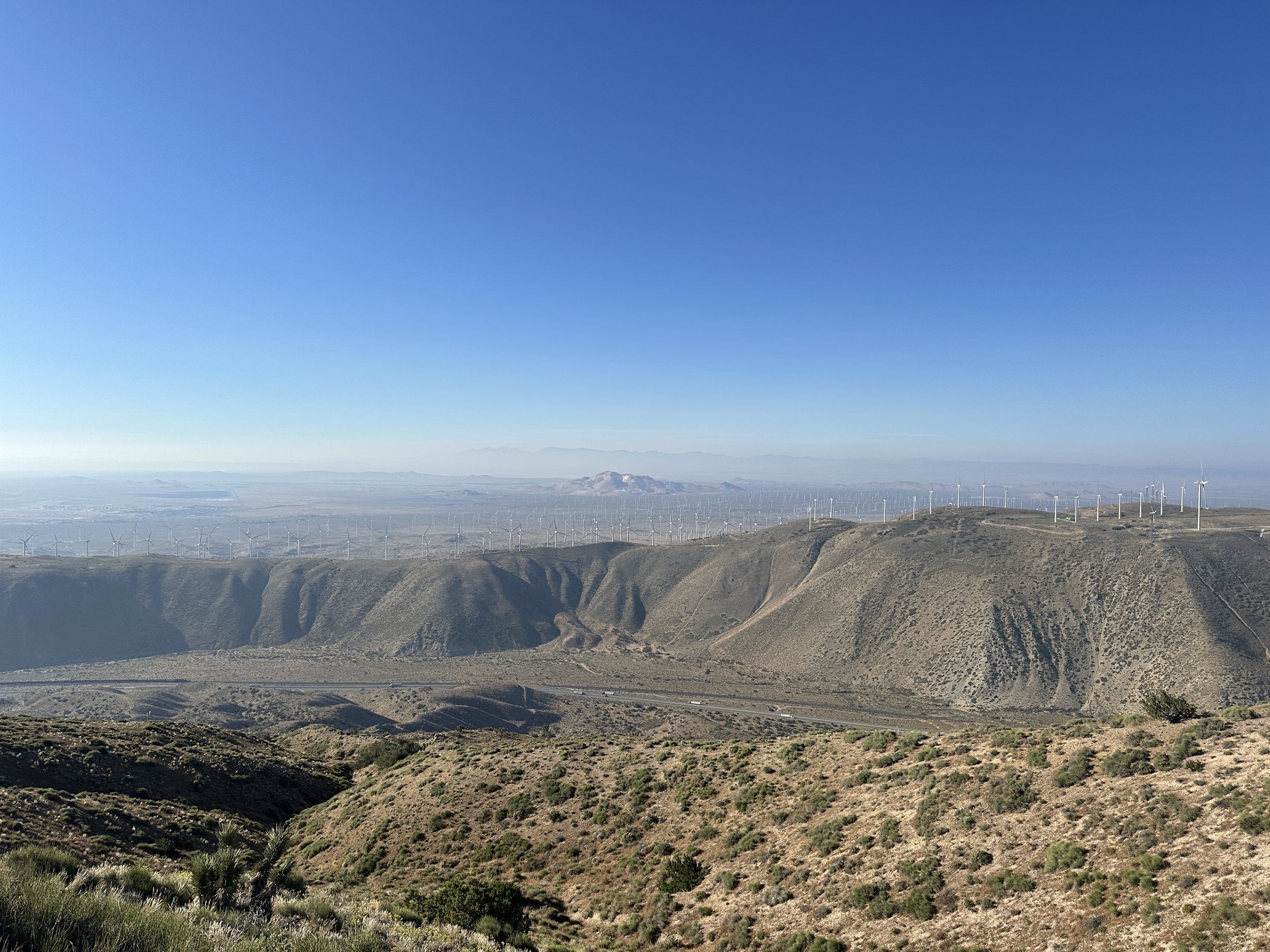
The next morning was a quick jaunt into Tehachapi. Unlike the hike into the wind farm, which felt odd, the hike down from above the turbines and through them left me awestruck. They poked up from behind hill crests like giant aluminum sunflowers behind a garden fence. Their shadows cast a mosaic over the hills and occasionally over the trail itself. And the scale of the wind farm, one of the world’s largest, is simply epic.

I was thrilled to run into Lite Bright, Door and Kidska right as I reached my hitch point into town and I was equally excited to reach Tehachapi. I had met some local grain farmers a few years back when I was in L.A. and learned about the famous marvel of railroad engineering, the Tehachapi Loop from Scout’s Journey’s North. I was more familiar with the name, though, from the Little Feat song Willin’ (though I recommend the Linda Ronstadt version):
And I've been from Tucson to Tucumcari
Tehachapi to Tonopah
Driven every kind of rig that's ever been made
Driven the back roads so I wouldn't get weighed
And if you give me; weed, whites, and wine
And you show me a sign
I'll be willin', to be movin'
The local bakery makes a killer reuben. The pizza place has gluten-free crust. The Best Western has laundry and a jacuzzi. The Walmart is a hiker’s resupply dream. I can also recommend the well-named Thai Hachapi, where Door, Kidska, Lite Bright and I had a veritable feast. Today, I expect to slack pack a short section of trail and may extend my stay for a friend’s birthday.
In the beginning of the hike, I knew I wanted to do this. Once I figured out my shoes and my feet, I knew I could do this. Now, with twenty percent of the trail behind me and a lot of uncertainty ahead, I had been thinking I was left with the question, “Will I do this?” I think I’m realizing now, as I luxuriate in Tehachapi’s riches, is that the nature of the question is “How will this all unfold?” I’m feeling a distinct lack of pressure at the moment, another luxury that might dissipate as soon as I figure out my flip plan and July rolls around. For now, it’s a nice place to be.

Sizing Up & The Mission to McDonald’s
It’s hard to believe it’s been almost two weeks since I left Big Bear. I’ve passed the 300 and 400 mile markers, finished traveling west through the San Gabriel Mountains, walked 22 miles to a McDonald’s, and dropped down below 3,000 feet. I’m currently in Acton (2,700 feet) and will stay relatively low until the climb from Tehachapi toward the Sierra—a far cry from the cloud carpeted vistas of the last week. This point in the trail always marks the shift from the taller peaks of Southern California to the hot oven of a desert that hikers must pass through before moving on. This year it represents another transition. Almost no hikers without extensive mountaineering experience are entering the Sierras. As a result, this is the point where hikers are making plans for what comes next. Flip up to Tahoe? Chester? Oregon? What’s the snow like in Washington? There are a lot of unknowns.
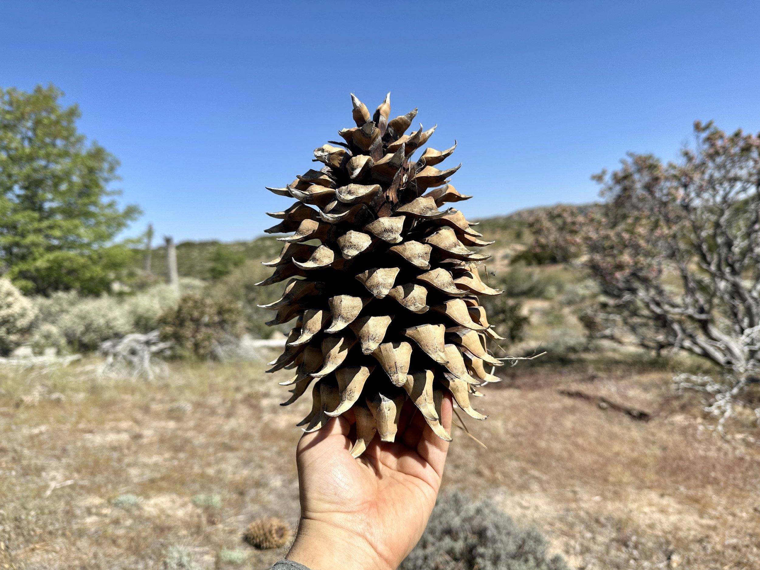
I left Big Bear on May 16th, and had made an effort to make sure I was carrying more than enough food for six days when I would resupply in Wrightwood. They say a day’s worth of food for PCT hikers should weigh about 2 pounds (or half to a quarter of the weight of a Coulter pine cone). This certainly felt like that at the least. Even at the minimum I was carrying over 30 pounds for the first time, even after shedding my snow equipment in Big Bear. Once I made it back to trail (ride from a couple in a nearby AirBnB + public bus + hitch from a Nepalese cook) I did what any self-respecting hiker would do. I knocked out a couple of miles and stopped early for a big lunch.
Back on trail with a marginally lighter pack, I appreciated some panoramic views of Big Bear Lake from above for the first time before running into Atlas again as well as Zippy, Vortex and Snake Mate at a campground ten miles later. We leapfrogged the next day, overlapping for lunch and siesta among many Holcomb Creek crossings before camping on the banks of the creek after a 19 mile day.

The next day was a short hop walking alongside the incredibly beautiful Deep Creek that would lead us to the Deep Creek Hot Springs. We were lucky enough to arrive at the end of a weekday and, along with a couple of dozen other PCT hikers, mostly had the glorious hot springs to ourselves. My friend Wiley and I are fans of the executive workout (hot tub and/or sauna without an actual workout) but I have to say that walking over 300 miles to a natural hot springs is as amazing as it is inefficient.

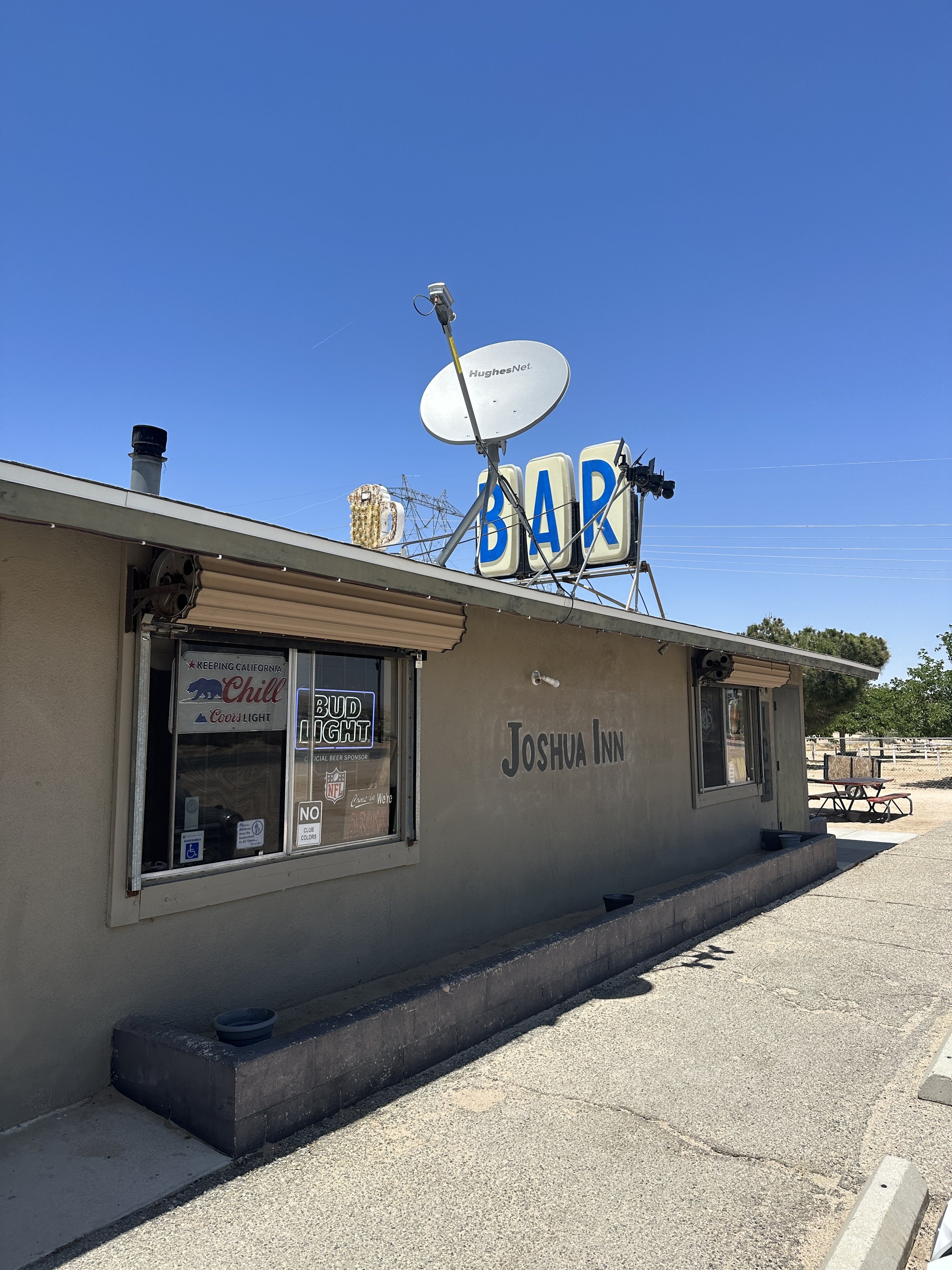
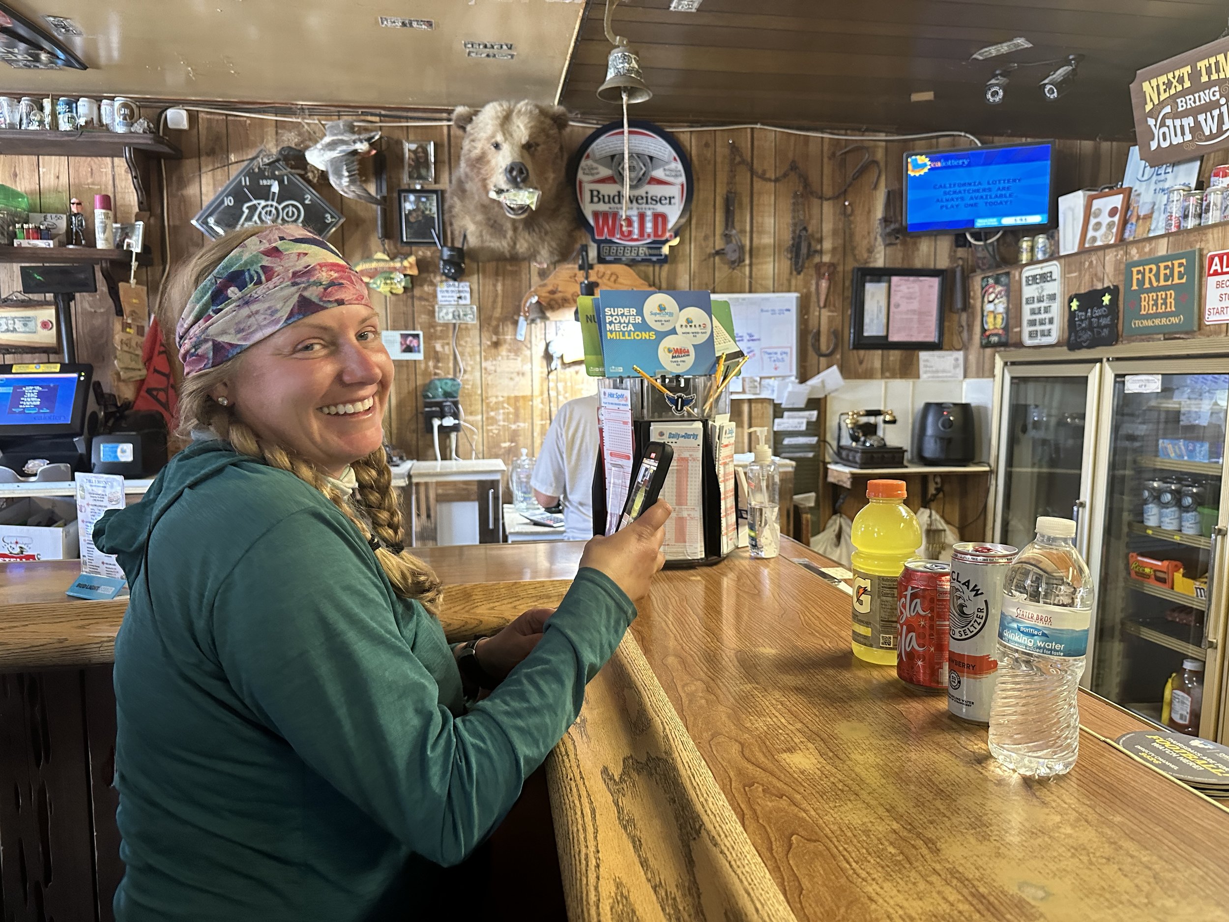
At this point, we were traveling as five and decided that the next day should include a daytime stop at Joshua Inn, a hiker friendly dive bar with a deli that would pick us up from trail. My job was to make sure we were headed back to trail in an hour. Friends, I failed in my mission. Four hours later we were climbing back onto the trail. I met Ted Talk at a brisk and cruel water crossing that forced you to plunge to your waist just before rising to a more civilized level. We broke for dinner at 7 when the group night hiked out so Atlas could make a resupply rendezvous in Cajon. My glasses had lost an arm so I passed on the night hiking and made camp.
Vortex with the four major beverage groups.

I woke up the next morning 22 miles from Cajon Junction and, more importantly, a trail adjacent McDonald’s. Fueled by hamburger hunger and protected by the shield of Vitamin I (ibuprofen), I decided to crank out this Mission to McDonald’s—my biggest effort to date. There was beautiful trail around Silverwood Lake. There was veggie burger trail magic. There was a cold creek perfect for foot soaking. There were beautiful austere hills out of another place and time. And then, just after I completed the last triumphant climb before Cajon Junction, a thunderstorm moved in. I was caught in a game of electrical pickle, stuck between the highest point on the highest hill and a series of metal electrical towers. Would my dreams of bunless burgers and an m&m McFlurry be denied? Would I be flame broiled? Thankfully, no. I waited out the storm, made my way to Route 66 and used that McDonald’s touch screen to do things I’m not proud of. C’est la guerre.


The mission was a success but my feet were once again a wreck. I had made the mistake of not sizing up my shoes in Big Bear. I was not going to let another chance go by. Just over twelve hours and an Uber ride from Rami Malek’s uncle later, I walked into the Rancho Cucamonga REI like Charlie into the Chocolate Factory. I walked out on cloud nine, sporting a pair Hoka Challengers, size 10.5 wide and soles thicker than the turkey avocado sandwich at Idyllwild Pizza.
These shoes have changed everything. Moving up a shoe size have given my feet the room they needed and the obscenely thick soles of the Hokas are giving my soles some much needed relief. My blisters have gone from one form of Oscar domination (Everything, Everywhere, All at Once) to another (All Quiet on the Western Front). Every step used to be a Princess and the Pea situation. Now, I’m Goldilocks and the trail is the third bowl of porridge.
The climb out of Cajon Junction the next day included 3,000 feet over 9 miles and for the first time, both my feet and legs were there for it. The day was a series of hills, nested behind one another. Rising above a valley dotted with yuccas and then a sea of clouds every mile or so would reveal the next hill and the loping path that the trail would take through it. Up was the only choice and maybe the new shoes were coloring things for me, but I found beauty in discovering the path at each new hill. There were views of San Gorgonio and even, in the distance, San Jacinto.
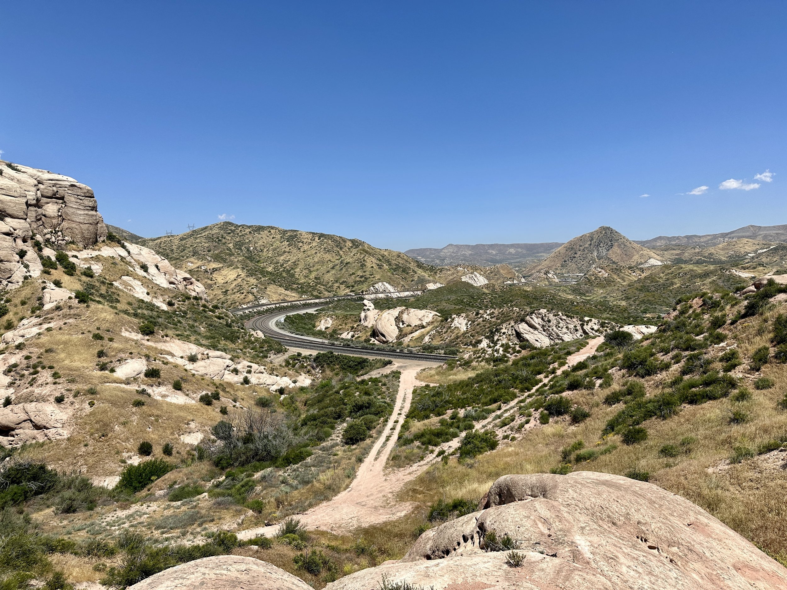
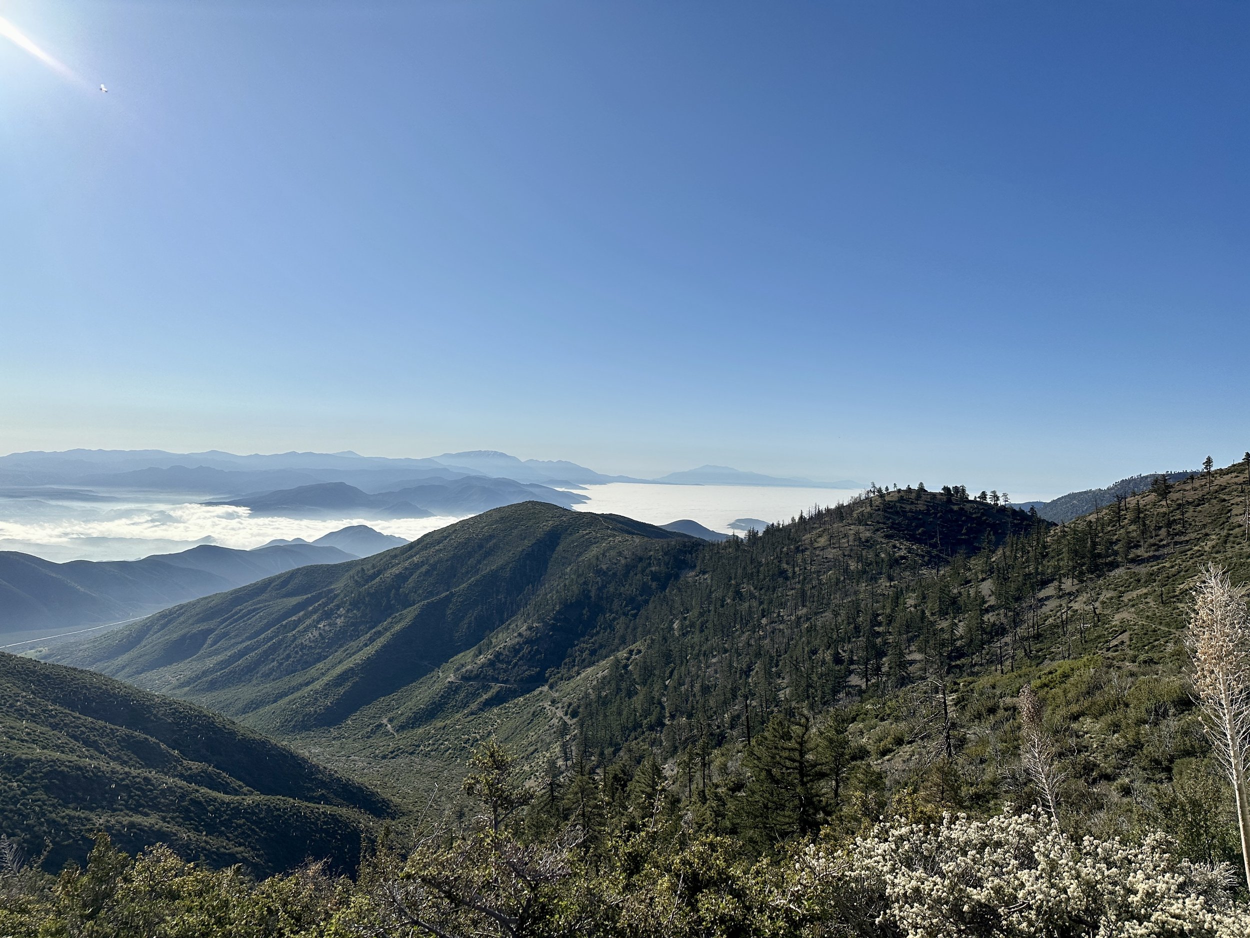
The climb ended the next afternoon just outside of Wrightwood, one of my favorite trail towns to date. Idyllwild embraces hikers. Big Bear Lake absorbs them. Wrightwood, though, is a small town that makes space for us. There’s no outfitter, but the local hardware store has created a big area for gear and a backyard for hikers to plan and congregate. The Grizzly Cafe found more ways to accommodate us than we could have asked for and the local grocer stocked all of our favorites. A local property manager makes sure, one way or another, hikers have a place to stay, part of a group or not.

After sharing an AirBnB with (and I love this list of names) Zippy, TT, Vortex, Snake Mate, Atlas, Banshee, Teddy Bear, Cookie and Angry Dane, I was off again. I road walked an apocalyptic Highway 2 around Baden-Powell to avoid the snow, took an alternate around the trail to avoid protected Yellow Legged Frog habitat and soon found myself hiking in the section of the Angeles National Forest that I had hiked the most often when I lived in LA. I had no idea back then how close the PCT came to my back yard. The night before last I camped on a ridge with sunset views of Strawberry Peak, where I used to hike all the time. I was so excited to be nearby I almost made a side quest out of it. Instead, I received amazing trail magic from Todd, the keeper of a local fire station, camped in Mattox Canyon, a perfect desert oasis, and reconnected with Ted Talk.
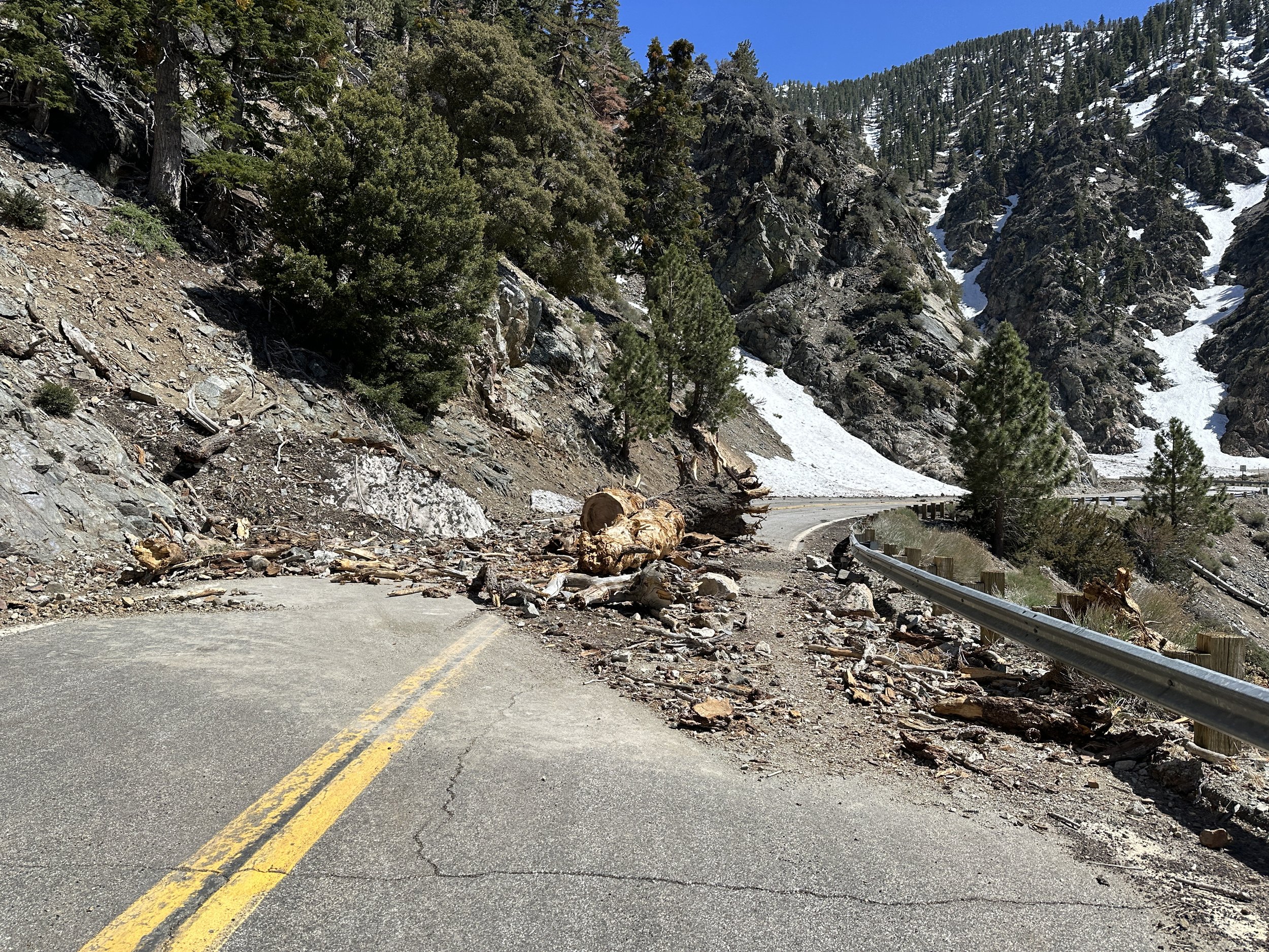

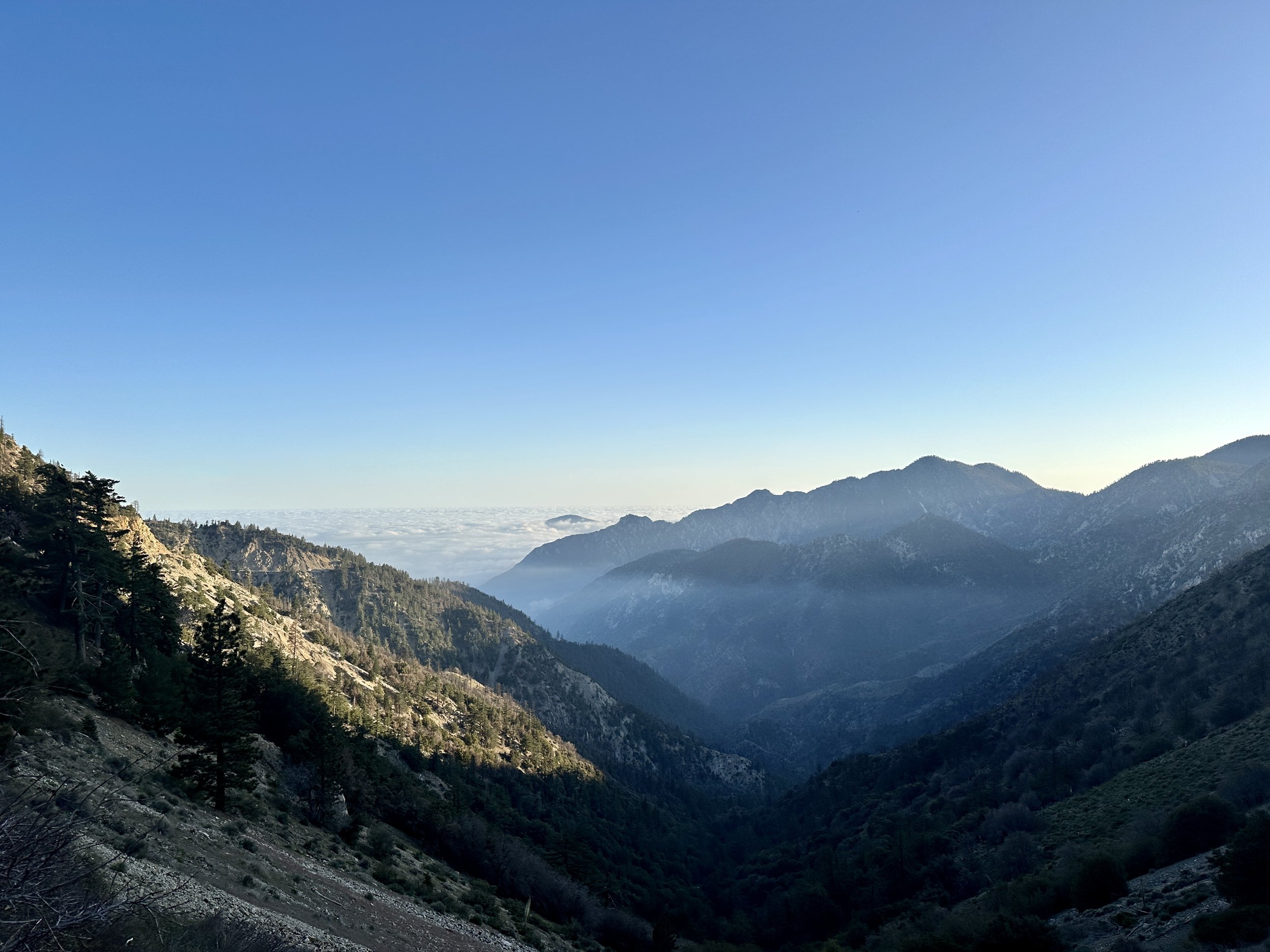
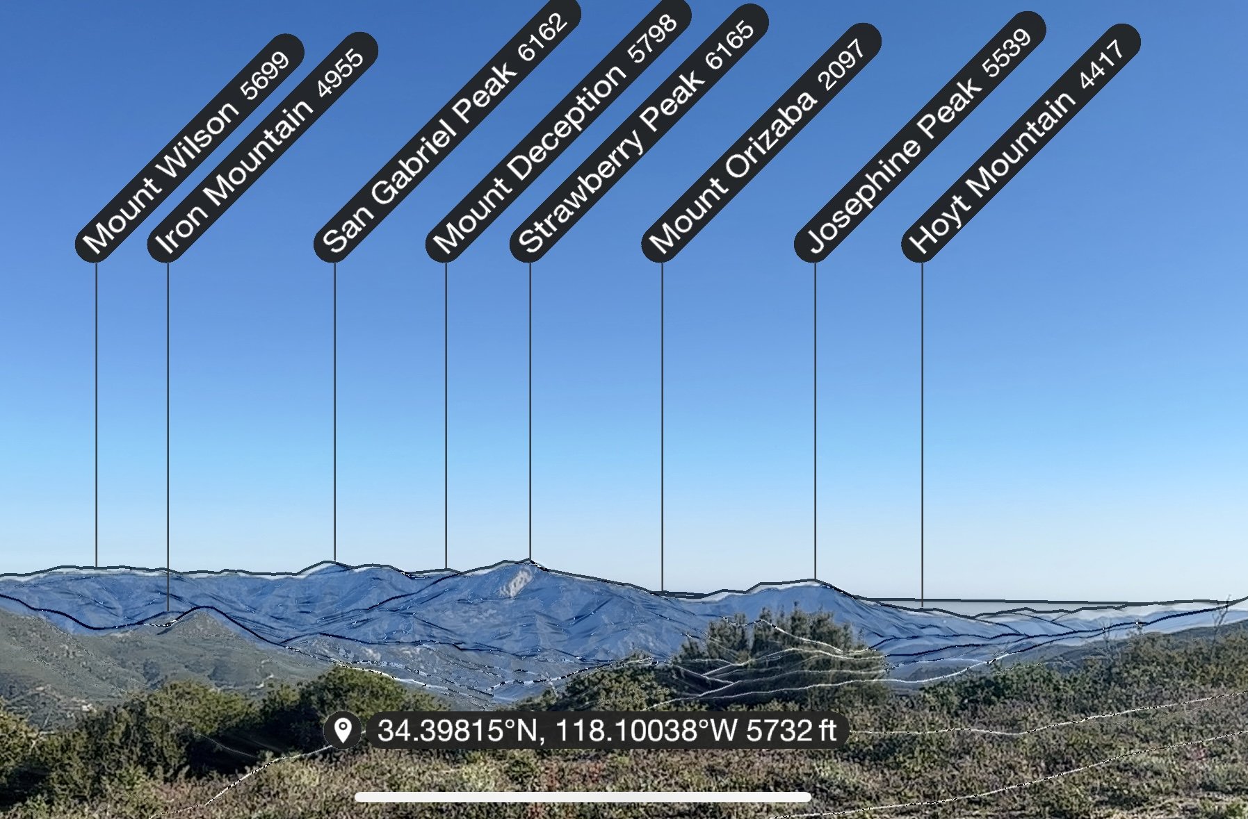
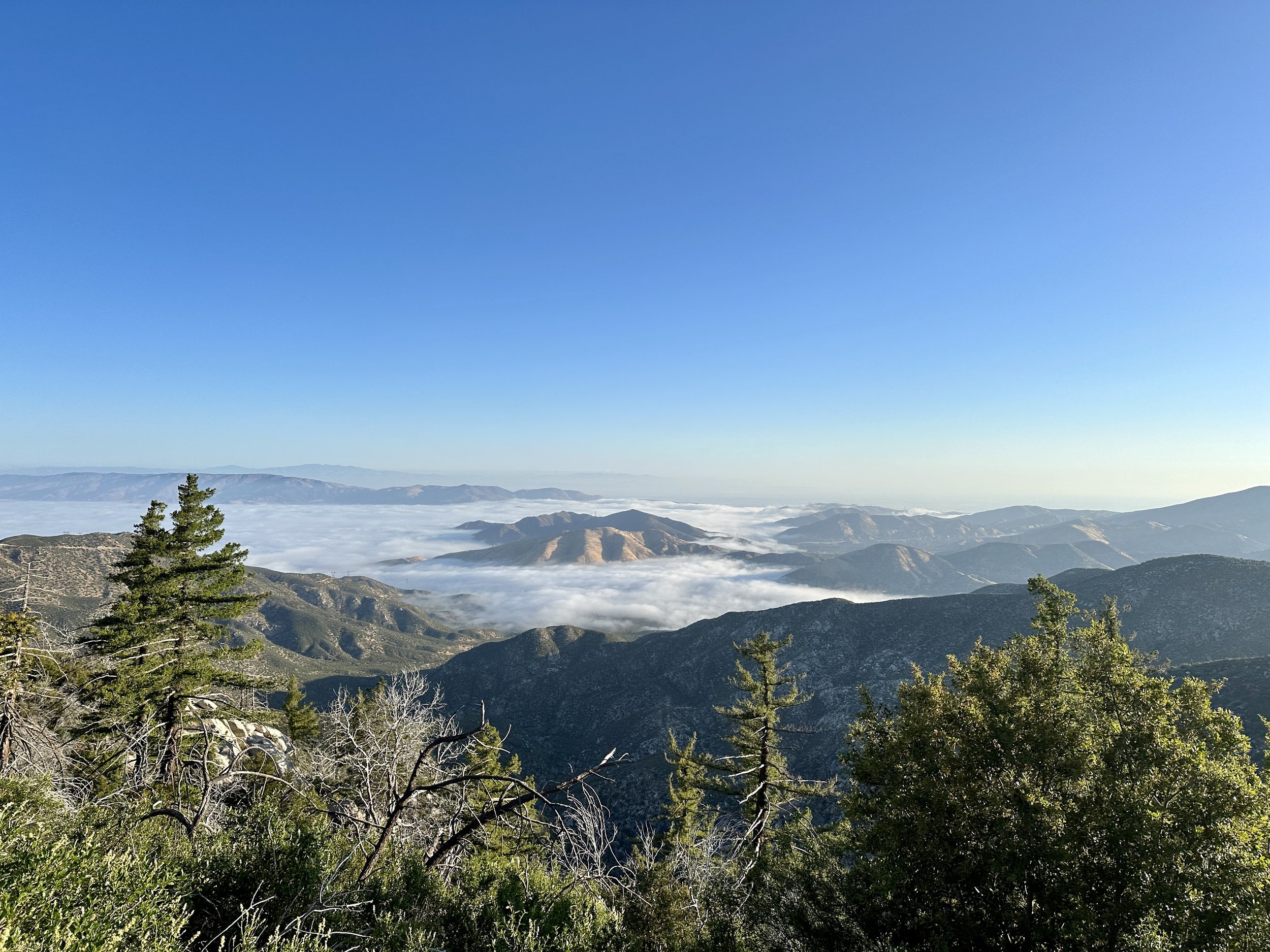
Yesterday, I hiked my first ten before ten (10 miles before 10 a.m.). Tomorrow some friends from LA are going to come up for a visit and provide some trail magic themselves (1 p.m. onward at the parking lot by the Indian Canyon Trailhead in Acton if anyone on trail is reading). I’m more excited to hike than to rest and I’m excited to link up some big mile days.
After the two weeks that came before, I’m wondering what the next set of challenges will be. I’m not looking to get in the way of this trend but, in a way, I’m looking forward to handling whatever comes next. I’ll be happy to ride the good times, but I know before long I’ll have the chance to deal with any problems that arise, hopefully, with poise and determination.


Highs and Lows on a Sky Island
Things have really been trending upward, both literally--23,000 feet of gain in concentrated segments over the last 116 miles--and in terms of finding my rhythm on the trail. There has been little routine recently: one rest day, one day of slackpacking (hiking with no or an underloaded pack), three nearos (days with nearly zero miles), five days of relatively traditional hiking and two incredibly challenging days traversing snow on Mount San Jacinto, one of which was absolutely harrowing.
This post is much longer than the ones that came before. I have had access to a real computer. Apparently a full sized keyboard does not lend itself to brevity.
After several days of rest and improvement of my Achilles tendinites, I got the go ahead from Blaze Physio to slack pack the 6.5 miles I missed by getting off the trail at Mary’s Oasis as a 13 mile round trip (If any future PCT hikers are reading this: never get off the trail in Anza). I did my PT and there was a little pain on the hike, but when I woke up on Wednesday, my achilles had never felt better. We were back in business

I waited out the storm that was passing through on Thursday in the common room of the Silver Pines Lodge with a dozen other hikers, shooting the breeze, and drinking the finest drinks that the Idyllwild markets had to offer. By the afternoon, the storm was over and I caught a hitch up to the Paradise Valley Cafe to get back on trail. My Hotel California situation was over! I hiked a short distance up and out from the highway and set up my tent with a warm desert view.

My first full day back began with a little drizzle during breakfast and then a morning nap. Why not? I was only going to do 10 miles or so on my achilles. This indulgent start belied the fact that the day would prove to be one of my most exciting yet. The trail ahead was basically a well-graded climb approaching the sky island of San Jacinto. Even though I was still building up my hiker legs and general fitness, I was able to have conversations with my fellow hikers as we moved beyond 5,000 feet. In fact, the grade of the PCT makes my overuse injury all the more frustrating. Compared to most other backpacking that I’ve done, and with the exception of the conditions I would see in next few days, the PCT is gentle as it’s graded for pack animals. It lacks the grueling ascents of Yosemite’s high country or the direct climbs of the Great Smoky Mountains, at least for now.
Around 4 p.m. though, the temperature plunged. A dip at this time is normal, making it a great time to push out some more miles before making camp. This was different though. A giant gray cloud had moved over the mountain and the wind was relentless. It can be comfortable hiking my sun hoody and shorts down into the 50s. This was not comfortable. The winds that had buffeted my tent the night before picked up and prevented any sort of warmth from building up from my efforts. As I climbed past 6,000 feet, I could see a sunny day off to my right. At each saddle, the winds howled and there was only dreariness above and to my left.
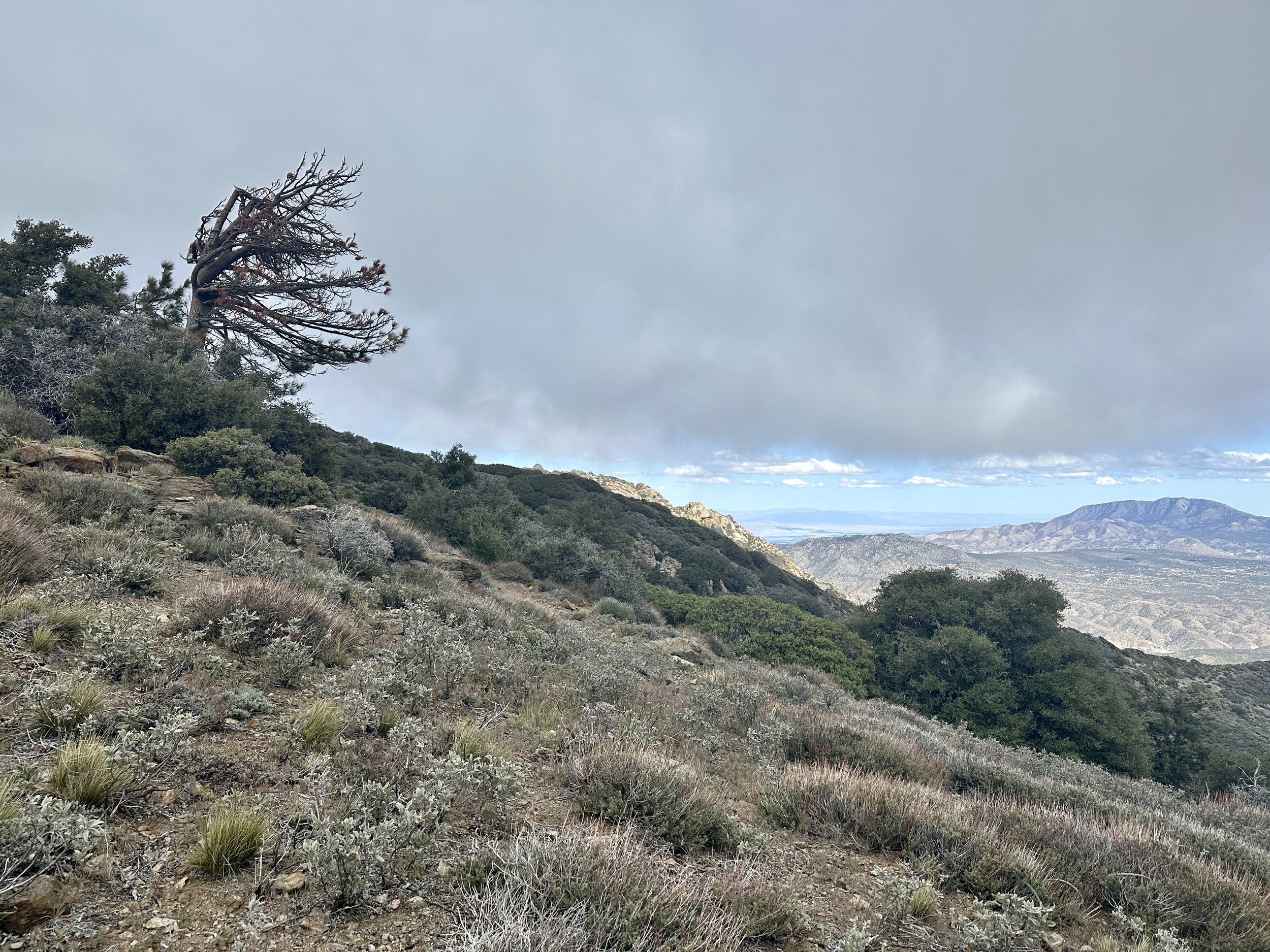
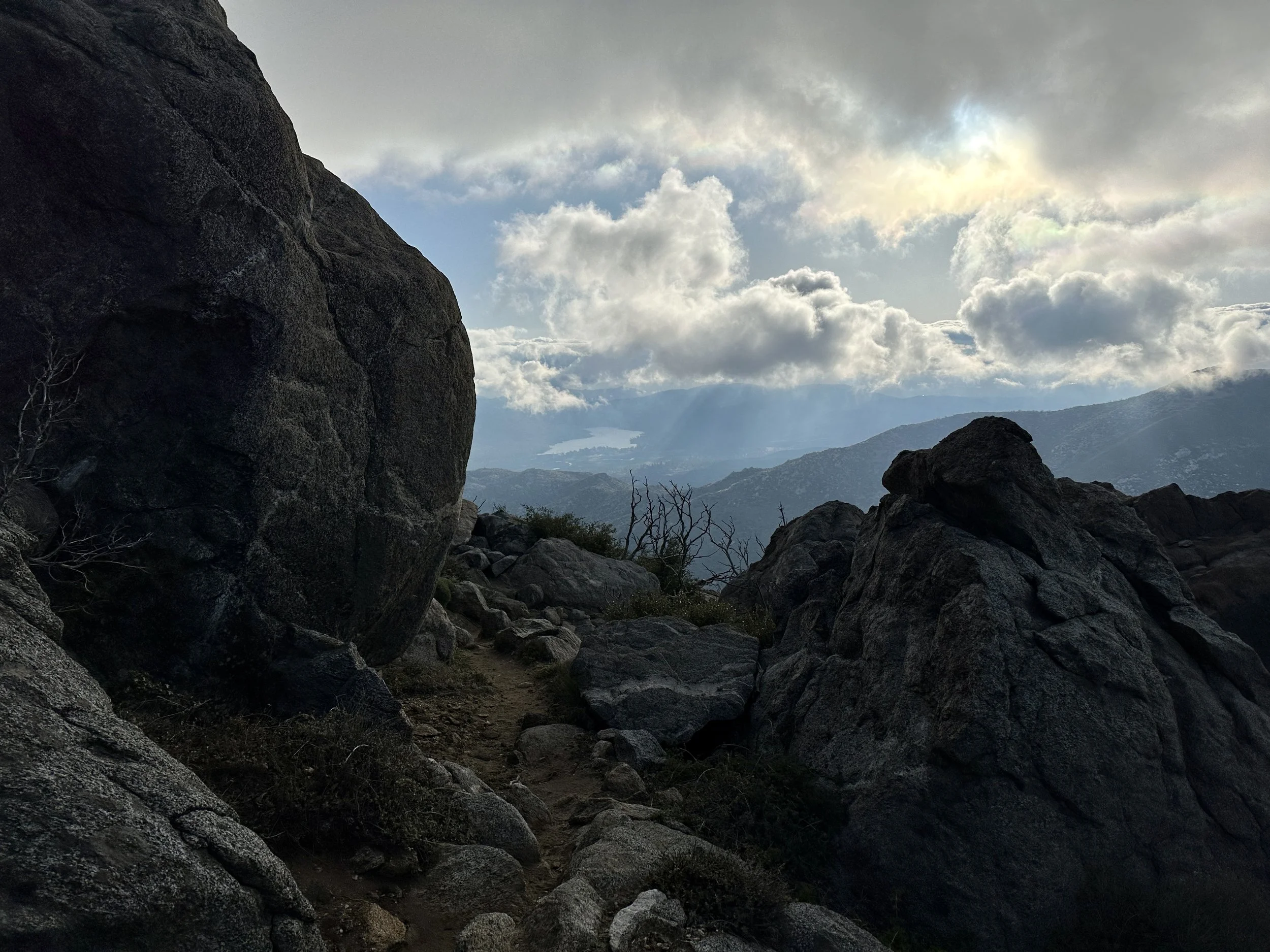

Eventually, around 10 miles in, the big climbing for the day was done. As I reached a level portion of the ridge, a small break appeared in the cloud. A beam of light came down, reminiscent of the old Hebrew National hot dog commercials. It was warm. It was glorious. And for a few moments, it shined on me–I was that blessed hot dog. As I basked in the sacred light, Jan, Oofa and Rene, a trio I had run into during my slack pack, caught up to me and captured the moment. They would go on to camp at a nearby spring a few hundred feet down. I decided to push on. I had enough water and wanted to find an easier spot to camp.
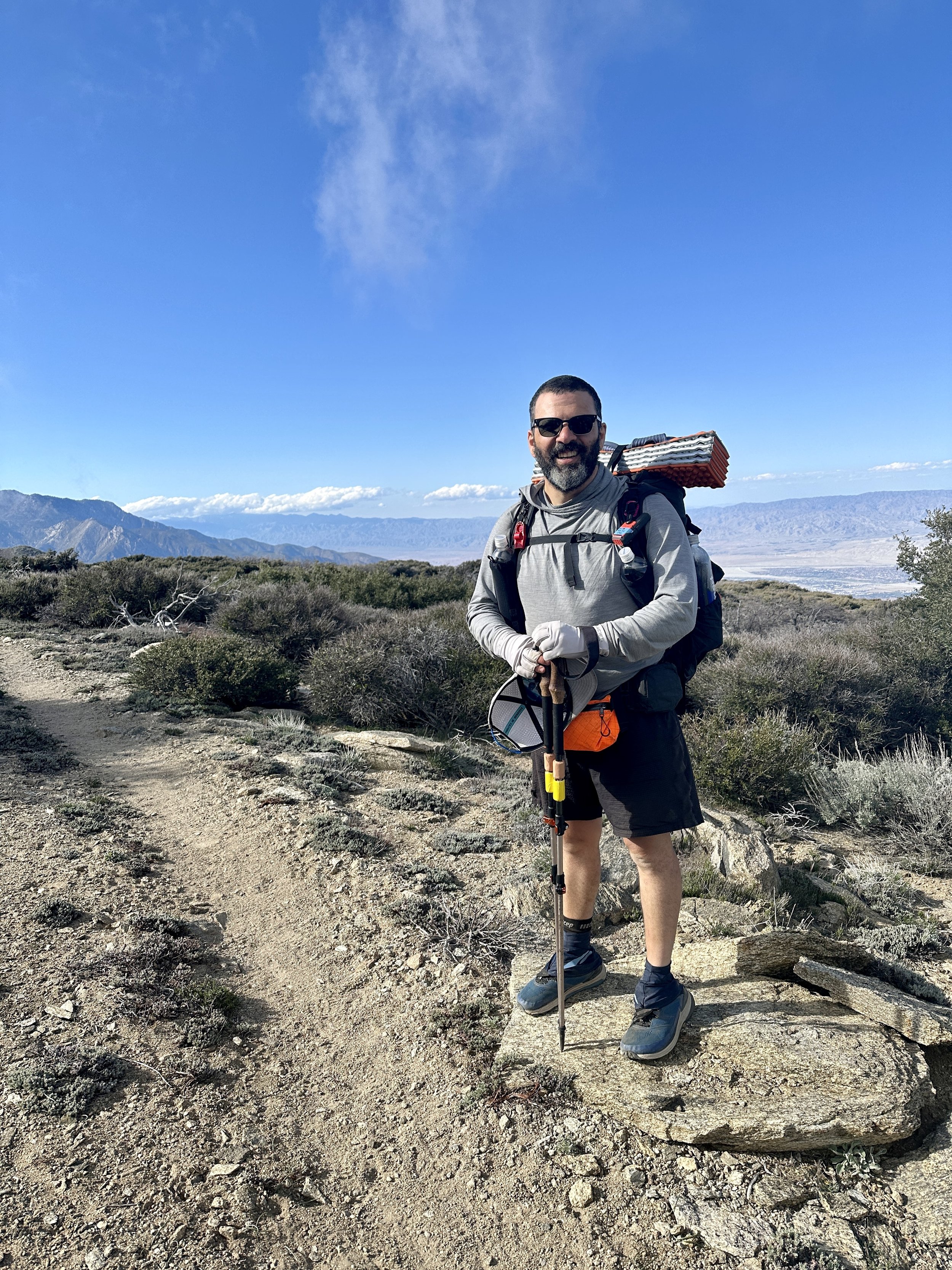
The trail kissed 7,000 feet and then rose above it for the first time. I was tempted to give up and take one of the few exposed campsites.. At this point, I was rushing. I was losing light and it was getting colder. Worse, the trail was passing through a burn area full of widow makers–dead trees that are liable to fall on sleeping campers–not something I was willing to risk while camping on this windy mountain. As I rushed on, a Canadian couple, Lloyd and Tania, appeared behind me. Bad news. More competition. They also told me that the next campsite was full and that we’d have to go further.
It was an interesting end to the day. Was I uncomfortable? Yes. Was I unhappy? In that moment, also, yes. But I realized that there was no danger and nothing was beyond my skill set. The worst case scenario was a little night hiking. I could handle that. Beyond my skill set would come a few days later. On that night, I indulged in an avocado I had packed out from Idyllwild. It was my first fresh food on trail and it was glorious.
After 12 miles and change I made it to a large campsite with many other hikers. I officially met Lloyd and Tania and the next morning, their friend Martin who, a week later would extend an incredible offer of kindness and generosity even though we only saw each other a few times in between. This trail is an amazing place full of amazing people.
The following day brought the rise up to Apache Peak. This was a hard day of hiking. I don’t know if it was general fatigue, the new steep grade or the altitude, but I was struggling. Numerous blowdowns (dead trees that had come down across the trail) required climbing or navigating around.
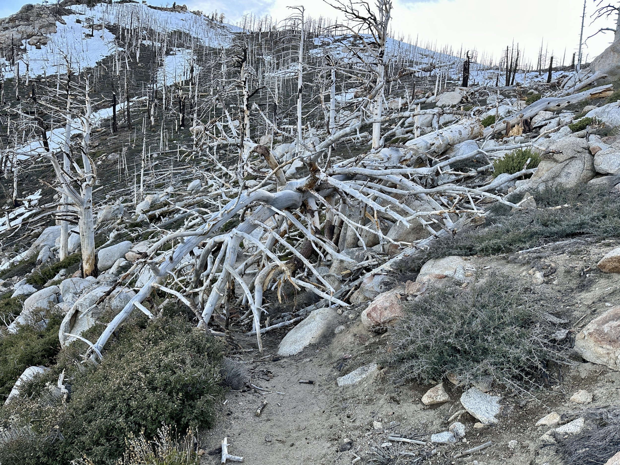
There were also the infamous traverses around Apache Peak, the first potentially dangerous section of trail. Apache Peak, in snow years, could provide extreme exposure, that is a high risk of injury in case of a fall. San Jac Jon, an Englishman who summits San Jacinto multiple times a week in almost all conditions, provides weekly reports on conditions on the mountain at sanjacjon.com. Even after the recent storm he noted that Apache Peak on the PCT could be navigated with microspikes and an ice axe, equipment I had training on.
After the first traverse on Apache, though, I decided, I would get off the trail at Saddle Junction and take the alternate trail to reconnect with the PCT at mile 190. It wasn’t particularly nerve wracking. I just decided the reward was not worth the risk. There was enough snow to slip. There was not enough snow to self-arrest (stop a slide with an ice axe).
The day remained a slog and I worked through the remaining miles with Tony from Texas, whose wife was along for the journey, supporting by van, but leaving the backpacking to Tony. I hike faster when talking with others and during tough stretches this can really take my mind off the hiking. Tony definitely helped me get through the drudgery of the day.
Finally, after a day long on obstacles and elevation, but short on miles, I made it to a camp at 8200 feet that must have had 30 tents. All of the usual suspects were there: Jan, Oofa, Rene, Lloyd, Tania, Martin and more. I found my little slice of San Jacinto heaven and accidentally and repeatedly kicked out the tent stakes of my good-natured neighbor, Pacman, while I was setting up. He and I would spend much of the next week together, including the challenges of the days ahead.

The campsite was stunning. A carpet of clouds lay beneath us with various ridgelines and peaks poking through. Everyone was thrilled the day was over. My feelings at the campsite turned from sullenness to elation. Maybe I would do Fuller Ridge after all. I would decide the next morning at Saddle Junction.
The morning after the climb around and above Apache peak brought a quick exodus from the camp and crisp snow cover, perfect for navigating in microspikes. It was a fun morning with Door, Kidska and Light Bright, a truly exciting trio to hike with and talk about life. Pacman joined in and we had a great alpine time, admiring the views and taking pictures above snow buried signs. We walked on, getting closer to Fuller Ridge, a dangerous stretch with little margin for error.
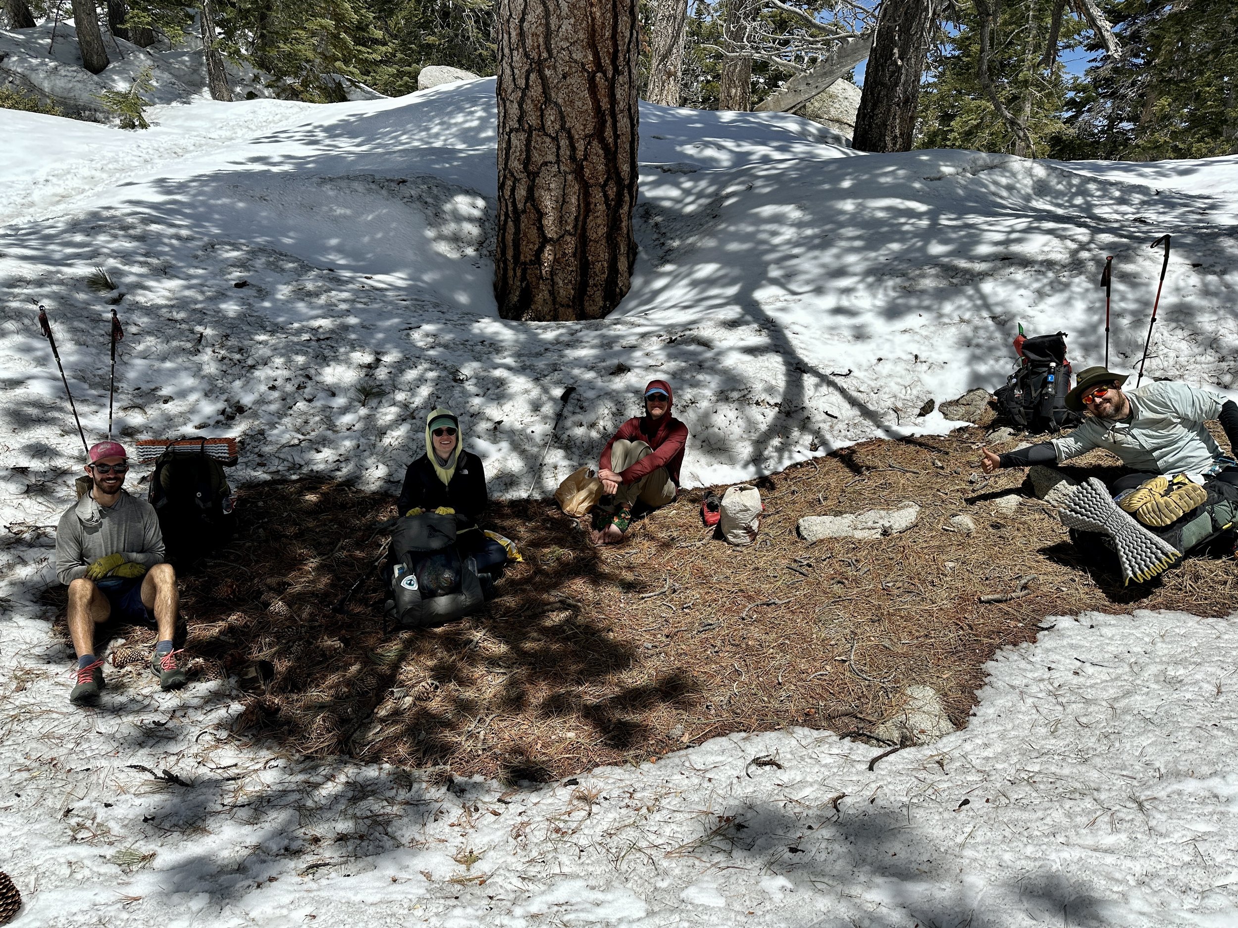
When the five of us hit Saddle Junction, I initially stayed back before pushing on. In the end, I decided, I could always back track and come back to take the bail out at Saddle Junction. I did not. I’m here and I’m fine. But I certainly wish I had.
As we went on, a good seven or eight miles before Fuller, the snow started to soften. There was a clear boot path and little exposure. Travel was still fairly fun. There was a small decline that some hikers were down climbing. I decided to glissade down. Despite a few winter day hikes in Colorado and a full three days of winter mountaineering on Mount Washington in February, this was my first lesson that letting go of control on snow without aggressive equipment and real thoughtfulness could quickly go south. The short glissade decided to become a slightly longer one. I used my trekking pole to arrest and in doing so, bent it. In some ways this was a win. One of the reasons I have heavier aluminum poles, compared to lighter carbon fiber ones, is that carbon fiber would snap in such conditions; not great when you need your poles to support your tent or provide stability on snowy terrain. I could bend this pole back for the time being.
There was never any real risk in this slide, but the sense of losing control is never a good one. If this had been the only instance, I think my headspace going into the next day would have been different, but, unfortunately, it wasn’t. As the five of us headed on we found a number of snow bumps, maybe 5-10 feet long along tree wells and I feel like I was the only one that slipped coming down them. I didn’t reassess and I didn’t change my strategy. A second pole bent. At this point it was clear that Kidska, Door and Light Bright would continue on that day and Pacman and I would end at Strawberry camp, about 4 miles before Fuller Ridge. After a water stop, Pacman continued on to camp and I said I would meet him, and decide if I was going to go forward or not then.
On the next tree well bump after Pacman had moved on, I slipped again, this time snapping one of my poles in two. Now, I still had the right equipment to navigate a snowy traverse: an ice axe for the uphill side, a trekking pole for the downhill side and my spikes. It didn’t matter. Once the pole snapped, my confidence was absolutely shattered.
I took some time to look at my options: I could return to Saddle Junction. I could also, it turned out, descend from Strawberry Camp via Deer Spring Trail. I could go in and do Fuller Ridge.
Backtracking solo did not appeal. Deer Spring Trail solo also did not. I didn’t know the snow conditions or how often it was traveled. I had also got information from a hiker ahead that had done Fuller Ridge before the recent storm that it was not so dramatic. I decided that pressing on with a group, including Pac-Man, that was starting the next morning the way to go. We would start at 6:30 the next morning.
The early part of the day was incredible. Stunning views. Slow but safe snow travel that made us all feel accomplished. We took pictures. We told stories. I took my time. I used my ice axe to down climb the type of short descents that had given me trouble the day before. Even after getting off course we were in good spirits for a quick lunch and even better as we hit a quarter mile of dry switchbacks down and back up the trail. Conversations were flowing. Things were looking up. And then we hit Fuller Ridge.
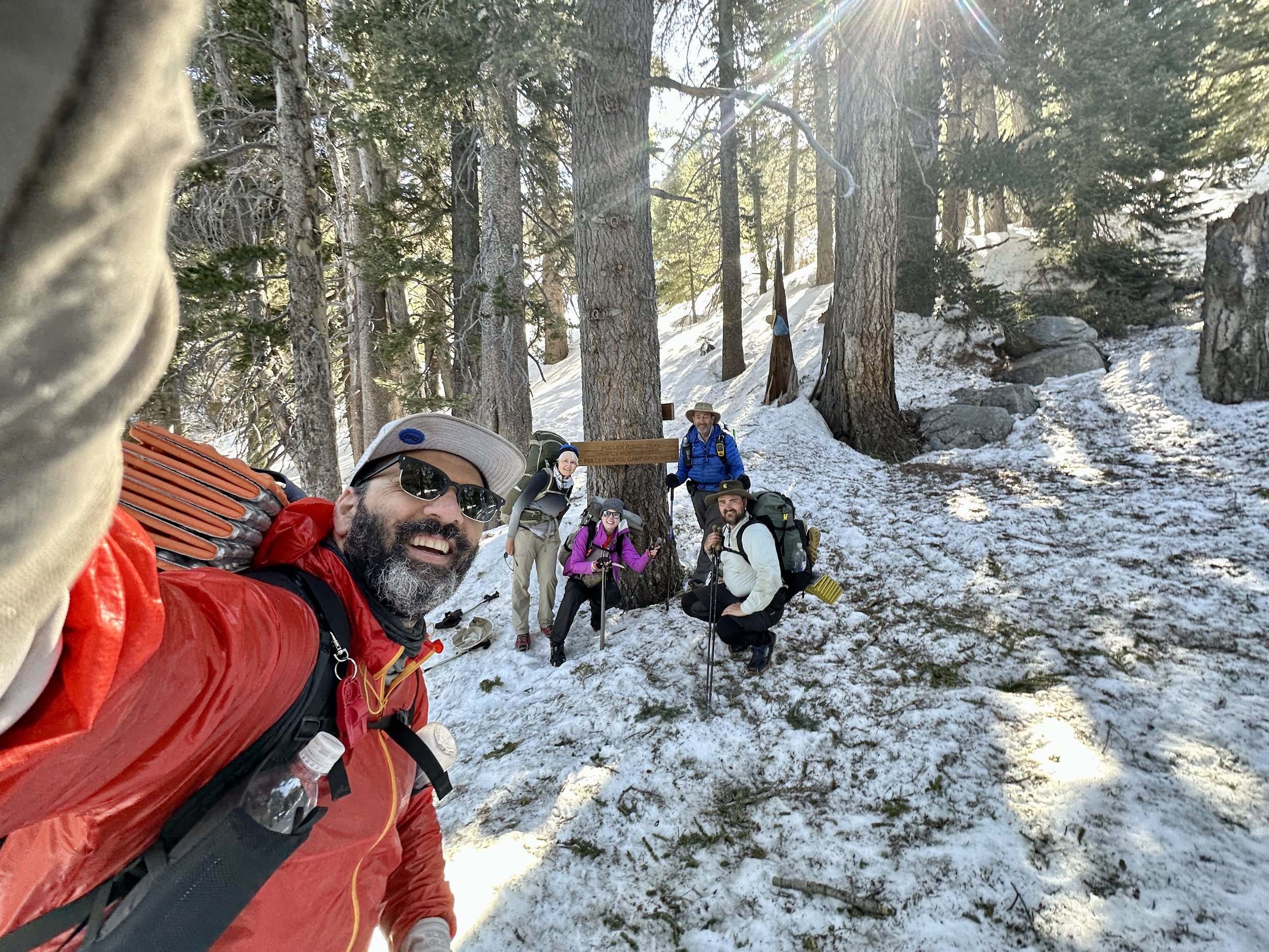
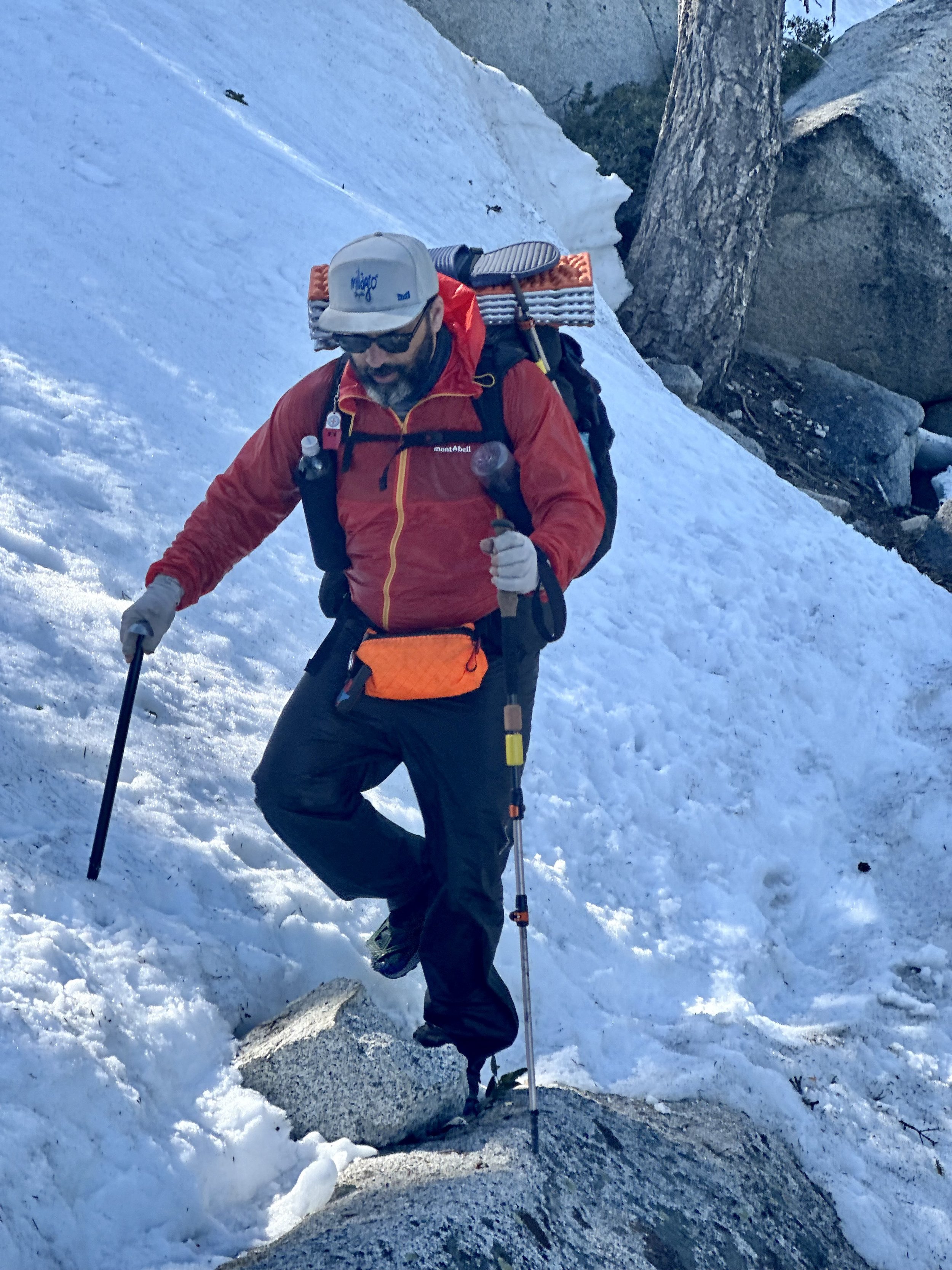
The Fuller Ridge section of the trail is quite a bit like Apache in that it is also very exposed. Unlike the four short snow traverses that remained, however, Fuller Ridge was three full miles of eastern facing slope, completely snow covered and some of the first to get hit by the sun's light. San Jac Jon had said that a few days after the storm it would likely be difficult to navigate Fuller with microspikes. We were probably just beyond that timeline, but not well beyond it.
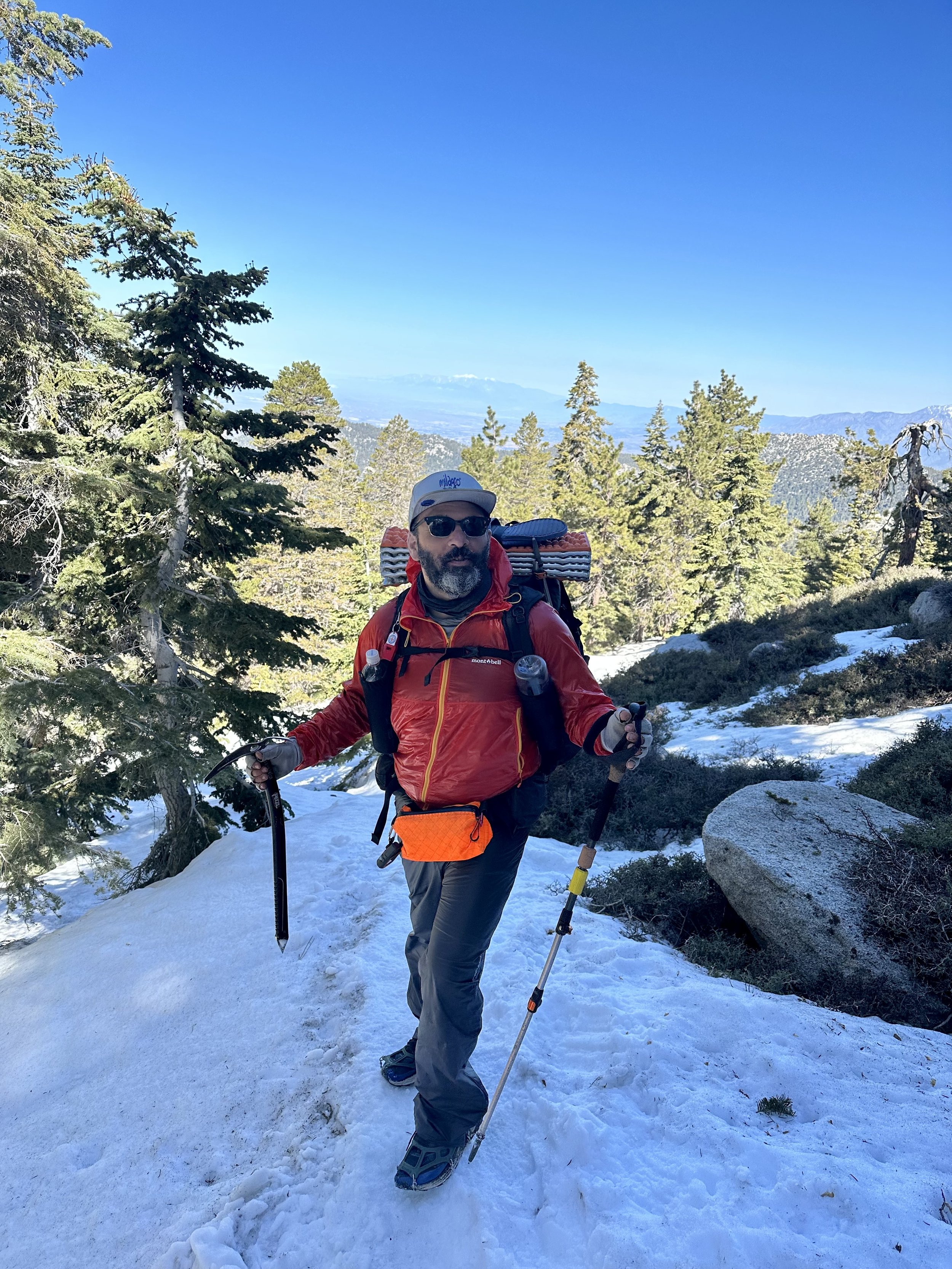
We hit Fuller Ridge at noon and the snow had been melting in the sun all morning. What followed was five hours of the most harrowing hiking I’ve ever done. Every step was taken with near constant exposure to falls that felt certain to be fatal. Slips were common and each one came with an adrenaline spike proportional to the consequences.
Experienced hikers and climbers navigate exposed routes all the time and one of the capacities they have is the ability to work in exposure with less fear. Even while we were on Fuller Ridge, another group of hikers flew through, and when I caught up with them later, didn’t seem to think it was so bad.
For our group of five, two of whom had no ice axes, only trekking poles, it was another story. We marched forward in silence. I have never been so ceaselessly on edge for so long. To maintain an absolutely uncompromising level of focus under a blanket of such fear brought me into a place I had never inhabited before. Eventually, I pushed through the last fraction of a mile with one member of the group. The terrain evened out. Patches of pine duff emerged and we came upon the other three snacking at a tent site.
The cathartic release was intense. To finally have the absence of the fear and the relief from the focus was incredible. I had extreme gratitude for being alive, but it will be the release from these feelings that I think I’ll remember most acutely.
We quickly packed up and started making our way down San Jacinto, happily padding away on terra firma. Before we turned off from a final viewpoint, I asked the other four, Sweetgreens, Linda, Pacman, and Anna to bring it in and we made a little circle with our arms around each other. I was certainly no leader of the day but I wanted to mark the moment. I said that today had been a lot, at least for me, and that I was glad that we had gone through it together. On a journey like this a group can fracture at any moment as individuals meet competing needs and timelines. Having this moment felt important.

Racing down easy trail to a beautiful creek washed so much of the day off of us. We made camp a quarter mile up from the clear, cold stream and that night I cowboy camped for the first time, sleeping under the shadow of San Jacinto as the stars faded into the sky. It was cold and the wind howled, but I slept.
Less than 24 hours later, we would be feasting on In N Out Burger and enjoying the hospitality of the Morongo Casino Resort, the finest trick stop casino I’ve ever been to. How quickly things go back to normal after near misses is staggering.

The next morning, my brilliant plan to resupply through Instacart delivery to the casino did not pan out. So after a big breakfast at the casino, Pacman and I raided the local Dollar General, met a few more hikers and were off to climb back out of the windy basin between San Jacinto and San Gorgonio, the tallest peak in Southern California.
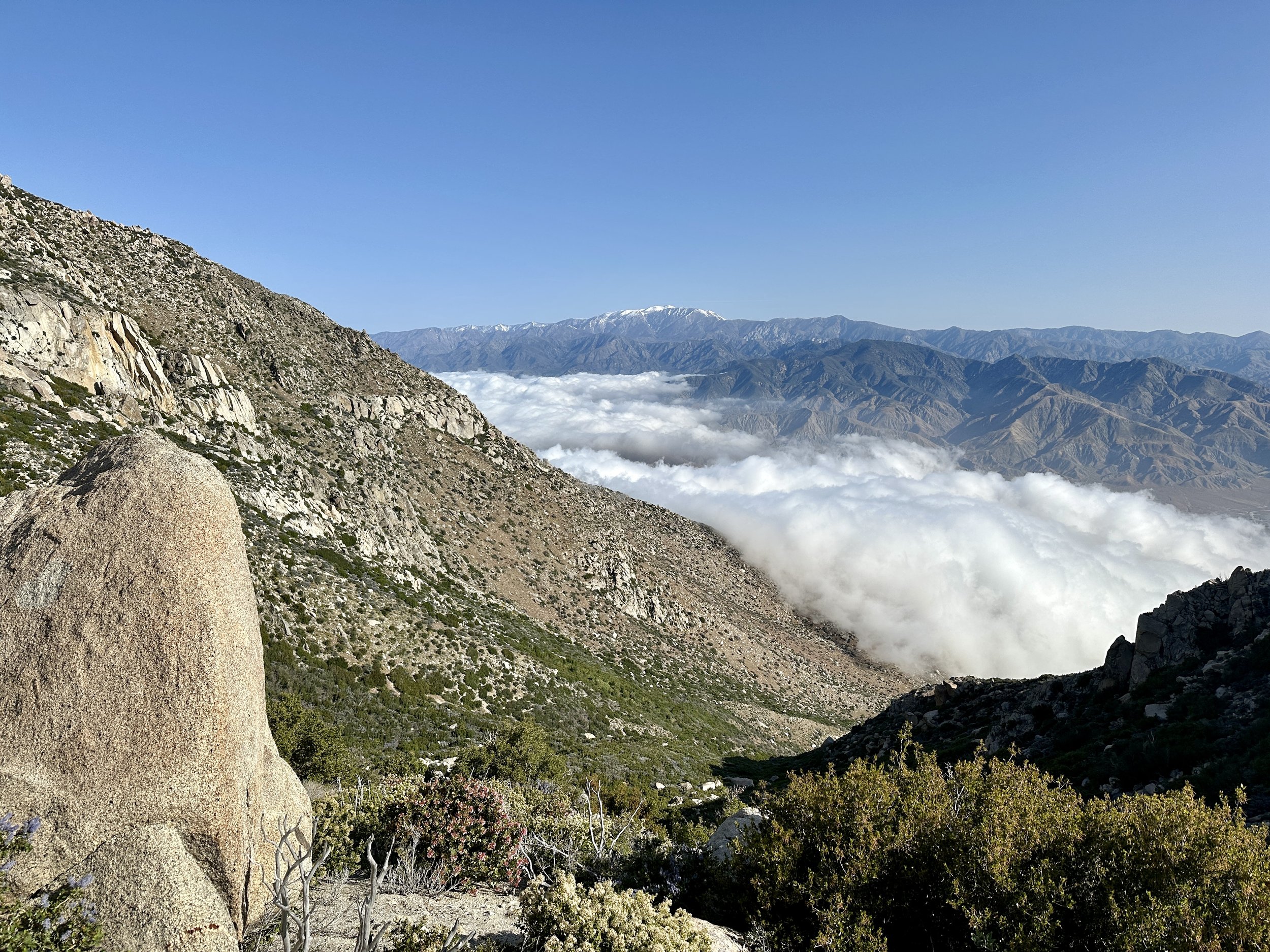
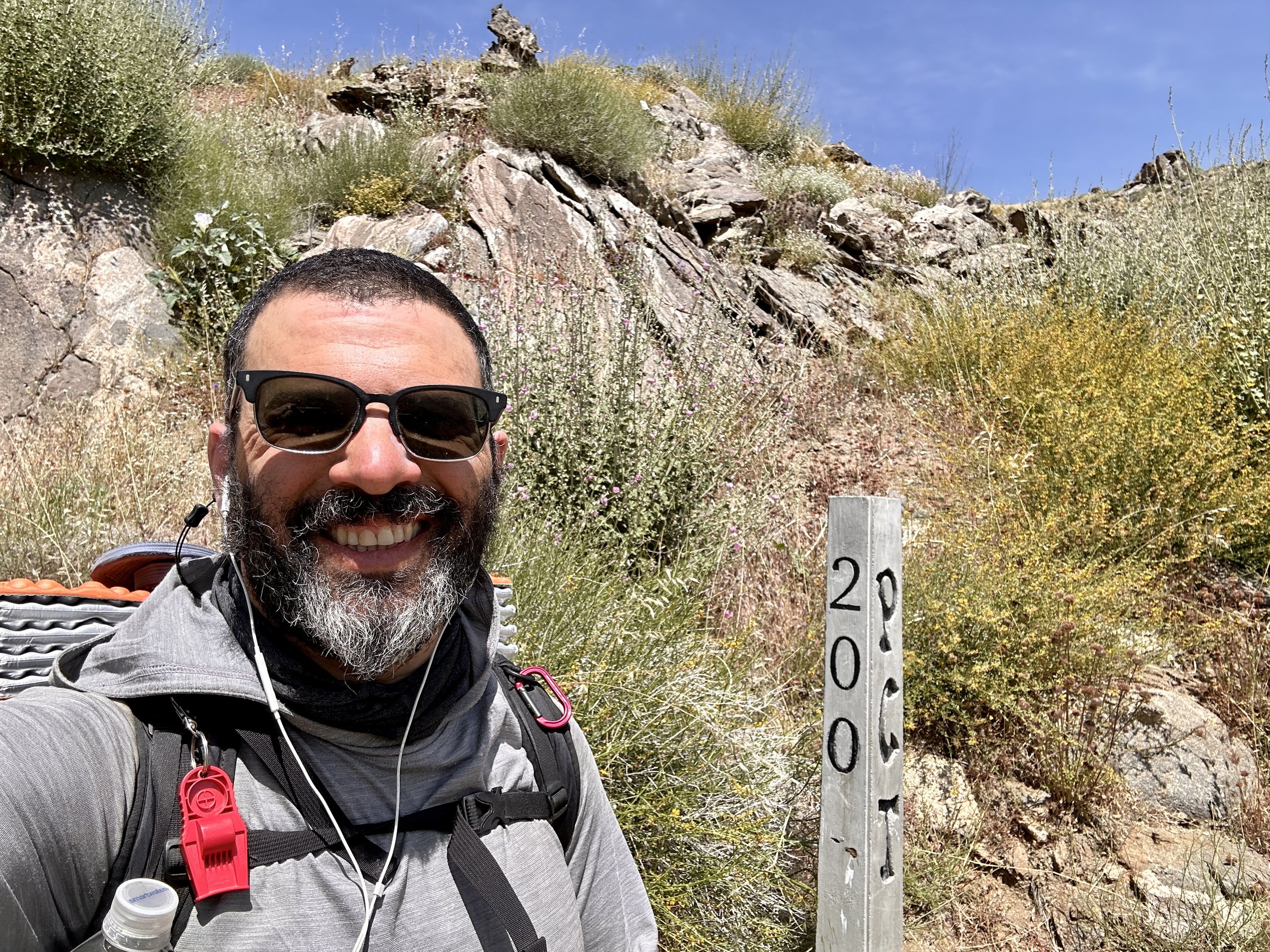
The descent from San Jacinto had been nonstop and windy. The local windmill farms were there for a reason. Even veteran hikers had struggled through a dispiriting last three miles, leaning against the wind, legs stung by wind-flung sand before the I-10 oasis, a bastion of trail magic with cold drinks and snacks for hikers passing through.
The rise into the Transverse Range was no different, but with the casino’s finest eggs in our bellies, it was easier to start into the wind. Pacman was off like a shot and I simply marched through, enjoying the rise into the desert I had become familiar with before San Jacinto. All the while, San Jacinto’s familiar snow streaked peak would come back into view. I’m not sure if I would recognize it without the snow, but with its streaks of confectioner’s sugar, I don’t think I could ever miss it.
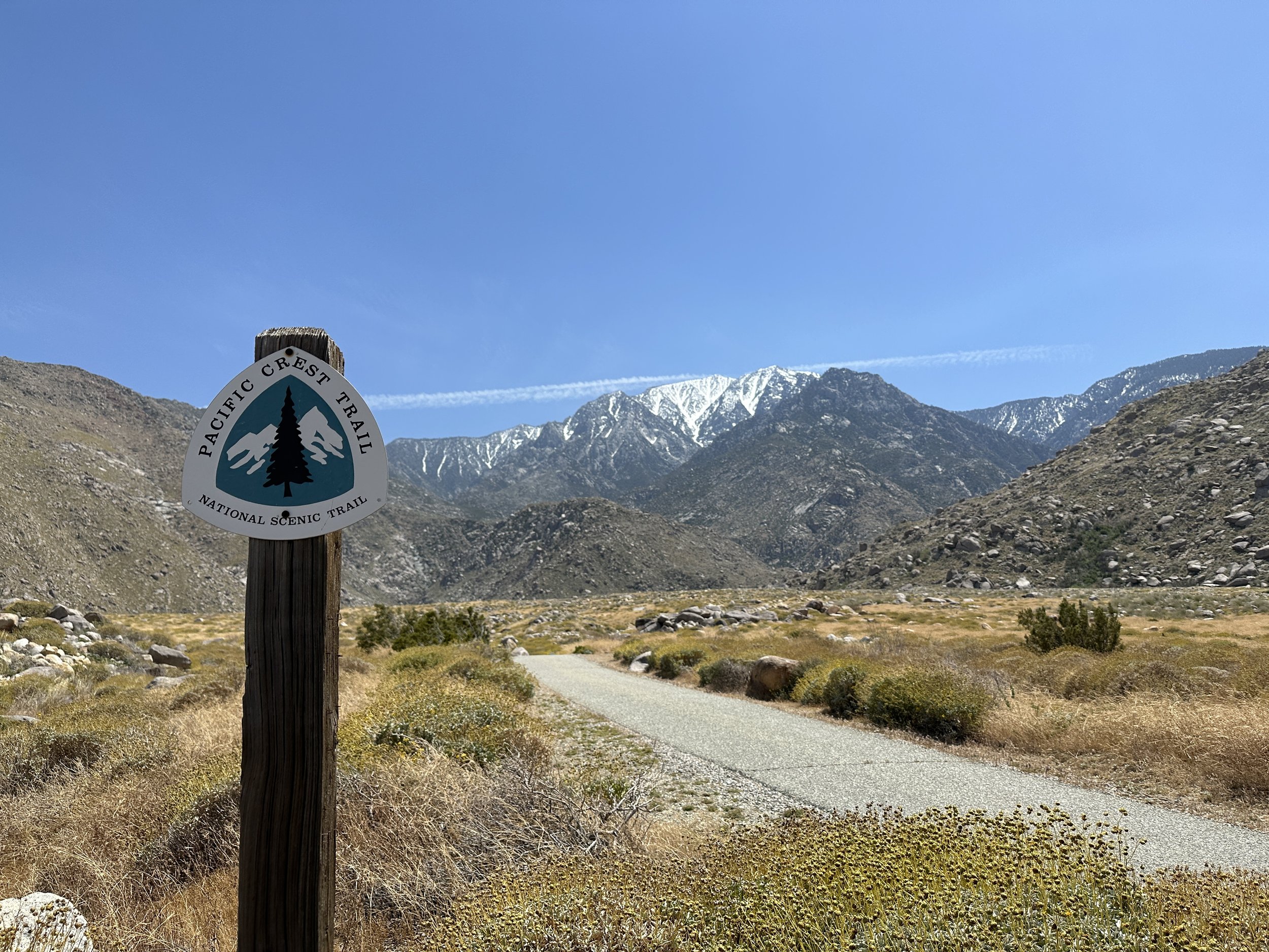
Before reaching the Whitewater River I met Sticks, a fireman from San Diego, and briefly hiked again with Tony. Occasionally, on a hike like this, you cross paths with a hiker of incredible capacity–30 and even 40 mile days being possible, almost standard for them. They’re a memorable blip on your hike but you’re unlikely to ever see them again. Earlier in the hike Old Head was a ghost, arriving after dark and departing before first light. On the night by the Whitewater River, Rat Tail arrived at 4 and we got on like gangbusters. We Cowboy camped on the band if the river and talked until hiker midnight, which is 9 p.m. and is observed with the solemnity of Yom Kippur. They broke the mold when they made this hiker and I hope the trail brings us back together again.
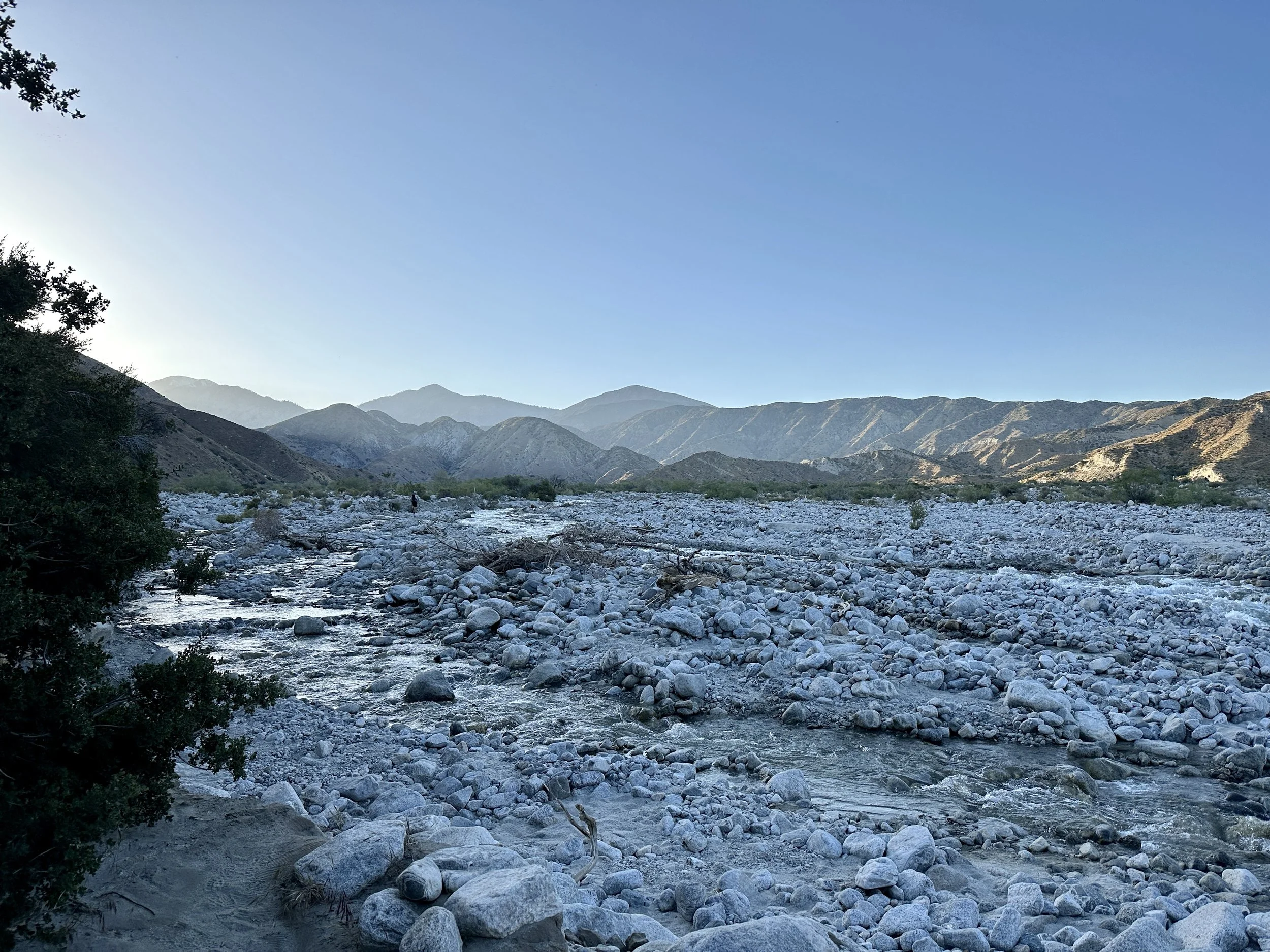
The next morning Sticks, Rat Tail and Roo guided the water crossing, the biggest in Southern California. After that we were all off on our own paces. I hiked a lot with Kachow and learned about his experiences moving to Norway after high school and the moment that made him want to work crafting houses from wood.
We would then descend to Mission Creek which, at its first crossing, became a hiker oasis. If there was a bingo card for hiker siestas, surely someone would have won. Underwear drying on a tree. Check. Hikers cooling feet in stream. Check. Hikers drying quilts and tents. Check. Hikers elevating feet. Check. Hikers sleeping. Check. Hikers comparing blisters. Check.
Kachow asked if I knew what the tree was that we were resting under (it was a sycamore), and he mentioned that he felt guilty for wondering what the wood inside looked like.
The rest of the day included at least twenty more crossings of Mission Creek, very wet shoes (which apparently are good for my blisters), and a big rise of 4,500 feet into the mountains.
The next day was a similar rise, and I was on a mission to make it to mile 250 to hitch into Big Bear to get a package and, hopefully, new shoes. I did what had taken me 12 hours the day before in 8 and couldn’t have been prouder. The joints might be in rebellion, but the muscles are executing the mission. I picked up the package and met Papa Smurf, a trail angel, who had accepted my shoes picked me up. REI sent the wrong shoes but it didn’t matter. I had met the goal and I had the bounty of a Stater Bros. and a Vons–real grocery stores!—my resupply.
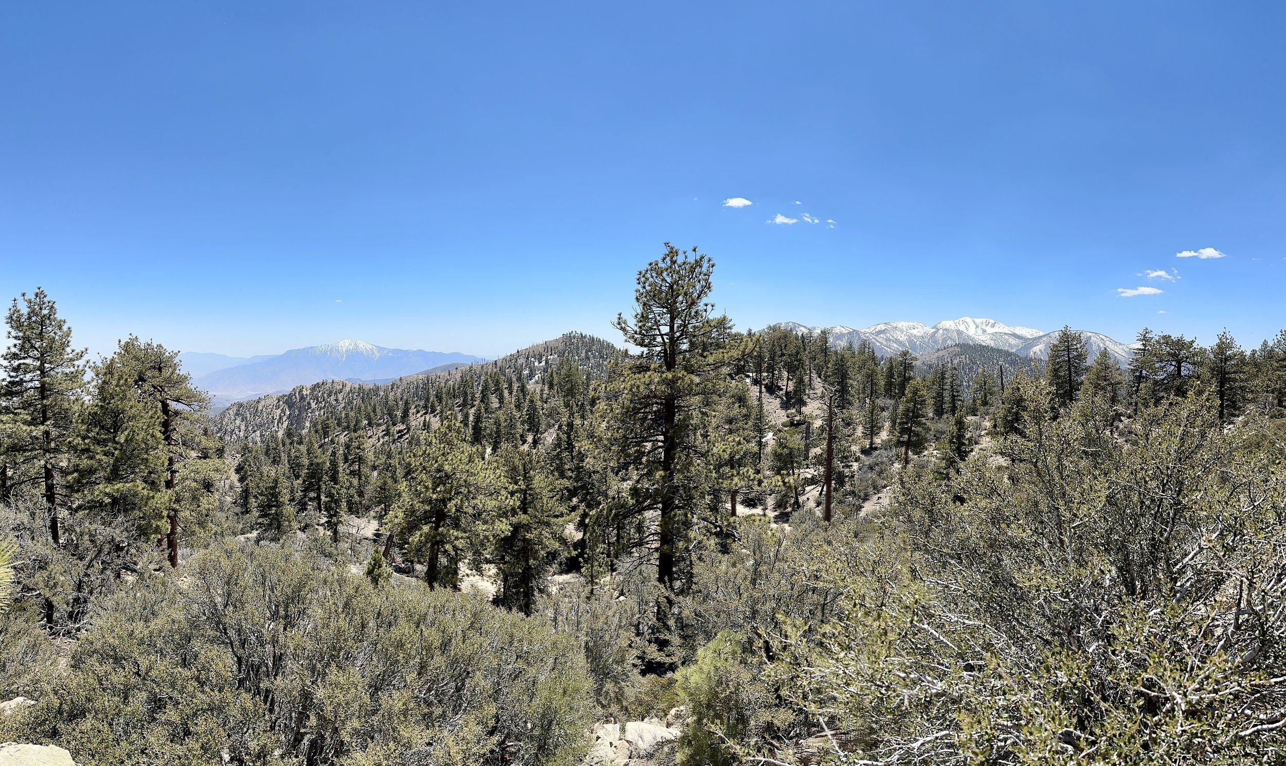
San Jacinto to the left. San Gorgonio to the right. I missed the opportunity to capture these two along with Baden-Powell (the next peak) and San Antonio (a.k.a. Mount Baldy) near LA.

Looking east to LA from San Gorgonio
I spent the night at an impossibly cheap, accommodating hotel with two jacuzzis and dollar laundry before heading back to the trail to knock out a couple of nearos along Ararastre Creek. I ran into Jan, Oofa, Rene and Kachow. I had another session with Blaze Physio. I had some great chats with my original tramily (trail family) up the road.
Somewhere between San Jacinto and Big Bear I realized that I had been treating every setback on the hike as an existential threat to continuing on. If it wasn’t one thing, it was another. But it was clear that obstacles would keep coming. New things would start to hurt. Groups would form but also separate. A successful hike wouldn’t necessarily be defined by a continuous footpath to Canada, but by successfully navigating continuous adversity. I could enjoy the hike and I would definitely enjoy the people. But it would never be easy. The commitment is to see it through.
Not that long ago, I approached some repeated conflict in my life the same way. I couldn’t see a path to resolution and I still don’t know if there was one. I do know that I could have worked harder. I hope that persevering through the challenges of the trail helps me get better at this for the future. Successful completion of the trail depends on it, and, who knows what else might come from it?

Feast When You Can
I’m currently in the town of Idyllwild, California. With its mashup of artists, hippies, hikers, climbers and locals, it reminds me a lot of New Paltz, New York where I grew up. The town has a dog for a mayor and a very welcoming attitude toward hikers. From the local inns to the gear shop to the post office, it really feels like people are happy we’re here.

I left Julian a week ago today and rejoined the trail at mile 77.3 at Scissor’s Crossing. The same trail angel that picked me up also took a number of hikers that I knew for a bit of a crowded ride back to the trail

We all hit the trail together for the relatively long climb and 14 mile water carry out of Shelter Valley. Immediately there was a change in the flora and we saw barrel cacti for the first time. There were also a lot of rattle snakes out for their morning sun, interrupting our path up at least four times that morning.

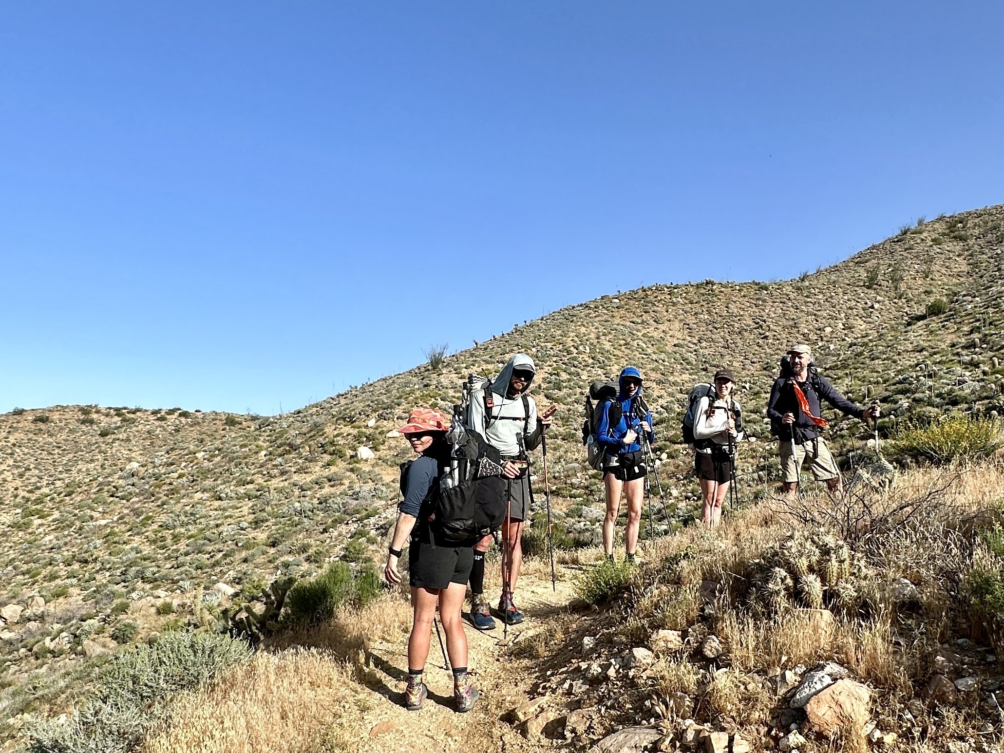
The blisters hadn’t fully resolved and slowed me down until I found a make shift solution about halfway through the day. I was thrilled to finally be hiking without pain again and enjoyed the hike to the Gate Three water cache, a short off-trail detour where trail angels deposit pallets of Kirkland water jugs and mercifully break a 24 mile water carry to a very manageable 14 & 10. Before I dropped my pack to head down for water I ran into a few hikers including Chill, who unbeknownst to either of us, would cook a stellar breakfast for our Idyllwild AirBnB about 6 days later.
I ate dinner and camped with the 4/18 crew and made the mistake of not securing my tent stakes with rocks. I was awoken in the middle of the night with half of my tent collapsed on me. I considered just sleeping that way, but the thought of the other half of the tent collapsing later on in the night was too unappealing, so I dug deep, got out of my warm quilt, restaked the tent, secured the stakes with rocks, and made it through the rest of the night without incident.
The following days had early starts and late finishes which made for classic views of the mountains in a collage of blue silhouettes. There was beautifully varied terrain, including pastureland with a riot of flowering grasses. I suspect that the cows that live and eat there have a superior diet to me at the moment. The days also brought a lot of miles, almost certainly too many, but more on that later.
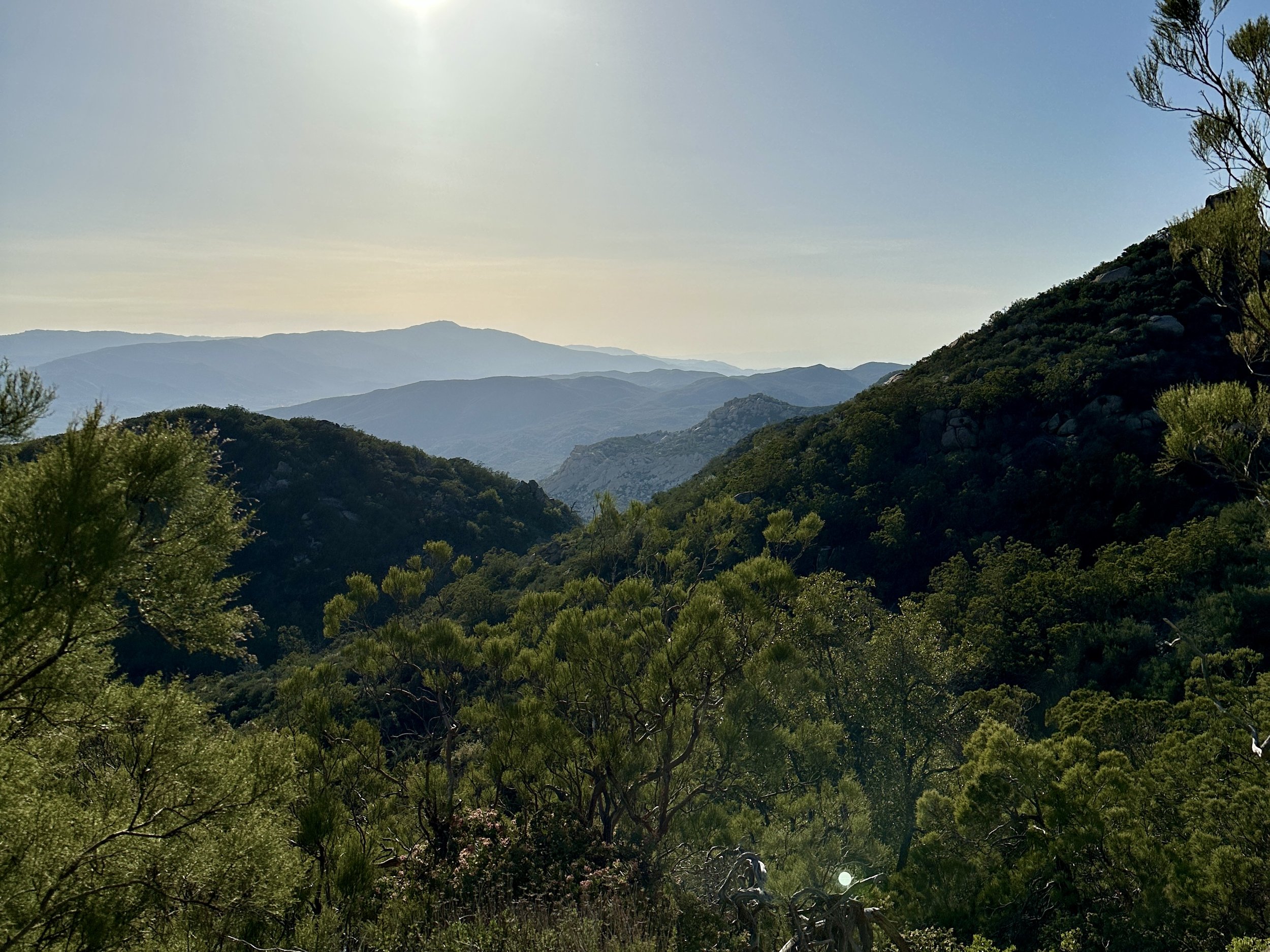
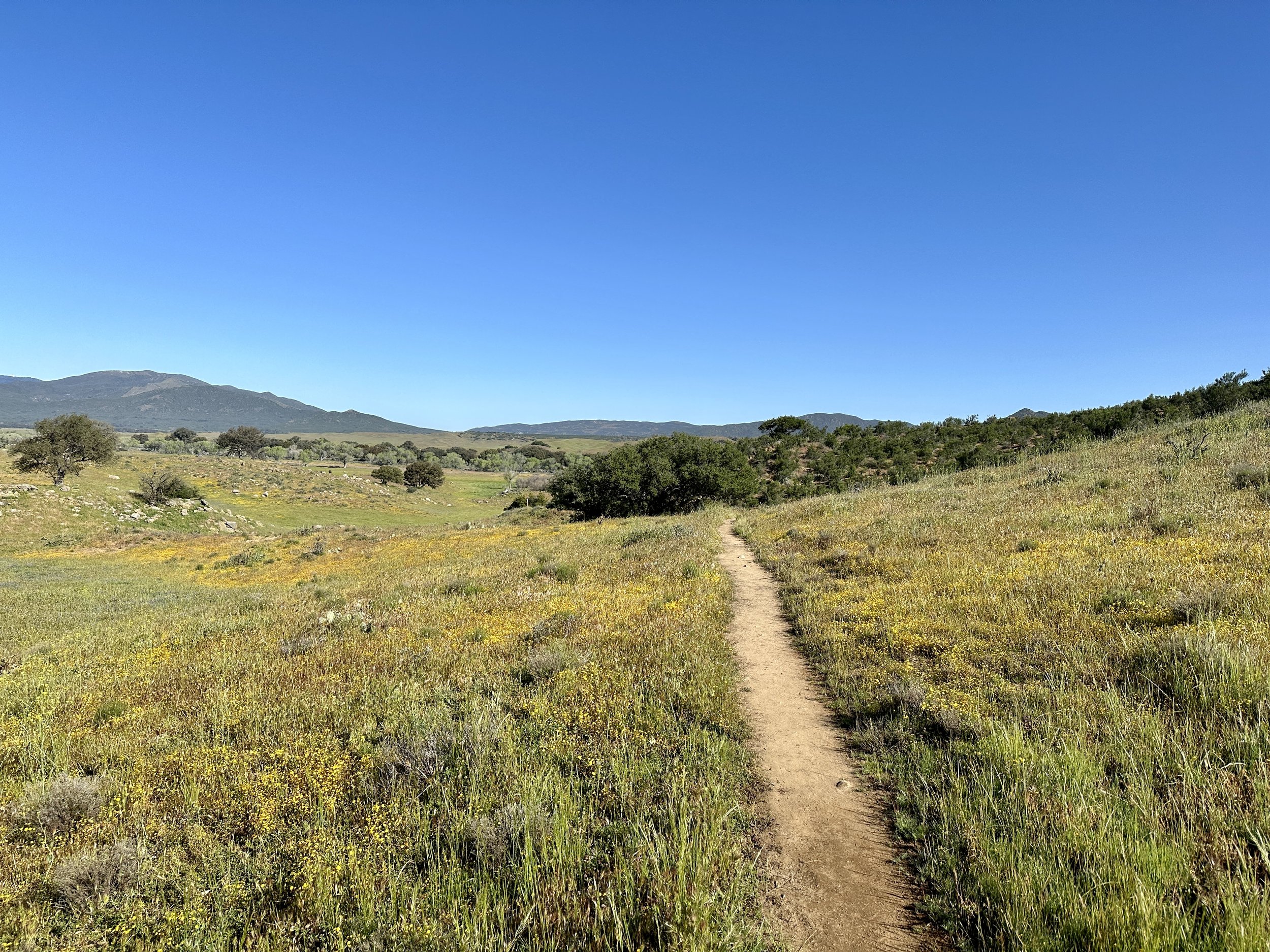
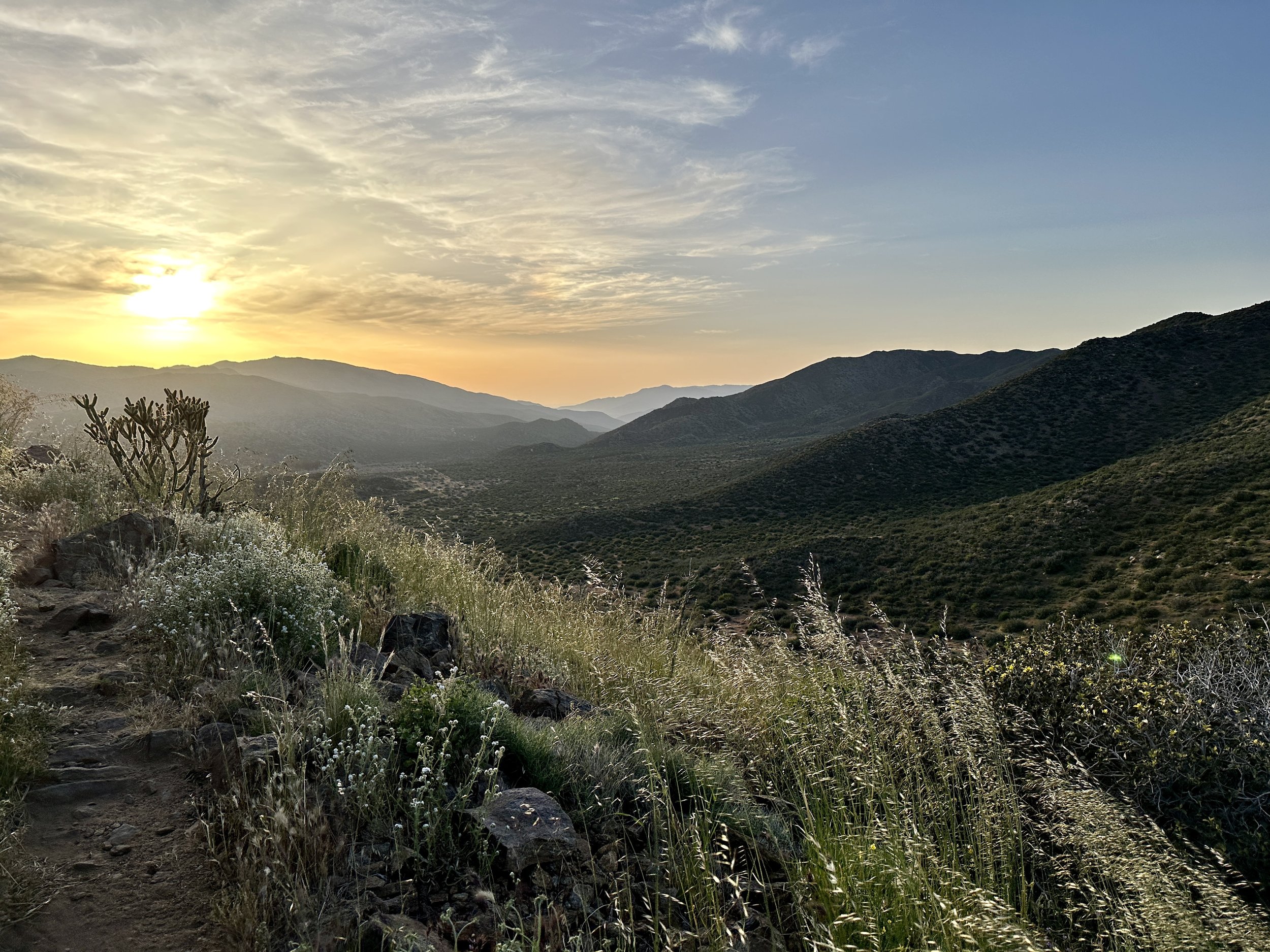
They also brought the news that South Fork San Joaquin River Bridge at mile 854.5 in Kings Canyon, which is the only safe a passage across the river, has been severely damaged. I had already been prepared for the fact that there may be a need to hike the Sierra section of the PCT out of order this year, but the news that there might be a major disruption regardless was pretty disorienting.
While I still haven’t gotten over the news, this particular setback made me think of thruhiking as analogous to life and how we’re not entitled to any specific experiences. We’re not entitled to a continuous footpath on the trail and we’re not entitled to manifesting the visions that we have for ourselves exactly as we would intend or as others seem to have manifested for themselves. All we can do is try to hew as closely as possible to our values and goals and be good about checking in on those values and goals.
These were good thoughts to have in my head because things were about to get a lot harder. The first big struggle was hunger. The Mountain Goats have a great song called Steal Smoked Fish with the chorus, “Feast when you can and dream when there’s nothing to feast on.” Friends, I did some real dreaming this week.
I started doing bigger miles, again to keep up with some hikers whose company I enjoyed, but then out of necessity. A half day out of Warner Springs (Mile 109.5) I realized that I had grossly underestimated my resupply the day before. I had come into previous resupply points close to empty and knew I wasn’t buying enough calories but had bought enough food to get me to town where I could gorge and make up for some of the deficit. Whether I did 18, 18, 18, 6 as some of my friends did or four days of 15, I realized that my only path to Paradise Valley Cafe, my hitch point into Idyllwild, was going to be on two days of half rations and barely a breakfast on the last day.
I have never ever been this hungry. I dreamed about food at night and even though I my hiker hunger had not yet kicked in, not being able to snack during the day or go to bed satiated at night was awful. The bar that I would usually have for breakfast in my first mile was consumed before I finished packing up my tent. I just couldn’t wait for the calories. Also, somehow, a single wrapped prune had made its way into my food bag. Something I’d noticed the week before. I had no idea where it came from. I thought that the mysterious prune was a good omen and I planned on taking it to Canada with me. Let me tell you, I devoured that prune under the shade of dessert scrub without shame or remorse.
I don’t know what real hunger feels like, the kind of hunger where there is truly no hope for enough, but I do know what kind of charity is getting my next donation.
As hungry as I was, the community of hikers around me and once again seeing Mount San Jacinto on the rise from Lost Valley Spring helped keep me going. But another problem arose on this climb, an absolutely searing pain in my right Achilles. I now know that with a little rest, some good physical therapy, and a change of footwear, this is not going to end my hike. But for the 30 miles of agony, when rest wasn’t an option because of the low food stores, I wasn’t so sure. I was behind my friends. I was in pain and I was hungry.
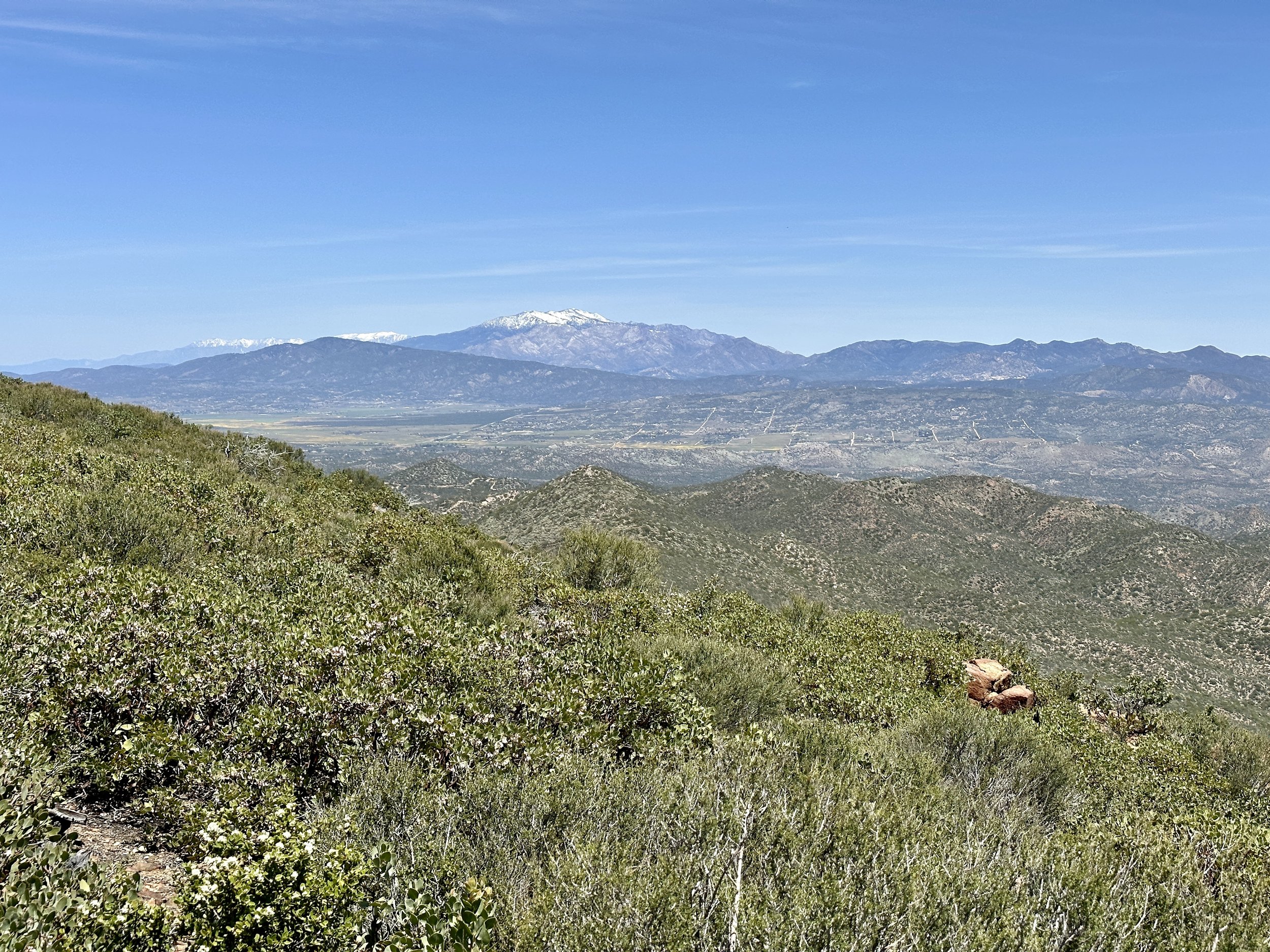
The final day of hiking included a 4 mile climb from my most beautiful campsite yet through Nance Canyon where the landscape started to resemble the landscape I knew from Joshua Tree.
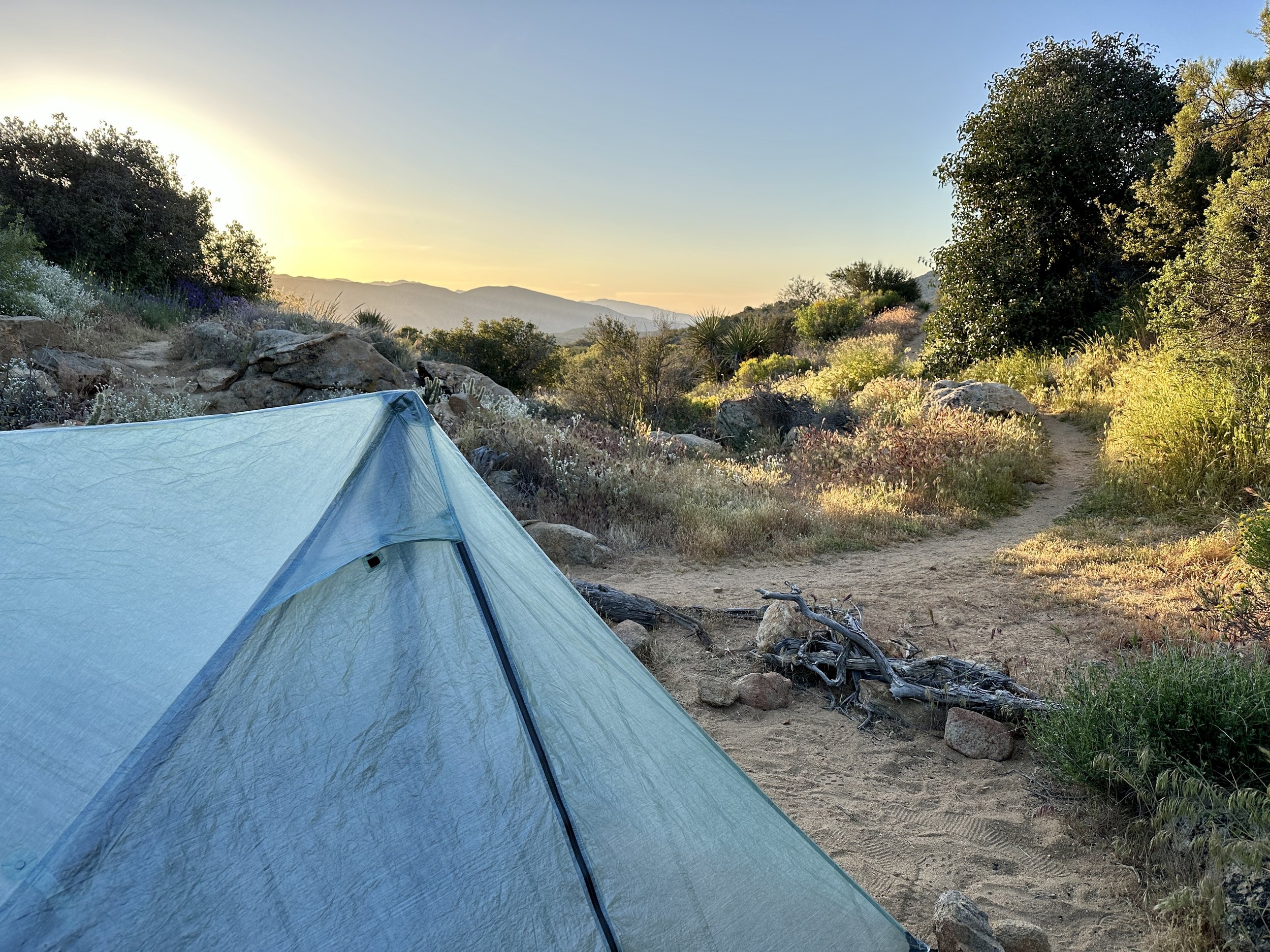
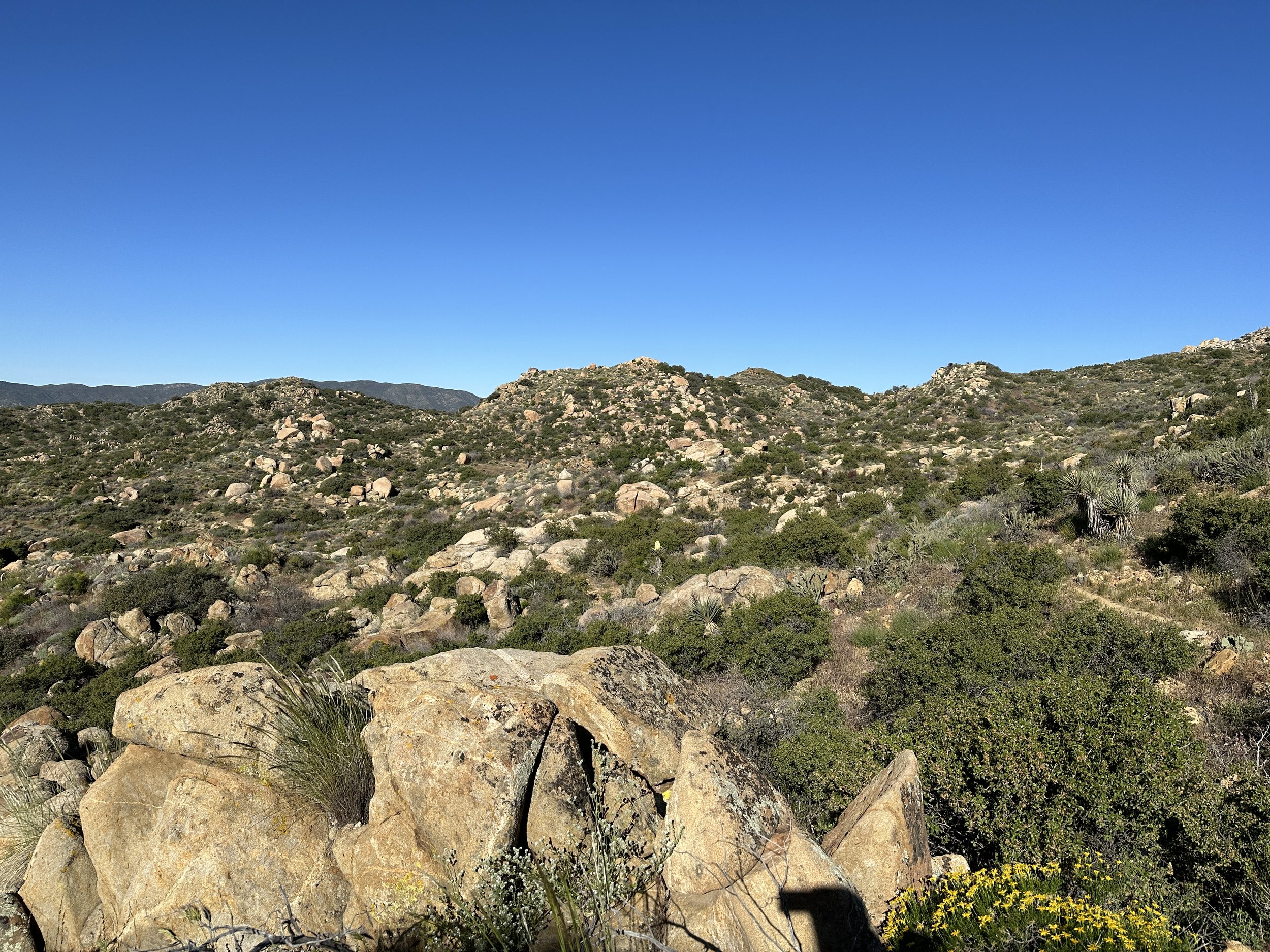
By the time I got to the top I had slowed to about a mile an hour because of my Achilles. I just couldn’t walk uphill and had 6.5 more miles of just that. At mile 145.4 I decide to get off trail in what I learned was Anza, California because my map showed roads and roads mean hitches. As it turned out, these were dirt roads lined with sparsely occupied homesteads and horse farms. I occasionally had one bar of service and less often saw a car on the road.
Eventually, two women gave me directions to pavement where, miraculously, within a minute I was in a car with a cheery woman who loved hiking and hikers. Twenty minutes later I was enjoying a burger, a salad and a Redbridge gluten-free beer. Redbridge is swill, but on Friday it was the nectar of the gods. Not long after I arrived, a Czech hiker named One Beer arrived and it was a particular relief to see him again even though we’d caught up earlier in the day. A few minutes later I was offered a ride into town by Lieutenant Dan, who had arranged the trail magic at Scissor’s Crossing on Day 6. They say the trail provides.
My spirits hadn’t risen yet but my fortunes had. Trippy invited me to an AirBnB in town with the 4/18 crew. In addition to a warm welcome and a cold bag of ice for my Achilles heel, I was treated to one of Leggy’s signature margaritas. Saturday was a two hot tub day and, much to my relief, a session with Blaze Physio (a physical therapist who thruhiked the PCT in 2019 and works the trail during hiking season) assured me that my hike wasn’t over and that I wasn’t doing permanent damage to my Achilles.
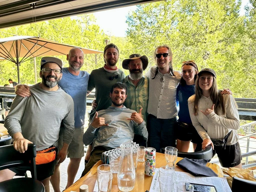
A couple of days with the Day 2 dinner crew and Trevor (now Stonehenge) and Kyler (now Binks) restored my spirit. Family breakfast. Family dinner. I even got to play a little guitar.
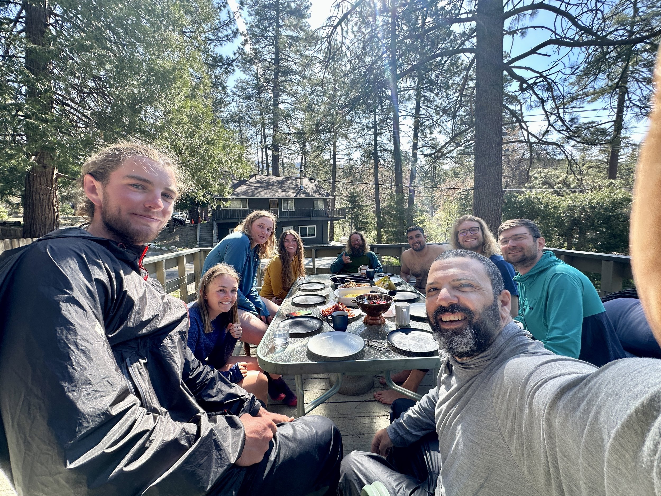
It’s not smooth sailing yet. The Achilles still needs time. The weather on San Jacinto, my next step and the first major milestone I was looking forward to, is not cooperating.
But I do have a room with DIsco Daddy, an appointment tomorrow with Blaze Physio, and a real eagerness to take this perspective forward to meet the challenges of the next 2,500 miles.

Green Hills, White Peaks & Clear Creeks
I’ve been on trail for seven days now which equates to 77.1 PTC miles, but who’s counting? Today I’m taking a zero (zero mile day) to rest up, do some trail errands, and resupply in the quaint mountain town of Julian.
Already, the range of landscapes, thoughts, relationships and experiences is pretty incredible.

Just the experience of seeing the Southern Terminus Monument was incredibly emotional. To finally be at the place where this journey that I had spent almost a year preparing for would begin was totally overwhelming. The five grey pillars stood out from the dessert scrub and were a stark contrast to the imposing austerity of the border wall. It is ironic that a journey already marked by camaraderie and connection begins at a place whose main purpose has become one of exclusion.
I got a late start on Monday, around 11 a.m. It was an easy walk through horse farms and agricultural land before starting an easy rise into some low desert hills. As the elevation got higher and the border wall further, the way the structure hugged the rise and fall of the horizon reminded me of the Great Wall of China, though one that I hope won’t stand or be remembered for as long.
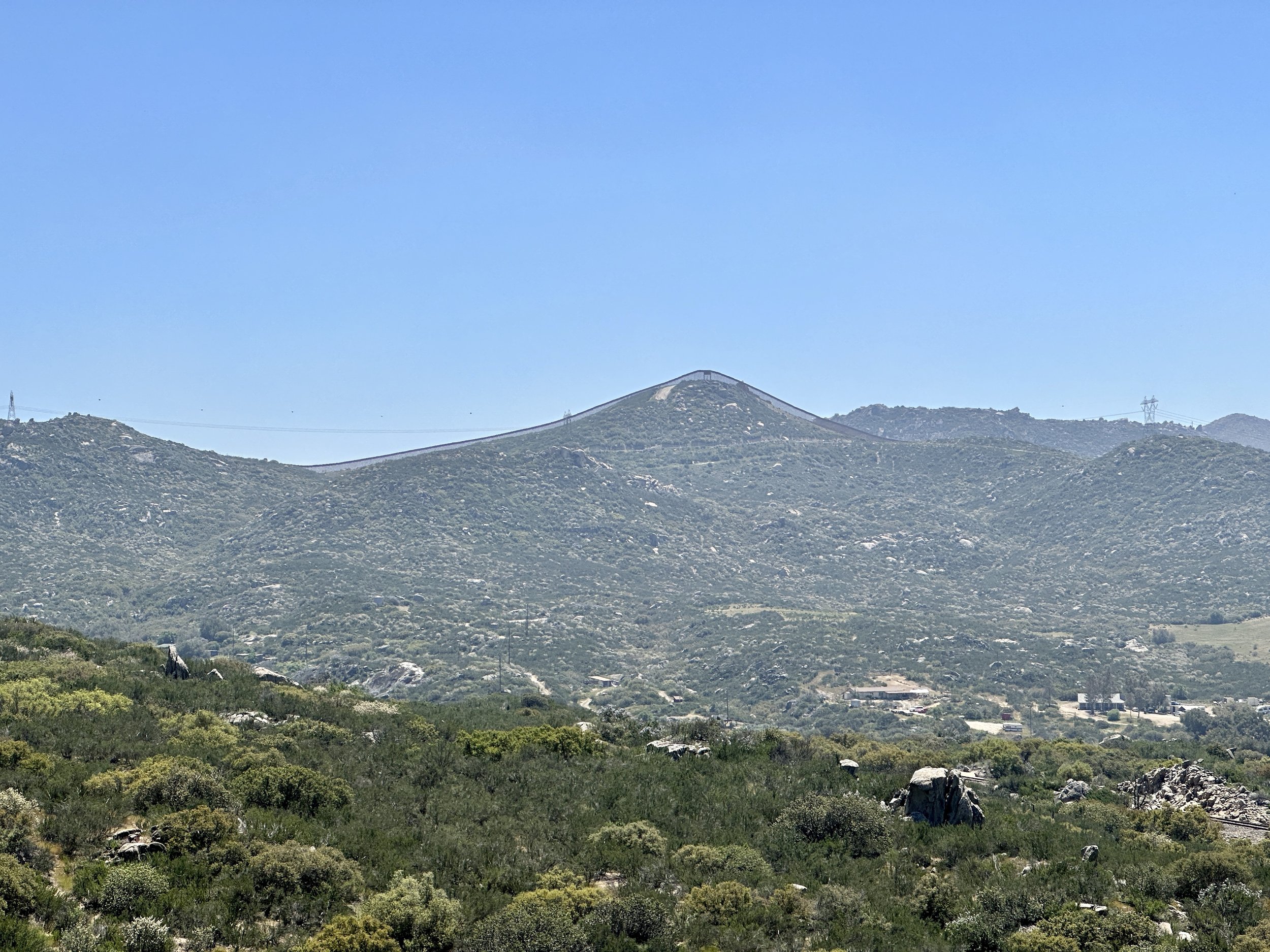
After solo camping that first night, it was a relatively easy jaunt into Lake Morena where it felt a little early to indulge in a burger at the Malt Shop, but indulge I did and it was delicious. On the way out from the shop I ran into Trevor and Sydney and then Kyler. Unbeknownst to us we would spend the rest of the week hiking together.

After leapfrogging with a large group of hikers through the mixed use land that follows Lake Morena, about a dozen of us made camp past a creek at Mile 25. It felt like that night was when the hike and the community around the hike really began. After making camp, we all sat in a circle to eat dinner as strangers but went to bed that night with a bond based around this common undertaking. It seems that there is an innate positivity to the relationships that form on trail. I’m really excited to see how this evolves.
The next morning I passed through Boulder Oaks campground where Kyler directed me to my first hiker box. I was getting low on food and was still a day out from my next resupply at Mount Laguna and was thrilled for the first time in my life to find a box of Raisinettes.
The trail then rose up into some foothills where Trevor and Sydney caught up to me before we found Kyler stopped on the trail. He mentioned that he thought we had just passed the turn off to the Kitchen Creek Falls and that he was going go back to go check it out. We all thought that was a fine plan, so we went back with him and headed down about 200 feet to a beautiful secluded falls that ended in a pool perfect for a dip. We took turns taking cold plunges (my first!), talking and basking in the sun. We weren’t back on trail for long before we went back down to Kitchen Creek for lunch and more lounging. How we even made 12 miles that day, I have no idea.


The rest of the afternoon was a stunning ridge walk with occasional views of Tecate Peak in Mexico and ended with a beautiful campsite under a live oak about five miles from Mount Laguna, our next resupply. Even better were the conversations. I may have been with three hikers half my age, but we had the easiest of times rating candy and talking about life.

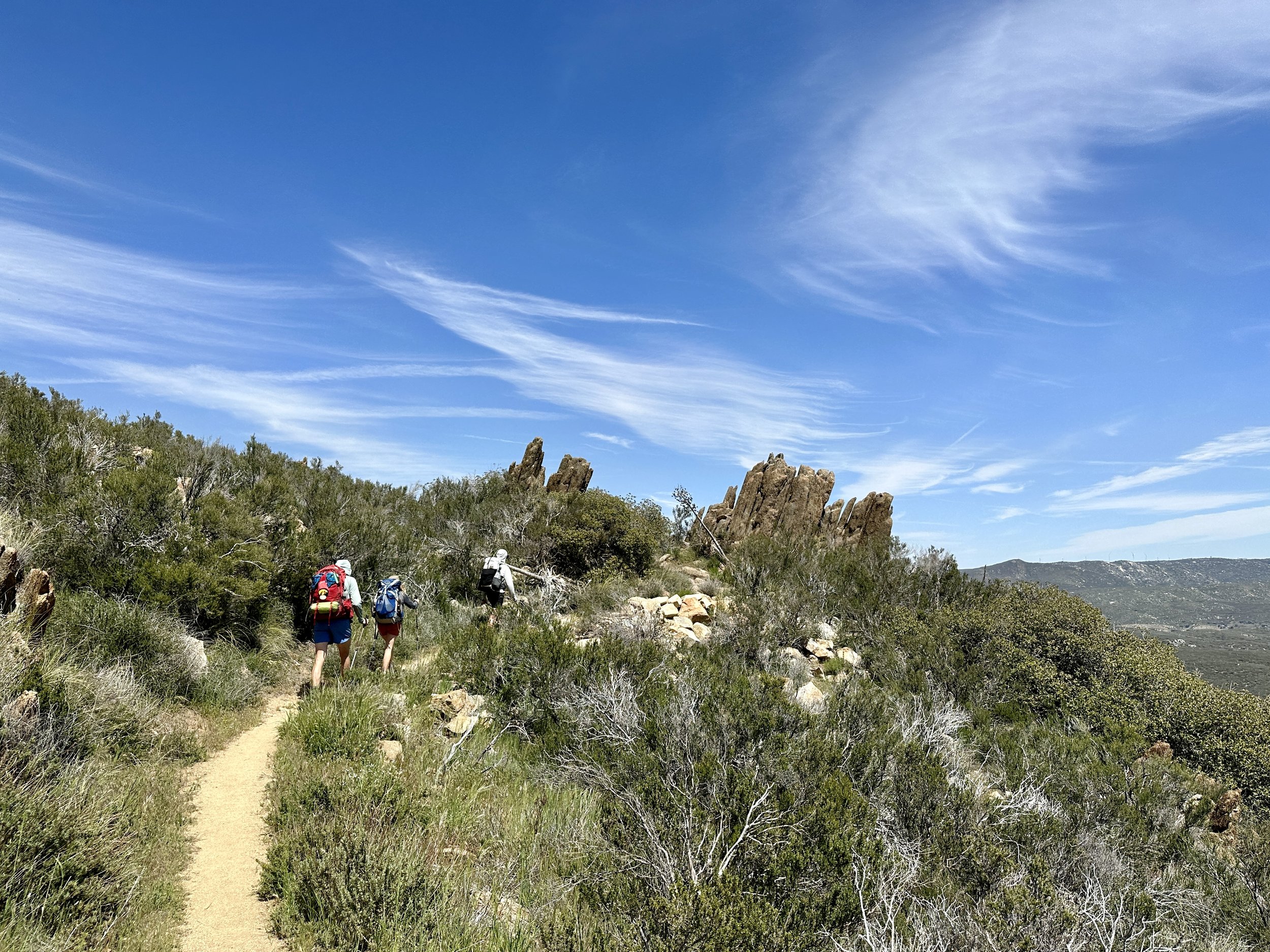
The five miles into and out of Mount Laguna were some of the best hiking yet and we had views of snow covered Mount San Jacinto, which is about a week away, as well as the San Bernardino mountains a bit further on. All the while, there’s been so much rain that it was hard to believe this section is known as the dessert. The hills are green, lush even and everything is blooming. Even after two and a half years of hiking in Southern California, I’ve never seen it like this.


Before heading out of one of the Mount Laguna campgrounds I was thrilled to see that Barney “Scout” Mann, author of Journeys North, was there with some trail magic (treats for hikers). I couldn’t eat the brownies but I was thrilled to be able to tell the author of a book that I love how much it means to me. The meeting was an auspicious start to a two creek day with plenty of soaking and meet-ups and leapfrogging.

The day that we headed into Julian dispelled any illusions that we were not in the dessert. For the first time there were no more surprise creeks between water sources. The sun beat down relentlessly and shade was wherever you could squeeze in under some manzanita. Combined with some new and truly epic blisters, this was the first trying day on trail.

Even then, when we got to the bridge at Scissor’s Crossing, we found some phenomenal trail magic in addition to the much anticipated water cache: Beer! Gummy Worms! Hard kombucha! It was one for the books.
We still had room to feast at the Julian Brewing Company. Trevor, Sydney and Kyler went on to do a little night hiking to make a deadline for Warner Springs and I went on to a much needed shower at the Stagecoach RV Resort. I’ll meet up with Matt and Jess and some other hikers in Julian today and be back on trail tomorrow for the longest water carry yet.
It Starts in the Desert
The beginning.
Last week was my last as an Ambassador for Glenfiddich. It was a job that took me to seven countries, thirty states and one very special farm in Ohio. Colleagues from all over the country and the world became friends. I was able to take an innate curiosity and love for communicating and turn it into a career. I shared my love for whisky and hospitality close to home and as far away as Sydney. Some nights, I had front row access to the most incredible bars and restaurants in the world and, often, got to peak behind the curtain.
My last day was Friday, April 14th. The week that led up to that couldn’t have been a better ending. I had dinner with our Malt Master, a man of incredible talent and modesty, and got to present with him for the first time. I was also able to bring in the bar team from Angel’s Share, a bar that was foundational in the cocktail revival in New York and that was at the center of some of my earliest and most important experiences of what cocktails could be.
The last day ended and I met up with a friend in Newark to see Bruce Springsteen & the E-Street band absolutely blow the roof off of the Prudential Center. I had never been further away at a Springsteen concert and he and the band had never been older, and still, I got absolutely lost in the music.
The next morning, I packed up my hiking gear and boarded a plane to San Diego where Jess and Matt, friends from Boston, have been hosting me and have showed me parts of the city I didn’t get to know during my time on the West Coast. There was a long walk on a beach and I cannot recommend the tacos at Taco Machin highly enough. We also grabbed dinner at Callie, which my friend Ann opened and runs. Like I said when they first opened, “run, don’t walk.”
In a couple of hours Jess and Matt are going to drive me to Campo, California where I’m going to tap the Southern Terminus of the PCT and start walking north to Canada. Somehow, I only started to feel the immensity of this project in the last week. It’s accidental, but completely appropriate, that this endeavor in endurance is beginning on the same day as the Boston Marathon. I also take it as auspicious that this beginning is being facilitated by friends made over the last seven years and who are continuing to follow their passion for hospitality, which is what all of my love of food and whisky and cocktails is really about anyway.
I hope I meet the challenges of this journey in stride and accept the good parts along with grace. I hope you enjoy following along.